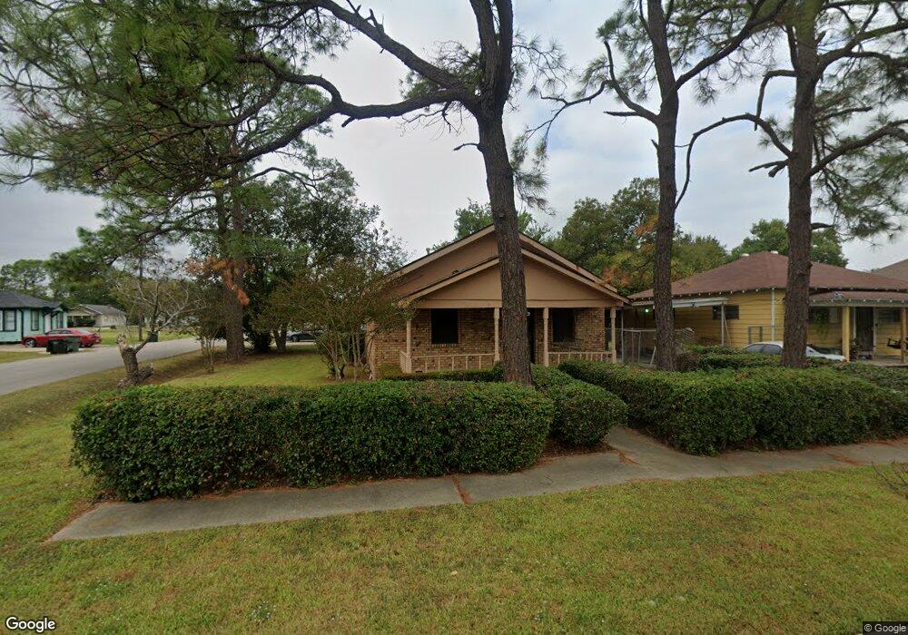
1701 Thomas Blvd Port Arthur, TX 77640
Estimated Value: $105,000 - $130,000
2
Beds
2
Baths
1,040
Sq Ft
$108/Sq Ft
Est. Value
About This Home
This home is located at 1701 Thomas Blvd, Port Arthur, TX 77640 and is currently estimated at $112,188, approximately $107 per square foot. 1701 Thomas Blvd is a home located in Jefferson County with nearby schools including DeQueen Elementary School, Abraham Lincoln Middle School, and Memorial High School.
Ownership History
Date
Name
Owned For
Owner Type
Purchase Details
Closed on
Apr 25, 2023
Sold by
Mahavir Holdings Llc
Bought by
Gasper Manuel
Current Estimated Value
Purchase Details
Closed on
Apr 29, 2010
Sold by
Fannie Mae
Bought by
Mahavir Holdings Llc
Purchase Details
Closed on
Feb 2, 2010
Sold by
Anderson Darrell W and Anderson Christina
Bought by
Federal National Mortgage Association
Purchase Details
Closed on
Sep 21, 2004
Sold by
Fisher Robert Thomas and Fisher Virgin Mary
Bought by
Anderson Christina
Home Financials for this Owner
Home Financials are based on the most recent Mortgage that was taken out on this home.
Original Mortgage
$32,500
Interest Rate
5.29%
Mortgage Type
Purchase Money Mortgage
Create a Home Valuation Report for This Property
The Home Valuation Report is an in-depth analysis detailing your home's value as well as a comparison with similar homes in the area
Home Values in the Area
Average Home Value in this Area
Purchase History
| Date | Buyer | Sale Price | Title Company |
|---|---|---|---|
| Gasper Manuel | -- | None Listed On Document | |
| Mahavir Holdings Llc | -- | Jefferson County Title Co | |
| Federal National Mortgage Association | $21,651 | None Available | |
| Anderson Christina | -- | Jefferson County Title Co |
Source: Public Records
Mortgage History
| Date | Status | Borrower | Loan Amount |
|---|---|---|---|
| Previous Owner | Anderson Christina | $32,500 |
Source: Public Records
Tax History Compared to Growth
Tax History
| Year | Tax Paid | Tax Assessment Tax Assessment Total Assessment is a certain percentage of the fair market value that is determined by local assessors to be the total taxable value of land and additions on the property. | Land | Improvement |
|---|---|---|---|---|
| 2025 | $2,869 | $98,776 | $4,550 | $94,226 |
| 2024 | $2,869 | $100,166 | $2,450 | $97,716 |
| 2023 | $2,869 | $84,981 | $1,225 | $83,756 |
| 2022 | $2,699 | $84,981 | $1,225 | $83,756 |
| 2021 | $2,186 | $65,962 | $1,225 | $64,737 |
| 2020 | $1,334 | $43,803 | $1,225 | $42,578 |
| 2019 | $1,312 | $41,150 | $1,230 | $39,920 |
| 2018 | $1,227 | $38,490 | $1,230 | $37,260 |
| 2017 | $1,193 | $38,490 | $1,230 | $37,260 |
| 2016 | $1,127 | $38,490 | $1,230 | $37,260 |
| 2015 | $1,043 | $34,950 | $1,230 | $33,720 |
| 2014 | $1,043 | $34,950 | $1,230 | $33,720 |
Source: Public Records
Map
Nearby Homes
- 1730 Thomas Blvd
- 1833 11th St
- 515 Lake Charles Ave
- 1900 Thomas Blvd
- 1626 14th St
- 1948 13th St
- 1431 13th St
- 2036 12th St
- 927 Stilwell Blvd
- 1312 13th St
- 1235 13th St
- 1947 & 1949 8th St
- 916 Charleston Ave
- 11351 Gulfway Dr
- 1320 9th St
- 1400 8th St
- 1114 14th St
- 2736 Thomas Blvd
- 1110 15th St
- 1457 Saint Augustine Ave
- 1711 Thomas Blvd
- 1721 Thomas Blvd
- 1217 New Orleans Ave
- 1232 New Orleans Ave
- 1647 Thomas Blvd
- 1733 Thomas Blvd
- 1637 Thomas Blvd
- 1700 12th St
- 1720 12th St
- 1233 New Orleans Ave
- 1737 Thomas Blvd
- 1627 Thomas Blvd
- 1736 12th St
- 1227 Vicksburg Ave
- 1720 Thomas Blvd
- 1748 12th St
- 1736 Thomas Blvd
- 1746 Thomas Blvd
- 1746 Thomas Blvd
- 1801 Thomas Blvd