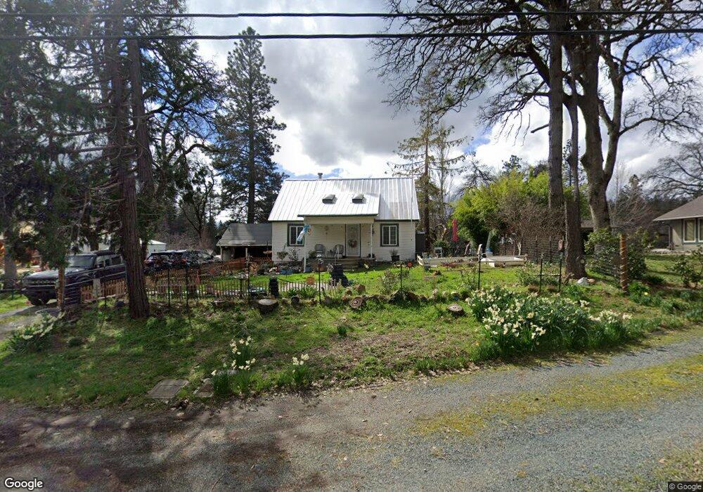
17014 State Highway 49 Nevada City, CA 95959
Estimated Value: $333,000 - $611,000
2
Beds
1
Bath
1,159
Sq Ft
$368/Sq Ft
Est. Value
About This Home
This home is located at 17014 State Highway 49, Nevada City, CA 95959 and is currently estimated at $426,974, approximately $368 per square foot. 17014 State Highway 49 is a home located in Nevada County with nearby schools including Deer Creek Elementary School, Seven Hills Intermediate School, and Forest Charter School.
Ownership History
Date
Name
Owned For
Owner Type
Purchase Details
Closed on
Aug 19, 2019
Sold by
Harper George Russell and Harper Patricia Ann
Bought by
Mayorga Ana A
Current Estimated Value
Home Financials for this Owner
Home Financials are based on the most recent Mortgage that was taken out on this home.
Original Mortgage
$167,000
Outstanding Balance
$146,261
Interest Rate
3.7%
Mortgage Type
New Conventional
Estimated Equity
$280,713
Create a Home Valuation Report for This Property
The Home Valuation Report is an in-depth analysis detailing your home's value as well as a comparison with similar homes in the area
Home Values in the Area
Average Home Value in this Area
Purchase History
| Date | Buyer | Sale Price | Title Company |
|---|---|---|---|
| Mayorga Ana A | $240,000 | Placer Title Company |
Source: Public Records
Mortgage History
| Date | Status | Borrower | Loan Amount |
|---|---|---|---|
| Open | Mayorga Ana A | $167,000 |
Source: Public Records
Tax History Compared to Growth
Tax History
| Year | Tax Paid | Tax Assessment Tax Assessment Total Assessment is a certain percentage of the fair market value that is determined by local assessors to be the total taxable value of land and additions on the property. | Land | Improvement |
|---|---|---|---|---|
| 2025 | $2,876 | $262,470 | $43,743 | $218,727 |
| 2024 | $2,815 | $257,325 | $42,886 | $214,439 |
| 2023 | $2,815 | $252,281 | $42,046 | $210,235 |
| 2022 | $2,756 | $247,335 | $41,222 | $206,113 |
| 2021 | $2,675 | $242,486 | $40,414 | $202,072 |
| 2020 | $2,666 | $240,000 | $40,000 | $200,000 |
| 2019 | $947 | $76,765 | $12,395 | $64,370 |
| 2018 | $926 | $75,260 | $12,152 | $63,108 |
| 2017 | $906 | $73,785 | $11,914 | $61,871 |
| 2016 | $874 | $72,340 | $11,681 | $60,659 |
| 2015 | $859 | $71,255 | $11,506 | $59,749 |
| 2014 | $844 | $69,860 | $11,281 | $58,579 |
Source: Public Records
Map
Nearby Homes
- 10265 Newtown Rd
- 16934 Indian Flat Rd
- 10402 Newtown Rd
- 11094 Cement Hill Rd
- 10980 Newtown Rd
- 11356 Constitution Ct
- 11065 White Oak Way
- 10943 Beckville Rd
- 12777 Daisy Blue Mine Rd
- 13000 Diamond Oaks Dr
- 13118 Cement Hill Rd
- 12921 Slate Creek Rd
- 16970 Old Downieville Hwy
- 661 Chief Kelly Dr
- 651 Chief Kelly Dr
- 12069 Newtown Rd
- 12141 Newtown Rd
- 631 Chief Kelly Dr
- 11772 Marjon Dr
- 660 Chief Kelly Dr
- 17014 California 49
- 17038 State Highway 49
- 16994 California 49
- 16994 Highway 49
- 10024 Newtown Rd
- 16963 State Highway 49
- 17049 State Highway 49
- 17086 State Highway 49
- 10068 Newtown Rd
- 10114 Newtown Rd
- 17020 Country Cir
- 17112 State Highway 49
- 10075 Newtown Rd
- 17107 State Highway 49
- 10188 Pleasant Hill Ct
- 17125 State Highway 49
- 10061 Newtown Rd