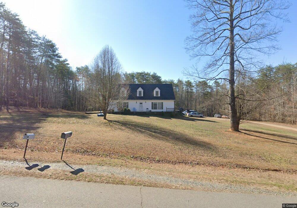
171 Shady Maple Dr Reidsville, NC 27320
Estimated Value: $252,000 - $275,000
4
Beds
3
Baths
2,175
Sq Ft
$120/Sq Ft
Est. Value
About This Home
This home is located at 171 Shady Maple Dr, Reidsville, NC 27320 and is currently estimated at $261,000, approximately $120 per square foot. 171 Shady Maple Dr is a home located in Rockingham County with nearby schools including Reidsville High School, Williamsburg Elementary School, and Reidsville Middle School.
Ownership History
Date
Name
Owned For
Owner Type
Purchase Details
Closed on
Dec 10, 2008
Sold by
U S Bank National Association
Bought by
Eleby Clifford L and Eleby Cynthia D
Current Estimated Value
Home Financials for this Owner
Home Financials are based on the most recent Mortgage that was taken out on this home.
Original Mortgage
$108,468
Interest Rate
5.08%
Mortgage Type
FHA
Purchase Details
Closed on
Jan 8, 2008
Sold by
Berry Bruce A and Berry Ashley J
Bought by
U S Bank National Association
Create a Home Valuation Report for This Property
The Home Valuation Report is an in-depth analysis detailing your home's value as well as a comparison with similar homes in the area
Home Values in the Area
Average Home Value in this Area
Purchase History
| Date | Buyer | Sale Price | Title Company |
|---|---|---|---|
| Eleby Clifford L | $110,000 | None Available | |
| U S Bank National Association | $132,000 | None Available |
Source: Public Records
Mortgage History
| Date | Status | Borrower | Loan Amount |
|---|---|---|---|
| Previous Owner | Eleby Clifford L | $108,468 |
Source: Public Records
Tax History Compared to Growth
Tax History
| Year | Tax Paid | Tax Assessment Tax Assessment Total Assessment is a certain percentage of the fair market value that is determined by local assessors to be the total taxable value of land and additions on the property. | Land | Improvement |
|---|---|---|---|---|
| 2025 | $1,562 | $239,905 | $34,401 | $205,504 |
| 2024 | $1,562 | $239,905 | $34,401 | $205,504 |
| 2023 | $1,562 | $162,106 | $31,274 | $130,832 |
| 2022 | $1,289 | $162,106 | $31,274 | $130,832 |
| 2021 | $1,289 | $162,106 | $31,274 | $130,832 |
| 2020 | $1,289 | $162,106 | $31,274 | $130,832 |
| 2019 | $1,240 | $162,106 | $31,274 | $130,832 |
| 2018 | $1,191 | $155,498 | $34,710 | $120,788 |
| 2017 | $1,191 | $155,498 | $34,710 | $120,788 |
| 2015 | $1,203 | $155,498 | $34,710 | $120,788 |
| 2014 | $1,191 | $155,498 | $34,710 | $120,788 |
Source: Public Records
Map
Nearby Homes
- 525 Grooms Rd
- 00 Rolling Meadows Dr
- 2053 U S Highway 158 W
- 2072 U S 158
- 2846 Grooms Rd
- Lot 1a Joe Cobb Rd
- Lot 2 Joe Cobb Rd
- Lot 1 A Joe Cobb Rd
- Lot 1B Joe Cobb Rd
- 221 Cart Dr
- 252 Palm Rd
- 219 Cart Dr
- 0 Cart Dr
- Lot 6 Cart Dr
- Lot 3 Cart Dr
- Lot 4 Cart Dr
- Lot 5 Cart Dr
- Lot 2 Cart Dr
- 126 Mullins Rd
- 0 Spice Rd
- 4270 Grooms Rd
- 4252 Grooms Rd
- 246 Shady Maple Dr
- 4185 Grooms Rd
- 310 Rolling Meadows Dr
- 4364 Grooms Rd
- 4145 Grooms Rd
- 4210 Grooms Rd
- 4230 Grooms Rd
- 195 Amy Ln
- 315 Rolling Meadows Dr
- 297 Rolling Meadows Dr
- 4415 Grooms Rd Unit 1
- 4415 Grooms Rd
- 240 Rolling Meadows Dr
- 135 Lucy Ln
- 102 Amy Ln
- 261 Rolling Meadows Dr
- 155 Lucy Ln
- 4465 Grooms Rd