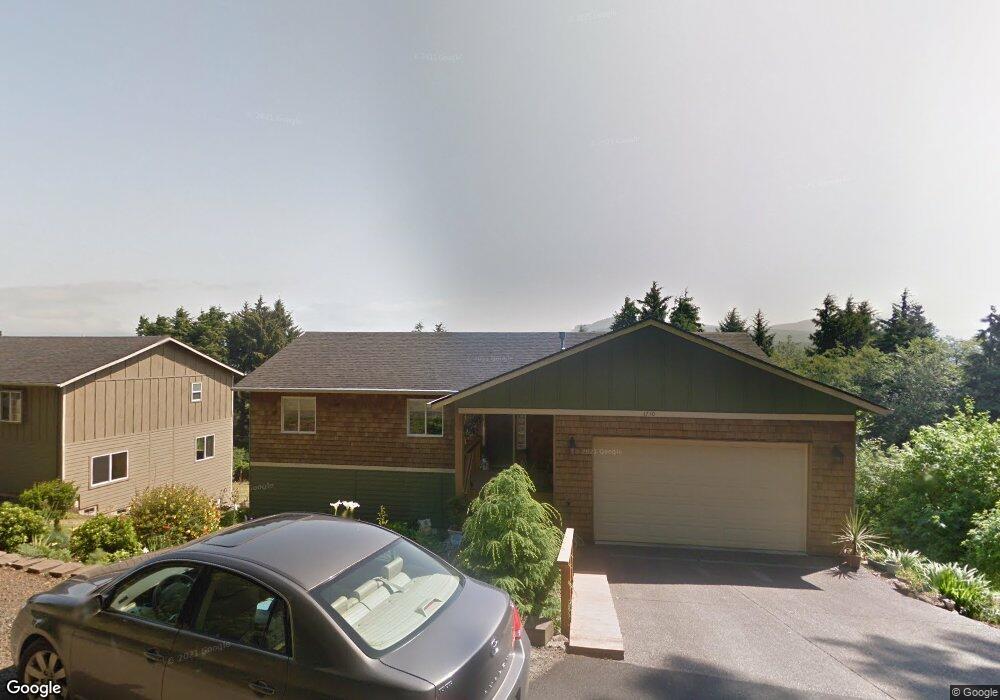
1710 SE Port Dr Lincoln City, OR 97367
Estimated Value: $646,000 - $845,000
3
Beds
3
Baths
1,376
Sq Ft
$546/Sq Ft
Est. Value
About This Home
This home is located at 1710 SE Port Dr, Lincoln City, OR 97367 and is currently estimated at $751,255, approximately $545 per square foot. 1710 SE Port Dr is a home located in Lincoln County with nearby schools including Taft Elementary School, Oceanlake Elementary School, and Taft High School.
Ownership History
Date
Name
Owned For
Owner Type
Purchase Details
Closed on
Aug 10, 2007
Sold by
Dahlman Robert S and Dahlman Tracy A
Bought by
Crosby Richard Milton and Crosby Mae Gaurana
Current Estimated Value
Home Financials for this Owner
Home Financials are based on the most recent Mortgage that was taken out on this home.
Original Mortgage
$270,800
Outstanding Balance
$223,225
Interest Rate
6.65%
Mortgage Type
Purchase Money Mortgage
Estimated Equity
$528,030
Purchase Details
Closed on
May 26, 2005
Sold by
Lien Wallace W and Lien Janet K
Bought by
Dahlman Robert S and Dahlman Tracy A
Create a Home Valuation Report for This Property
The Home Valuation Report is an in-depth analysis detailing your home's value as well as a comparison with similar homes in the area
Home Values in the Area
Average Home Value in this Area
Purchase History
| Date | Buyer | Sale Price | Title Company |
|---|---|---|---|
| Crosby Richard Milton | $338,500 | Wte | |
| Dahlman Robert S | $21,000 | Western Title & Escrow Co |
Source: Public Records
Mortgage History
| Date | Status | Borrower | Loan Amount |
|---|---|---|---|
| Open | Crosby Richard Milton | $270,800 |
Source: Public Records
Tax History Compared to Growth
Tax History
| Year | Tax Paid | Tax Assessment Tax Assessment Total Assessment is a certain percentage of the fair market value that is determined by local assessors to be the total taxable value of land and additions on the property. | Land | Improvement |
|---|---|---|---|---|
| 2024 | $5,240 | $305,160 | -- | -- |
| 2023 | $5,095 | $296,280 | $0 | $0 |
| 2022 | $4,953 | $287,660 | $0 | $0 |
| 2021 | $4,719 | $279,290 | $0 | $0 |
| 2020 | $4,611 | $271,160 | $0 | $0 |
| 2019 | $4,454 | $263,270 | $0 | $0 |
| 2018 | $4,353 | $255,610 | $0 | $0 |
| 2017 | $4,167 | $248,170 | $0 | $0 |
| 2016 | $3,909 | $240,950 | $0 | $0 |
| 2015 | $3,822 | $233,940 | $0 | $0 |
| 2014 | $3,725 | $227,130 | $0 | $0 |
| 2013 | -- | $220,520 | $0 | $0 |
Source: Public Records
Map
Nearby Homes
- 3400 SE Port Dr
- 6300 SE Quay Place
- 1800 BLk SE Oar Dr Unit TL 4100
- TL 6300 SE Quay Place
- 1851 SE Oar Dr
- 0 SE Quay Ave Unit 777055144
- T/L 500 SE 14th St
- 1496 SE Marine Ave
- 1502 SE Marine Ave
- 1219 SE Oar Ave
- Lot 6 SE Marine Ave
- 1453 SE Marine Ave
- 1455 SE Marine Ave
- 1218 SW 16th St
- 1423 SE 23rd Dr
- 2016 SE 8th St
- 720 SE Quay Ave
- TL1508 + NE East Devils Lake Rd
- 1966 SW Galley Ct
- 2273 SW Hwy 101
- 1660 SE Port Dr
- 0 SE Quay Place Unit 331397
- 0 SE Quay Place Unit 331384
- 0 SE Quay Place Unit 331390
- 0 SE Quay Place Unit 6100 23033926
- 0 SE Quay Place Unit 21466592
- 0 SE Quay Place Unit 20317527
- TL 3400 SE Port Dr
- 3700 SE Port Dr
- T/L 1000 SE Port Dr
- 1000 Block SE Port Dr
- 1500 blk SE Port Dr
- 400 Blk SE Port Dr
- Lot 3400 SE Port Dr
- 1691 SE Port Dr
- 1800 Blk SE Port Dr
- 1800 SE Port Dr
- 600 SE Port Dr
- TL 4500 SE Port Dr
- T/L 4000 SE Port Dr