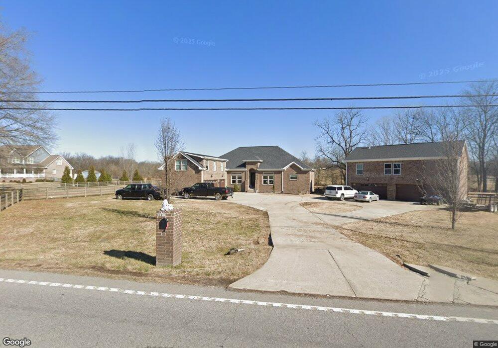
1716 25w Hwy Gallatin, TN 37066
Estimated Value: $864,000 - $1,379,000
3
Beds
3
Baths
3,697
Sq Ft
$289/Sq Ft
Est. Value
About This Home
This home is located at 1716 25w Hwy, Gallatin, TN 37066 and is currently estimated at $1,068,498, approximately $289 per square foot. 1716 25w Hwy is a home located in Sumner County with nearby schools including Howard Elementary School, Rucker Stewart Middle School, and Station Camp High School.
Ownership History
Date
Name
Owned For
Owner Type
Purchase Details
Closed on
Apr 13, 2010
Sold by
Hurst Daniel and Hurst Sara
Bought by
Davis Laymon L
Current Estimated Value
Home Financials for this Owner
Home Financials are based on the most recent Mortgage that was taken out on this home.
Original Mortgage
$17,000
Outstanding Balance
$11,289
Interest Rate
4.94%
Mortgage Type
Seller Take Back
Estimated Equity
$1,057,209
Create a Home Valuation Report for This Property
The Home Valuation Report is an in-depth analysis detailing your home's value as well as a comparison with similar homes in the area
Home Values in the Area
Average Home Value in this Area
Purchase History
| Date | Buyer | Sale Price | Title Company |
|---|---|---|---|
| Davis Laymon L | $22,000 | None Available |
Source: Public Records
Mortgage History
| Date | Status | Borrower | Loan Amount |
|---|---|---|---|
| Open | Davis Laymon L | $17,000 |
Source: Public Records
Tax History Compared to Growth
Tax History
| Year | Tax Paid | Tax Assessment Tax Assessment Total Assessment is a certain percentage of the fair market value that is determined by local assessors to be the total taxable value of land and additions on the property. | Land | Improvement |
|---|---|---|---|---|
| 2024 | $3,259 | $229,375 | $24,175 | $205,200 |
| 2023 | $3,353 | $148,875 | $16,700 | $132,175 |
| 2022 | $3,368 | $148,875 | $16,700 | $132,175 |
| 2021 | $3,368 | $148,875 | $16,700 | $132,175 |
| 2020 | $3,368 | $148,875 | $16,700 | $132,175 |
| 2019 | $3,368 | $0 | $0 | $0 |
| 2018 | $2,271 | $0 | $0 | $0 |
| 2017 | $203 | $0 | $0 | $0 |
| 2016 | $203 | $0 | $0 | $0 |
| 2015 | -- | $0 | $0 | $0 |
| 2014 | -- | $0 | $0 | $0 |
Source: Public Records
Map
Nearby Homes
- 1176 Liberty Ln
- 1869 Tennessee 25
- 650 Neals Ln
- 1017 Wickshire Dr
- 662 Neals Ln
- 1036 Middleton Ln
- 308 Collier Ln
- 315 Cummings Ln
- 540 Bradford Dr
- 0 Franklin Rd
- 608 Bradford Dr
- 1328 Wentworth Dr
- 2045 Liberty Ln
- 688 Douglas Ln
- 1273 Wentworth Dr
- 420 Dorchester Place
- 415 Buckingham Blvd
- 300 Remington Ave
- 305 Remington Ave
- 1239 Wentworth Dr
- 1716 Highway 25
- 0 Hwy 25 W Unit 1638062
- 0 Hwy 25 W Unit 1770044
- 0 Hwy 25 W Unit RTC2473961
- 0 Hwy 25 W Unit RTC2391104
- 0 Hwy 25 W Unit RTC2362722
- 0 Hwy 25 W Unit RTC2359175
- 0 Hwy 25 W Unit RTC2359142
- 0 Hwy 25 W Unit 2245866
- 0 Hwy 25 W Unit 2245865
- 0 Hwy 25 W Unit 2245864
- 0 Hwy 25 W Unit 2245863
- 0 Hwy 25 W Unit 2241732
- 100 Collier Ln
- 2 Collier Ln
- 3 Collier Ln
- 5 Collier Ln
- 130 Rollins Ln
- 101 Collier Ln