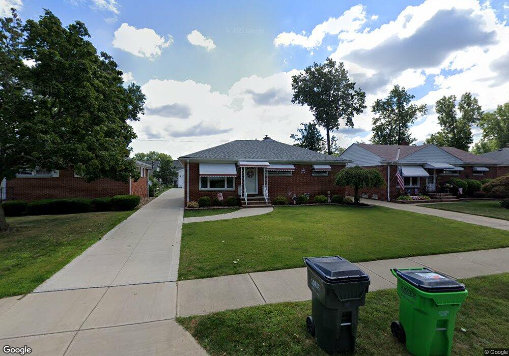
1719 Empire Rd Wickliffe, OH 44092
Estimated Value: $213,000 - $221,000
4
Beds
3
Baths
1,584
Sq Ft
$137/Sq Ft
Est. Value
About This Home
This home is located at 1719 Empire Rd, Wickliffe, OH 44092 and is currently estimated at $217,000, approximately $136 per square foot. 1719 Empire Rd is a home located in Lake County with nearby schools including Wickliffe Elementary School, Wickliffe Middle School, and Wickliffe High School.
Ownership History
Date
Name
Owned For
Owner Type
Purchase Details
Closed on
Jul 16, 1999
Sold by
Dempsey Nancy
Bought by
Meluch Edward M and Meluch Loretta L
Current Estimated Value
Home Financials for this Owner
Home Financials are based on the most recent Mortgage that was taken out on this home.
Original Mortgage
$135,900
Outstanding Balance
$38,007
Interest Rate
7.54%
Estimated Equity
$178,993
Purchase Details
Closed on
Sep 8, 1995
Sold by
Jurcevic Tomica
Bought by
Dempsey Nancy
Home Financials for this Owner
Home Financials are based on the most recent Mortgage that was taken out on this home.
Original Mortgage
$93,500
Interest Rate
7.76%
Mortgage Type
New Conventional
Create a Home Valuation Report for This Property
The Home Valuation Report is an in-depth analysis detailing your home's value as well as a comparison with similar homes in the area
Home Values in the Area
Average Home Value in this Area
Purchase History
| Date | Buyer | Sale Price | Title Company |
|---|---|---|---|
| Meluch Edward M | $151,000 | Executive Title Agency Corp | |
| Dempsey Nancy | $110,000 | -- |
Source: Public Records
Mortgage History
| Date | Status | Borrower | Loan Amount |
|---|---|---|---|
| Open | Meluch Edward M | $135,900 | |
| Closed | Dempsey Nancy | $93,500 |
Source: Public Records
Tax History Compared to Growth
Tax History
| Year | Tax Paid | Tax Assessment Tax Assessment Total Assessment is a certain percentage of the fair market value that is determined by local assessors to be the total taxable value of land and additions on the property. | Land | Improvement |
|---|---|---|---|---|
| 2024 | -- | $71,930 | $18,100 | $53,830 |
| 2023 | $6,407 | $52,100 | $15,640 | $36,460 |
| 2022 | $3,120 | $52,100 | $15,640 | $36,460 |
| 2021 | $3,752 | $52,100 | $15,640 | $36,460 |
| 2020 | $3,533 | $41,680 | $12,510 | $29,170 |
| 2019 | $3,532 | $41,680 | $12,510 | $29,170 |
| 2018 | $3,079 | $44,100 | $13,860 | $30,240 |
| 2017 | $3,104 | $44,100 | $13,860 | $30,240 |
| 2016 | $3,089 | $44,100 | $13,860 | $30,240 |
| 2015 | $3,035 | $44,100 | $13,860 | $30,240 |
| 2014 | $2,673 | $44,100 | $13,860 | $30,240 |
| 2013 | $2,672 | $44,100 | $13,860 | $30,240 |
Source: Public Records
Map
Nearby Homes
- 30705 Grant St
- 30530 Grant St
- 1711 Rush Rd
- 1737 Drenik Dr
- 1590 Dennis Dr
- 1648 Douglas Rd
- 5510 Wildwood Ct Unit 81-A
- 1847 Eldon Dr
- 1842 Eldon Dr
- 1569 Douglas Rd
- 1560 Douglas Rd
- 1616 Lee Terrace Dr Unit C9
- 5463 Millwood Ln Unit 42C
- 5218 Liberty Ln Unit A
- 30335 Euclid Ave Unit 7
- 30335 Euclid Ave Unit 50
- 34345 Giovanni Ave
- 1719 E 300th St
- 5520 Bretton Ct Unit A
- 5551 Ivy Ct
- 1713 Empire Rd
- 1725 Empire Rd
- 1731 Empire Rd
- 1707 Empire Rd
- 1418 Birdie Ln Unit 4
- 1424 Birdie Ln
- 1412 Birdie Ln
- 1737 Empire Rd
- 1430 Birdie Ln
- 1701 Empire Rd
- 1406 Birdie Ln
- 1436 Birdie Ln Unit 7
- 1741 Empire Rd
- 1720 Empire Rd
- 1714 Empire Rd
- 1726 Empire Rd
- 1732 Empire Rd
- 1708 Empire Rd
- 1442 Birdie Ln
- 0 Grant St