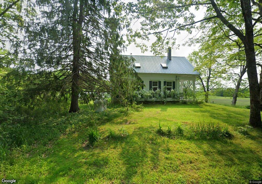
172 Fisher Rd Bowdoinham, ME 04008
Estimated Value: $489,000 - $633,000
--
Bed
--
Bath
2,350
Sq Ft
$238/Sq Ft
Est. Value
About This Home
This home is located at 172 Fisher Rd, Bowdoinham, ME 04008 and is currently estimated at $560,442, approximately $238 per square foot. 172 Fisher Rd is a home with nearby schools including Mt Ararat High School.
Ownership History
Date
Name
Owned For
Owner Type
Purchase Details
Closed on
Apr 7, 2014
Sold by
Malcolm L Jewell T L and Malcolm Mendell
Bought by
Mendall Nina J and Mendall Peter J
Current Estimated Value
Home Financials for this Owner
Home Financials are based on the most recent Mortgage that was taken out on this home.
Original Mortgage
$250,000
Interest Rate
4%
Mortgage Type
Commercial
Create a Home Valuation Report for This Property
The Home Valuation Report is an in-depth analysis detailing your home's value as well as a comparison with similar homes in the area
Home Values in the Area
Average Home Value in this Area
Purchase History
| Date | Buyer | Sale Price | Title Company |
|---|---|---|---|
| Mendall Nina J | -- | -- | |
| Mendall Nina J | -- | -- |
Source: Public Records
Mortgage History
| Date | Status | Borrower | Loan Amount |
|---|---|---|---|
| Closed | Mendall Nina J | $250,000 |
Source: Public Records
Tax History Compared to Growth
Tax History
| Year | Tax Paid | Tax Assessment Tax Assessment Total Assessment is a certain percentage of the fair market value that is determined by local assessors to be the total taxable value of land and additions on the property. | Land | Improvement |
|---|---|---|---|---|
| 2024 | $6,665 | $317,400 | $123,000 | $194,400 |
| 2023 | $6,228 | $319,400 | $125,000 | $194,400 |
| 2022 | $4,763 | $263,300 | $101,400 | $161,900 |
| 2021 | $4,492 | $264,700 | $102,800 | $161,900 |
| 2020 | $159 | $265,800 | $107,800 | $158,000 |
| 2019 | $166 | $265,300 | $107,300 | $158,000 |
| 2018 | $4,102 | $239,200 | $107,500 | $131,700 |
| 2017 | $4,014 | $238,200 | $106,500 | $131,700 |
| 2016 | $4,131 | $237,200 | $105,500 | $131,700 |
| 2015 | $3,810 | $231,600 | $99,900 | $131,700 |
| 2014 | $3,772 | $232,100 | $100,400 | $131,700 |
| 2013 | $3,577 | $232,300 | $100,500 | $131,800 |
Source: Public Records
Map
Nearby Homes
- Lot 08 Sara's Way
- 51 Mountain View Cir
- 428 Cathance Rd
- 19 Spear Dr
- 75 Adams Landing Rd
- 45A-A Hornbeck Cross
- 594 Middlesex Rd
- 36.5 Acres Augusta Rd
- 83 Hemlock Hill Ln
- 0 White Rd
- 1338 Meadow Rd
- 210 Augusta Rd
- 314 Meadow Rd
- 17 Chestnut Dr
- 744 Ridge Rd
- 143 White Rd
- 20 Eagle Point Rd
- 107 Stevenson Way
- 215 Ward Rd
- 26 Bay Park Dr