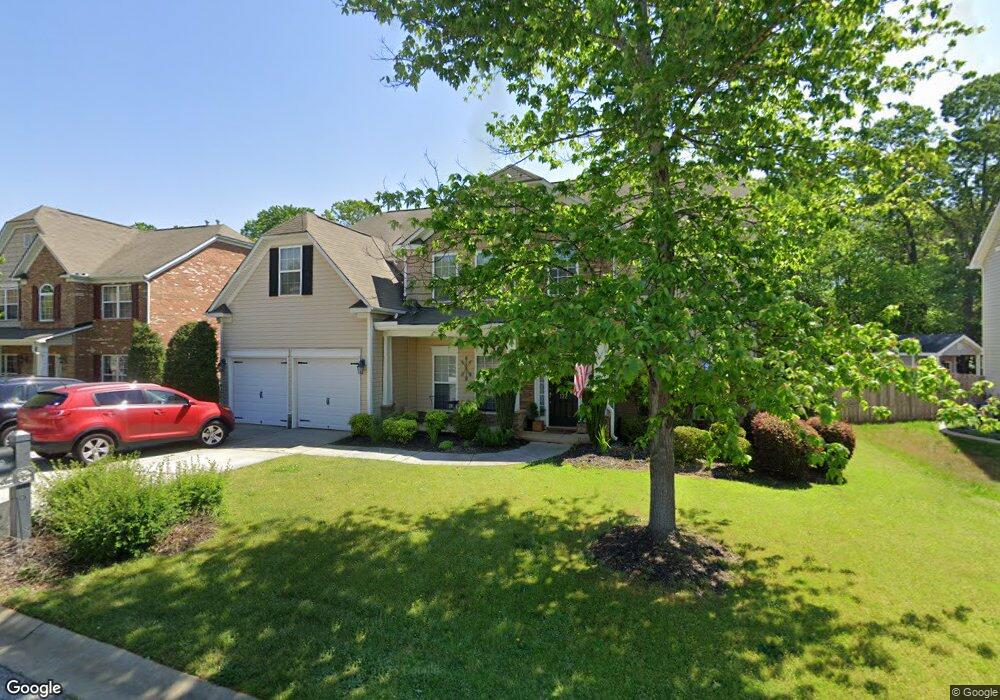
172 Heritage Point Dr Simpsonville, SC 29681
Estimated Value: $407,163 - $515,000
3
Beds
3
Baths
2,902
Sq Ft
$151/Sq Ft
Est. Value
About This Home
This home is located at 172 Heritage Point Dr, Simpsonville, SC 29681 and is currently estimated at $438,041, approximately $150 per square foot. 172 Heritage Point Dr is a home located in Greenville County with nearby schools including Bryson Elementary School, Bryson Middle School, and Hillcrest High School.
Ownership History
Date
Name
Owned For
Owner Type
Purchase Details
Closed on
Mar 24, 2015
Sold by
Harvey William A and Harvey Jennifer A
Bought by
Preston Kenneth T and Kleiner Preston Rebecca Anne
Current Estimated Value
Home Financials for this Owner
Home Financials are based on the most recent Mortgage that was taken out on this home.
Original Mortgage
$198,000
Outstanding Balance
$152,261
Interest Rate
3.79%
Mortgage Type
Purchase Money Mortgage
Estimated Equity
$285,780
Purchase Details
Closed on
Oct 27, 2006
Sold by
Mccar Homes Greenville Llc
Bought by
Harvey William A and Harvey Jennifer A
Home Financials for this Owner
Home Financials are based on the most recent Mortgage that was taken out on this home.
Original Mortgage
$203,200
Interest Rate
6.39%
Mortgage Type
Purchase Money Mortgage
Create a Home Valuation Report for This Property
The Home Valuation Report is an in-depth analysis detailing your home's value as well as a comparison with similar homes in the area
Home Values in the Area
Average Home Value in this Area
Purchase History
| Date | Buyer | Sale Price | Title Company |
|---|---|---|---|
| Preston Kenneth T | $220,000 | -- | |
| Harvey William A | $254,120 | None Available |
Source: Public Records
Mortgage History
| Date | Status | Borrower | Loan Amount |
|---|---|---|---|
| Open | Preston Kenneth T | $198,000 | |
| Previous Owner | Harvey William A | $203,200 |
Source: Public Records
Tax History Compared to Growth
Tax History
| Year | Tax Paid | Tax Assessment Tax Assessment Total Assessment is a certain percentage of the fair market value that is determined by local assessors to be the total taxable value of land and additions on the property. | Land | Improvement |
|---|---|---|---|---|
| 2024 | $1,938 | $9,750 | $1,600 | $8,150 |
| 2023 | $1,938 | $9,750 | $1,600 | $8,150 |
| 2022 | $1,893 | $9,750 | $1,600 | $8,150 |
| 2021 | $1,894 | $9,750 | $1,600 | $8,150 |
| 2020 | $1,785 | $8,600 | $1,400 | $7,200 |
| 2019 | $1,786 | $8,600 | $1,400 | $7,200 |
| 2018 | $1,649 | $8,600 | $1,400 | $7,200 |
| 2017 | $1,649 | $8,600 | $1,400 | $7,200 |
| 2016 | $1,585 | $214,980 | $35,000 | $179,980 |
| 2015 | $4,125 | $214,980 | $35,000 | $179,980 |
| 2014 | $4,687 | $249,040 | $40,000 | $209,040 |
Source: Public Records
Map
Nearby Homes
- 157 Heritage Point Dr
- 1024 Powderhorn Rd
- 377 Heritage Point Dr
- 214 Appomattox Dr
- 33 Golden Acre Ct
- 251 Oak Branch Dr
- 415 Raleighwood Ln
- 8 Valeria Place
- 103 Silver Falls Dr
- 22 Daybreak Place
- 14 Corsica Ct
- 222 Raleighwood Ln
- 106 Ashborne Ln
- 167 Strongridge Trail
- 6 Ashborne Ln
- 139 Strongridge Trail
- 112 Woodcross Dr
- 48 Woodcross Dr
- 6 Burge Ct
- 2 Woodcross Dr
- 168 Heritage Point Dr
- 176 Heritage Point Dr
- 180 Heritage Point Dr
- 164 Heritage Point Dr
- 169 Heritage Point Dr
- 173 Heritage Point Dr
- 165 Heritage Point Dr
- 177 Heritage Point Dr
- 160 Heritage Point Dr
- 184 Heritage Point Dr
- 161 Heritage Point Dr
- 181 Heritage Point Dr
- 156 Heritage Point Dr
- 46 Open Range Ln Unit 53
- 46 Open Range Ln
- 188 Heritage Point Dr
- 42 Open Range Ln
- 50 Open Range Ln
- 185 Heritage Point Dr
- 152 Heritage Point Dr