Estimated Value: $908,000 - $989,000
4
Beds
3
Baths
2,454
Sq Ft
$380/Sq Ft
Est. Value
About This Home
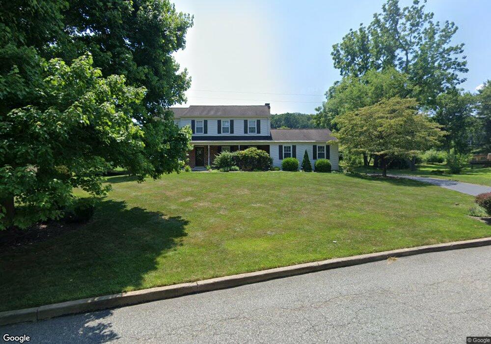
This home is located at 1720 Justin Ln, Paoli, PA 19301 and is currently estimated at $932,386, approximately $379 per square foot. 1720 Justin Ln is a home located in Chester County with nearby schools including Hillside Elementary School, Valley Forge Middle School, and Conestoga Senior High School.
Ownership History
Date
Name
Owned For
Owner Type
Purchase Details
Closed on
Sep 12, 2011
Bought by
Burks Clinton and Burks Susan
Current Estimated Value
Purchase Details
Closed on
May 16, 2008
Sold by
Ford Louis W and Ford Kathleen B
Bought by
Rau Tiffany D
Home Financials for this Owner
Home Financials are based on the most recent Mortgage that was taken out on this home.
Original Mortgage
$362,250
Interest Rate
5.94%
Mortgage Type
Purchase Money Mortgage
Create a Home Valuation Report for This Property
The Home Valuation Report is an in-depth analysis detailing your home's value as well as a comparison with similar homes in the area
Home Values in the Area
Average Home Value in this Area
Purchase History
| Date | Buyer | Sale Price | Title Company |
|---|---|---|---|
| Burks Clinton | $480,000 | -- | |
| Rau Tiffany D | $483,000 | None Available |
Source: Public Records
Mortgage History
| Date | Status | Borrower | Loan Amount |
|---|---|---|---|
| Previous Owner | Rau Tiffany D | $362,250 |
Source: Public Records
Tax History Compared to Growth
Tax History
| Year | Tax Paid | Tax Assessment Tax Assessment Total Assessment is a certain percentage of the fair market value that is determined by local assessors to be the total taxable value of land and additions on the property. | Land | Improvement |
|---|---|---|---|---|
| 2025 | $9,330 | $264,870 | $83,600 | $181,270 |
| 2024 | $9,330 | $264,870 | $83,600 | $181,270 |
| 2023 | $8,764 | $264,870 | $83,600 | $181,270 |
| 2022 | $8,538 | $264,870 | $83,600 | $181,270 |
| 2021 | $8,375 | $264,870 | $83,600 | $181,270 |
| 2020 | $8,144 | $264,870 | $83,600 | $181,270 |
| 2019 | $7,887 | $264,870 | $83,600 | $181,270 |
| 2018 | $7,731 | $264,870 | $83,600 | $181,270 |
| 2017 | $7,546 | $264,870 | $83,600 | $181,270 |
| 2016 | -- | $264,870 | $83,600 | $181,270 |
| 2015 | -- | $264,870 | $83,600 | $181,270 |
| 2014 | -- | $264,870 | $83,600 | $181,270 |
Source: Public Records
Map
Nearby Homes
- 1 Whitworth Ave
- 202 Shoreline Dr
- 109 Vincent Rd
- 106 N Valley Rd
- 1250 Swedesford Rd
- 340 Beechwood Rd
- 21 Manor Rd
- 2175 Swedesford Rd
- 29 Manor Rd
- 12 Moreland Rd
- 5 Kent Ln
- 104 Lynbrook Rd
- 521 Foxwood Ln
- 114 Manor Rd
- 1242 Old Lancaster Rd
- 2102 Quail Ridge Dr
- 1304 Weatherstone Dr Unit 1304
- 201 Penns Ln
- 3 Bryan Ave
- 1602 Weatherstone Dr Unit 1602
- 1712 Justin Ln
- 1726 Justin Ln
- 1706 Justin Ln
- 1734 Justin Ln
- 1721 Justin Ln
- 1727 Justin Ln
- 1713 Justin Ln
- 1735 Justin Ln
- 1702 Justin Ln
- 1704 Justin Ln
- 1742 Justin Ln
- 1707 Justin Ln
- 1701 Justin Ln
- 1750 Jennings Way
- 1742 Jennings Way
- 1758 Jennings Way
- 1734 Jennings Way
- 1728 Jennings Way
- 14 Kates Glen
- 18 Kates Glen