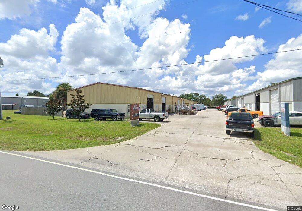
1720 Ranger Ave de Land, FL 32724
North DeLand Neighborhood
--
Bed
4
Baths
7,350
Sq Ft
0.45
Acres
About This Home
This home is located at 1720 Ranger Ave, de Land, FL 32724. 1720 Ranger Ave is a home located in Volusia County with nearby schools including Deland High School, George W. Marks Elementary School, and Deland Middle School.
Ownership History
Date
Name
Owned For
Owner Type
Purchase Details
Closed on
Jan 5, 2006
Sold by
Mcphail Properties Inc
Bought by
Mcphail Michael L and Mcphail Claudia M
Home Financials for this Owner
Home Financials are based on the most recent Mortgage that was taken out on this home.
Original Mortgage
$200,000
Outstanding Balance
$111,882
Interest Rate
6.19%
Mortgage Type
Commercial
Create a Home Valuation Report for This Property
The Home Valuation Report is an in-depth analysis detailing your home's value as well as a comparison with similar homes in the area
Home Values in the Area
Average Home Value in this Area
Purchase History
| Date | Buyer | Sale Price | Title Company |
|---|---|---|---|
| Mcphail Michael L | $85,247 | Ability Title Inc |
Source: Public Records
Mortgage History
| Date | Status | Borrower | Loan Amount |
|---|---|---|---|
| Open | Mcphail Michael L | $200,000 |
Source: Public Records
Tax History Compared to Growth
Tax History
| Year | Tax Paid | Tax Assessment Tax Assessment Total Assessment is a certain percentage of the fair market value that is determined by local assessors to be the total taxable value of land and additions on the property. | Land | Improvement |
|---|---|---|---|---|
| 2025 | $5,239 | $380,599 | $39,820 | $340,779 |
| 2024 | $5,239 | $371,208 | $39,820 | $331,388 |
| 2023 | $5,239 | $350,608 | $39,820 | $310,788 |
| 2022 | $4,895 | $327,586 | $39,820 | $287,766 |
| 2021 | $4,646 | $274,883 | $29,865 | $245,018 |
| 2020 | $4,388 | $274,578 | $29,865 | $244,713 |
| 2019 | $4,239 | $260,739 | $29,865 | $230,874 |
| 2018 | $3,583 | $168,508 | $29,865 | $138,643 |
| 2017 | $3,297 | $141,393 | $24,888 | $116,505 |
| 2016 | $2,972 | $129,415 | $0 | $0 |
| 2015 | $2,934 | $123,681 | $0 | $0 |
| 2014 | $2,955 | $121,681 | $0 | $0 |
Source: Public Records
Map
Nearby Homes
- TBD E International Speedway Blvd
- 147 Rip Cord Ln
- 0 E International Speedway Blvd
- 913 Lake Lindley Dr N
- 1618 Palm Ave
- 1403 Island Cove Dr
- 1702 Palmetto Ave
- 1410 Heather Glen Dr
- 1401 Hendren Dr
- 1300 Benton Lake Dr E
- 2324 Lake Talmadge Dr
- 1103 Lindley Cove Cir
- 0 Newport Ave
- 1150 Orangewood Ave
- 1 Smith Ct
- Miramar Plan at Andover Ridge
- Lancaster Plan at Andover Ridge
- Magnolia Plan at Andover Ridge
- Vista Plan at Andover Ridge
- Drexel Plan at Andover Ridge
- 1730 Langley Ave
- 1730 Langley Ave Unit A
- 1711 Ranger Ave
- 1704 Langley Ave
- 0 Langley Ave Unit V4637125
- 0 Langley Ave Unit V4642359
- 1525 Langley Ave
- 1525 Langley Ave Unit 2
- 1702 Langley Ave
- 1760 Langley Ave
- 1370 Saratoga St
- 1771 Langley Ave
- 0 Langley Ave Unit V4627574
- 1402 Yorktown St
- 1511 Lexington Ave
- 1511 Lexington Ave Unit 1
- 1335 Saratoga St
- 1511 Lexington Ave Deland 32 Ave
- 1301 Lexington Ave Unit B
- 1404 Yorktown St