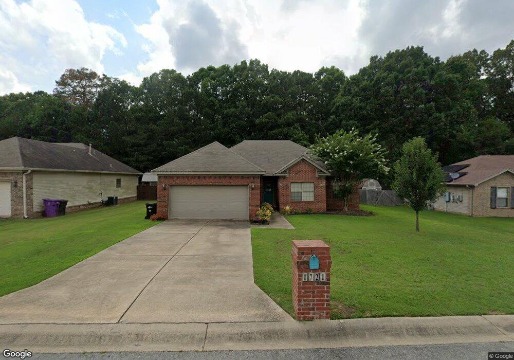
1721 Milburn Dr Benton, AR 72015
Estimated Value: $212,000 - $227,000
3
Beds
2
Baths
1,545
Sq Ft
$141/Sq Ft
Est. Value
About This Home
This home is located at 1721 Milburn Dr, Benton, AR 72015 and is currently estimated at $218,140, approximately $141 per square foot. 1721 Milburn Dr is a home located in Saline County with nearby schools including Angie Grant Elementary School, Benton Middle School, and Benton Junior High School.
Ownership History
Date
Name
Owned For
Owner Type
Purchase Details
Closed on
Oct 5, 2011
Bought by
Hurley
Current Estimated Value
Purchase Details
Closed on
Sep 30, 2011
Bought by
Hurley
Purchase Details
Closed on
Oct 30, 2008
Sold by
Ods Enterprises Llc
Bought by
Sumbles Randall Scott
Home Financials for this Owner
Home Financials are based on the most recent Mortgage that was taken out on this home.
Original Mortgage
$133,120
Interest Rate
6.18%
Mortgage Type
New Conventional
Purchase Details
Closed on
Sep 29, 2006
Sold by
Bryant Meadows Development Inc
Bought by
Ods Eterprises Llc
Home Financials for this Owner
Home Financials are based on the most recent Mortgage that was taken out on this home.
Original Mortgage
$114,900
Interest Rate
6.44%
Mortgage Type
Construction
Create a Home Valuation Report for This Property
The Home Valuation Report is an in-depth analysis detailing your home's value as well as a comparison with similar homes in the area
Home Values in the Area
Average Home Value in this Area
Purchase History
| Date | Buyer | Sale Price | Title Company |
|---|---|---|---|
| Hurley | $129,000 | -- | |
| Hurley | $129,000 | -- | |
| Sumbles Randall Scott | $130,000 | Title Co | |
| Ods Eterprises Llc | $21,000 | -- |
Source: Public Records
Mortgage History
| Date | Status | Borrower | Loan Amount |
|---|---|---|---|
| Previous Owner | Sumbles Randall Scott | $133,120 | |
| Previous Owner | Ods Eterprises Llc | $114,900 |
Source: Public Records
Tax History Compared to Growth
Tax History
| Year | Tax Paid | Tax Assessment Tax Assessment Total Assessment is a certain percentage of the fair market value that is determined by local assessors to be the total taxable value of land and additions on the property. | Land | Improvement |
|---|---|---|---|---|
| 2025 | $1,808 | $36,045 | $6,240 | $29,805 |
| 2024 | $1,851 | $36,045 | $6,240 | $29,805 |
| 2023 | $1,305 | $36,045 | $6,240 | $29,805 |
| 2022 | $1,276 | $36,045 | $6,240 | $29,805 |
| 2021 | $1,197 | $28,380 | $4,800 | $23,580 |
| 2020 | $1,197 | $28,380 | $4,800 | $23,580 |
| 2019 | $1,197 | $28,380 | $4,800 | $23,580 |
| 2018 | $1,219 | $28,380 | $4,800 | $23,580 |
| 2017 | $1,219 | $28,380 | $4,800 | $23,580 |
| 2016 | $1,613 | $28,450 | $4,800 | $23,650 |
| 2015 | $1,235 | $28,450 | $4,800 | $23,650 |
| 2014 | $1,246 | $28,450 | $4,800 | $23,650 |
Source: Public Records
Map
Nearby Homes
- 1709 Milburn Dr
- 1521 Chatfield
- 1507 Chatfield
- 2607 Silica Heights
- 2423 S Chatfield Rd
- 000 Sorrell Rd
- 00 S Neeley St
- 806 Canterbury
- 3222 Silica Heights
- 1304 Gray St
- 3108 Edison Ave
- 507 Algood St
- 508 Pleasant Ridge Dr
- 1423 Cedar
- 391 Genesis Dr
- 712 S Border St
- 605 Revis St
- 3503 S Chatfield Rd
- 921 Athens
- 1707 Dixie
- 1803 Milburn Dr
- 1715 Milburn Dr
- 1722 Milburn Dr
- 1804 Milburn Dr
- 1809 Milburn Dr
- 1710 Milburn Dr
- 1810 Milburn Dr
- 1815 Milburn Dr
- 1816 Milburn Dr
- 1703 Milburn Dr
- 1704 Milburn Dr
- 1751 Highway 35 S
- 1803 Auburn Hills Dr
- 1751 Highway 35 S
- 1821 Milburn Dr
- 1805 Auburn Hills Dr
- 1820 Milburn Dr
- 1813 Auburn Hills Dr
- 1801 Auburn Hills Dr
- 1819 Auburn Hills Dr