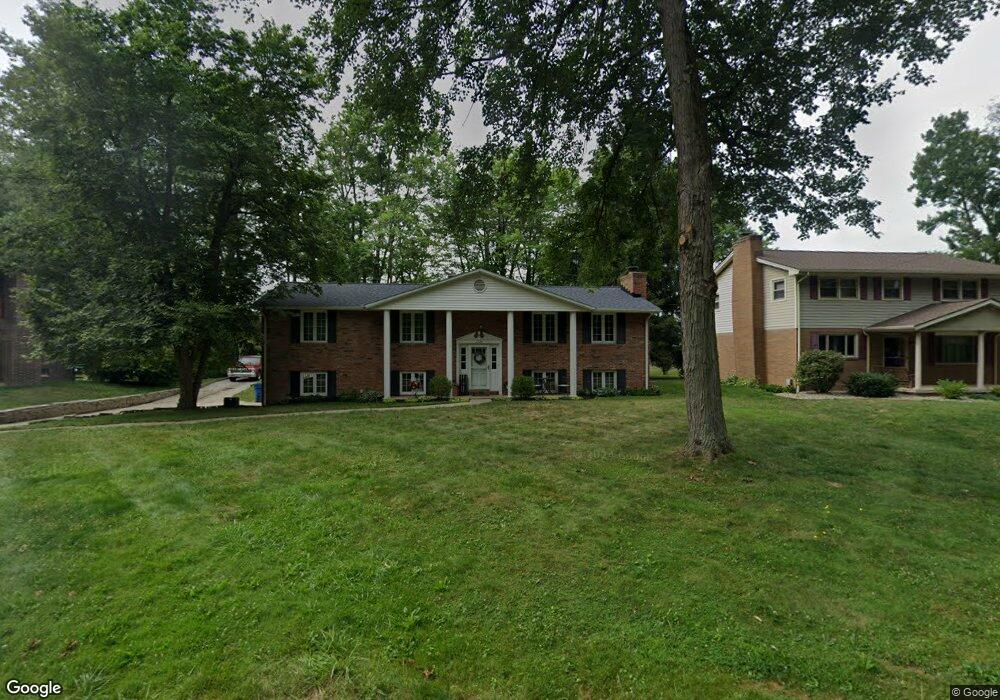
1724 E Broad St Louisville, OH 44641
Estimated Value: $244,496 - $274,000
3
Beds
2
Baths
2,106
Sq Ft
$123/Sq Ft
Est. Value
About This Home
This home is located at 1724 E Broad St, Louisville, OH 44641 and is currently estimated at $258,624, approximately $122 per square foot. 1724 E Broad St is a home located in Stark County with nearby schools including Louisville High School and St. Thomas Aquinas High School & Middle School.
Ownership History
Date
Name
Owned For
Owner Type
Purchase Details
Closed on
May 18, 2010
Sold by
Roberts Donald G and Roberts Stella
Bought by
Hawk Timothy C and Hawk Rachel D
Current Estimated Value
Home Financials for this Owner
Home Financials are based on the most recent Mortgage that was taken out on this home.
Original Mortgage
$138,037
Outstanding Balance
$93,646
Interest Rate
5.3%
Mortgage Type
FHA
Estimated Equity
$164,978
Purchase Details
Closed on
Dec 28, 1998
Sold by
Roberts Donald G and Roberts Stella
Bought by
Roberts Donald G and Roberts Stella
Create a Home Valuation Report for This Property
The Home Valuation Report is an in-depth analysis detailing your home's value as well as a comparison with similar homes in the area
Home Values in the Area
Average Home Value in this Area
Purchase History
| Date | Buyer | Sale Price | Title Company |
|---|---|---|---|
| Hawk Timothy C | $139,900 | Attorney | |
| Roberts Donald G | -- | -- |
Source: Public Records
Mortgage History
| Date | Status | Borrower | Loan Amount |
|---|---|---|---|
| Open | Hawk Timothy C | $138,037 |
Source: Public Records
Tax History Compared to Growth
Tax History
| Year | Tax Paid | Tax Assessment Tax Assessment Total Assessment is a certain percentage of the fair market value that is determined by local assessors to be the total taxable value of land and additions on the property. | Land | Improvement |
|---|---|---|---|---|
| 2025 | -- | $64,620 | $16,700 | $47,920 |
| 2024 | -- | $64,620 | $16,700 | $47,920 |
| 2023 | $2,547 | $59,260 | $15,750 | $43,510 |
| 2022 | $2,552 | $59,260 | $15,750 | $43,510 |
| 2021 | $2,560 | $59,260 | $15,750 | $43,510 |
| 2020 | $2,113 | $53,130 | $14,210 | $38,920 |
| 2019 | $2,122 | $53,130 | $14,210 | $38,920 |
| 2018 | $2,114 | $53,130 | $14,210 | $38,920 |
| 2017 | $1,934 | $46,910 | $12,500 | $34,410 |
| 2016 | $1,974 | $46,910 | $12,500 | $34,410 |
| 2015 | $1,980 | $46,910 | $12,500 | $34,410 |
| 2014 | $1,840 | $40,530 | $10,780 | $29,750 |
| 2013 | $924 | $40,530 | $10,780 | $29,750 |
Source: Public Records
Map
Nearby Homes
- 1715 High St
- 1812 E Broad St
- 641 S Nickelplate St
- 308 Superior St
- 2110 Edmar St
- 2015 E Main St
- 0 Michigan Blvd
- 520 S Silver St
- 728 E Broad St
- 204 E Broad St
- 510 S Bauman Ct
- 325 Lincoln Ave
- 908 Sand Lot Cir
- 107 E Broad St
- 1170 Winding Ridge Ave
- 3390 Meese Rd NE
- 910 Crosswyck Cir
- 1702 View Pointe Ave
- 428 Honeycrisp Dr NE
- 3047 Mcintosh Dr NE
- 1734 E Broad St
- 1714 E Broad St
- 1725 High St
- 1735 High St
- 1737 High St
- 504 S Marion Ave
- 1742 E Broad St
- 520 S Marion Ave
- 0 S Marion Ave Unit 4075814
- 0 S Marion Ave Unit 3768342
- 0 S Marion Ave
- 1752 E Broad St
- 1755 High St
- 1724 High St
- 1634 Monter Ave
- 1644 Monter Ave
- 1714 High St
- 1732 High St
- 1620 E Broad St
- 1626 Monter Ave