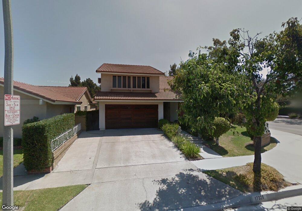
17328 Vickie Ave Cerritos, CA 90703
Estimated Value: $1,373,101 - $1,464,000
4
Beds
3
Baths
2,389
Sq Ft
$592/Sq Ft
Est. Value
About This Home
This home is located at 17328 Vickie Ave, Cerritos, CA 90703 and is currently estimated at $1,414,025, approximately $591 per square foot. 17328 Vickie Ave is a home located in Los Angeles County with nearby schools including Cecil B. Stowers Elementary School, Carmenita Middle School, and Cerritos High School.
Ownership History
Date
Name
Owned For
Owner Type
Purchase Details
Closed on
Apr 8, 1997
Sold by
Taylor Betty and Taylor Eugene
Bought by
Lee John Suk
Current Estimated Value
Home Financials for this Owner
Home Financials are based on the most recent Mortgage that was taken out on this home.
Original Mortgage
$204,000
Outstanding Balance
$26,584
Interest Rate
7.98%
Estimated Equity
$1,387,441
Purchase Details
Closed on
Mar 27, 1996
Sold by
Jackson Ronnie
Bought by
Taylor Eugene and Taylor Betty
Create a Home Valuation Report for This Property
The Home Valuation Report is an in-depth analysis detailing your home's value as well as a comparison with similar homes in the area
Home Values in the Area
Average Home Value in this Area
Purchase History
| Date | Buyer | Sale Price | Title Company |
|---|---|---|---|
| Lee John Suk | $255,000 | Provident Title | |
| Taylor Eugene | -- | Southland Title |
Source: Public Records
Mortgage History
| Date | Status | Borrower | Loan Amount |
|---|---|---|---|
| Open | Lee John Suk | $204,000 | |
| Closed | Lee John Suk | $25,500 |
Source: Public Records
Tax History Compared to Growth
Tax History
| Year | Tax Paid | Tax Assessment Tax Assessment Total Assessment is a certain percentage of the fair market value that is determined by local assessors to be the total taxable value of land and additions on the property. | Land | Improvement |
|---|---|---|---|---|
| 2025 | $5,195 | $421,380 | $176,538 | $244,842 |
| 2024 | $5,195 | $413,119 | $173,077 | $240,042 |
| 2023 | $5,029 | $405,020 | $169,684 | $235,336 |
| 2022 | $4,950 | $397,079 | $166,357 | $230,722 |
| 2021 | $4,825 | $389,295 | $163,096 | $226,199 |
| 2019 | $4,651 | $372,290 | $158,259 | $214,031 |
| 2018 | $4,304 | $364,991 | $155,156 | $209,835 |
| 2016 | $4,113 | $350,820 | $149,132 | $201,688 |
| 2015 | $4,058 | $345,551 | $146,892 | $198,659 |
| 2014 | $3,980 | $338,783 | $144,015 | $194,768 |
Source: Public Records
Map
Nearby Homes
- 13010 Artesia Blvd
- 18006 Point Conception Place
- 13370 Holly Oak Cir
- 13210 Sutton St
- 13044 Hedda Ln
- 12567 Semora St
- 16822 Sierra Vista Way
- 12525 Semora St
- 18517 Betty Way
- 12417 Rose St
- 16611 Shenandoah Ave
- 16429 Westbrook Ln
- 13548 Village Dr Unit A
- 12422 Cuesta Dr Unit 71
- 16308 Indian Creek Rd
- 12356 Reva St
- 0 Parcel: 7016-014-017 Ave Unit PW25183248
- 19008 Jeffrey Ave
- 17103 Cortner Ave
- 12360 Hedda Dr
- 17324 Vickie Ave
- 17227 Leal Ave
- 17221 Leal Ave
- 17320 Vickie Ave
- 13112 Abana Place
- 17329 Vickie Ave
- 17217 Leal Ave
- 17325 Vickie Ave
- 17314 Vickie Ave
- 13059 Carolyn St
- 13055 Carolyn St
- 13103 Carolyn St
- 17319 Vickie Ave
- 17213 Leal Ave
- 13118 Abana Place
- 13109 Carolyn St
- 17310 Vickie Ave
- 13043 Carolyn St
- 17313 Vickie Ave
- 13115 Carolyn St