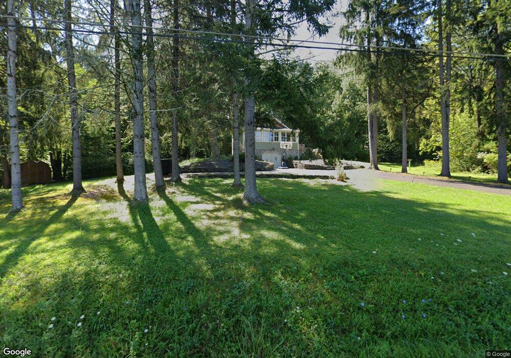
1740 Berme Rd Kerhonkson, NY 12446
Estimated Value: $483,000 - $566,000
2
Beds
2
Baths
1,230
Sq Ft
$430/Sq Ft
Est. Value
About This Home
This home is located at 1740 Berme Rd, Kerhonkson, NY 12446 and is currently estimated at $528,955, approximately $430 per square foot. 1740 Berme Rd is a home located in Ulster County with nearby schools including Rondout Valley High School.
Ownership History
Date
Name
Owned For
Owner Type
Purchase Details
Closed on
Dec 17, 2020
Sold by
Quinn Erin C
Bought by
Yang Dennis and Inn Jennifer
Current Estimated Value
Home Financials for this Owner
Home Financials are based on the most recent Mortgage that was taken out on this home.
Original Mortgage
$280,000
Outstanding Balance
$249,284
Interest Rate
2.7%
Mortgage Type
FHA
Estimated Equity
$279,671
Purchase Details
Closed on
Mar 29, 2013
Sold by
Rado Irena K and Rado Robert J
Bought by
Quinn Erin C
Home Financials for this Owner
Home Financials are based on the most recent Mortgage that was taken out on this home.
Original Mortgage
$100,000
Interest Rate
3.56%
Mortgage Type
New Conventional
Purchase Details
Closed on
Mar 1, 2007
Sold by
Nesbitt Ursela M
Bought by
Rado Robert J and Rado Irena K
Home Financials for this Owner
Home Financials are based on the most recent Mortgage that was taken out on this home.
Original Mortgage
$148,000
Interest Rate
6.19%
Mortgage Type
Purchase Money Mortgage
Create a Home Valuation Report for This Property
The Home Valuation Report is an in-depth analysis detailing your home's value as well as a comparison with similar homes in the area
Home Values in the Area
Average Home Value in this Area
Purchase History
| Date | Buyer | Sale Price | Title Company |
|---|---|---|---|
| Yang Dennis | $402,000 | New Millennium Title Group | |
| Quinn Erin C | $100,000 | -- | |
| Rado Robert J | $185,000 | Commonwealth Land Title Insu |
Source: Public Records
Mortgage History
| Date | Status | Borrower | Loan Amount |
|---|---|---|---|
| Open | Yang Dennis | $280,000 | |
| Previous Owner | Quinn Erin C | $100,000 | |
| Previous Owner | Rado Robert J | $148,000 |
Source: Public Records
Tax History Compared to Growth
Tax History
| Year | Tax Paid | Tax Assessment Tax Assessment Total Assessment is a certain percentage of the fair market value that is determined by local assessors to be the total taxable value of land and additions on the property. | Land | Improvement |
|---|---|---|---|---|
| 2024 | $5,762 | $225,000 | $40,000 | $185,000 |
| 2023 | $5,713 | $225,000 | $40,000 | $185,000 |
| 2022 | $5,226 | $225,000 | $40,000 | $185,000 |
| 2021 | $5,226 | $225,000 | $40,000 | $185,000 |
| 2020 | $4,296 | $183,000 | $40,000 | $143,000 |
| 2019 | $4,128 | $165,000 | $40,000 | $125,000 |
| 2018 | $4,201 | $160,000 | $52,500 | $107,500 |
| 2017 | $4,095 | $160,000 | $52,500 | $107,500 |
| 2016 | $4,089 | $160,000 | $52,500 | $107,500 |
| 2015 | -- | $160,000 | $52,500 | $107,500 |
| 2014 | -- | $160,000 | $52,500 | $107,500 |
Source: Public Records
Map
Nearby Homes
- 83 Sages Loop Rd
- 83 Sages Loop
- 40 Highland Ave
- 16 Sunset Dr
- 3 Anna St
- 22 Samsonville Rd Unit 3
- 215 Maple Ave
- 50 Spruce St
- 17 Boice Mill Rd
- 87 Boice Mill Rd
- 19 Boice Mill Rd
- 57 Samsonville Rd
- 161 Boice Mill Rd
- 150 Hilltop Terrace
- 59 Samsonville Rd
- 3 Rose Dr
- 15 Teradon
- TBD Boice Mill Rd
- 108 Samsonville Rd
- 9 Hamilton Dr