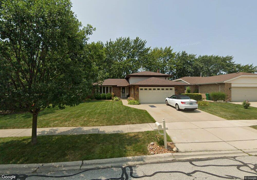
17454 Mulberry Ave Tinley Park, IL 60487
Central Tinley Park NeighborhoodEstimated Value: $354,505 - $391,000
3
Beds
2
Baths
1,323
Sq Ft
$282/Sq Ft
Est. Value
About This Home
This home is located at 17454 Mulberry Ave, Tinley Park, IL 60487 and is currently estimated at $372,626, approximately $281 per square foot. 17454 Mulberry Ave is a home located in Cook County with nearby schools including Christa Mcauliffe School, Prairie View Middle School, and Victor J Andrew High School.
Ownership History
Date
Name
Owned For
Owner Type
Purchase Details
Closed on
Jun 18, 2013
Sold by
Krause Robert B and Krause Sandra K
Bought by
Krause Robert B and Krause Sandra K
Current Estimated Value
Purchase Details
Closed on
May 6, 1994
Sold by
Lasalle National Trust Na
Bought by
Krause Robert B and Krause Sandra K
Home Financials for this Owner
Home Financials are based on the most recent Mortgage that was taken out on this home.
Original Mortgage
$126,000
Interest Rate
6.37%
Create a Home Valuation Report for This Property
The Home Valuation Report is an in-depth analysis detailing your home's value as well as a comparison with similar homes in the area
Home Values in the Area
Average Home Value in this Area
Purchase History
| Date | Buyer | Sale Price | Title Company |
|---|---|---|---|
| Krause Robert B | -- | None Available | |
| Krause Robert B | -- | Attorneys Title Guaranty Fun |
Source: Public Records
Mortgage History
| Date | Status | Borrower | Loan Amount |
|---|---|---|---|
| Previous Owner | Krause Robert B | $126,000 |
Source: Public Records
Tax History Compared to Growth
Tax History
| Year | Tax Paid | Tax Assessment Tax Assessment Total Assessment is a certain percentage of the fair market value that is determined by local assessors to be the total taxable value of land and additions on the property. | Land | Improvement |
|---|---|---|---|---|
| 2024 | $6,929 | $26,104 | $4,816 | $21,288 |
| 2023 | $5,830 | $31,000 | $4,816 | $26,184 |
| 2022 | $5,830 | $19,773 | $4,188 | $15,585 |
| 2021 | $5,673 | $19,772 | $4,187 | $15,585 |
| 2020 | $5,602 | $19,772 | $4,187 | $15,585 |
| 2019 | $6,812 | $24,433 | $3,768 | $20,665 |
| 2018 | $6,664 | $24,433 | $3,768 | $20,665 |
| 2017 | $6,505 | $24,433 | $3,768 | $20,665 |
| 2016 | $5,249 | $18,300 | $3,350 | $14,950 |
| 2015 | $5,151 | $18,300 | $3,350 | $14,950 |
| 2014 | $5,125 | $18,300 | $3,350 | $14,950 |
| 2013 | $5,169 | $19,744 | $3,350 | $16,394 |
Source: Public Records
Map
Nearby Homes
- 17533 Pecan Ln
- 17230 Shetland Dr
- 9201 175th St
- 9260 Windsor Pkwy Unit 80
- 9280 Windsor Pkwy Unit 92
- Fremont Plan at Radcliffe Place
- Calysta Plan at Radcliffe Place
- Danbury Plan at Radcliffe Place
- Briarcliffe Plan at Radcliffe Place
- Eden Plan at Radcliffe Place
- Amberwood Plan at Radcliffe Place
- 17631 Dover Ct
- 17324 Humber Ln
- 17224 Briar Dr
- 8543 Carriage Ln
- 8548 Bethany Ln
- 9413 Caledonia Dr
- 16950 90th Ave
- 17018 93rd Ave
- 17535 S La Grange Rd
- 17448 Mulberry Ave
- 17460 Mulberry Ave
- 17442 Mulberry Ave
- 17437 Bridalwood Ln
- 8990 175th St
- 17455 Mulberry Ave
- 17431 Bridalwood Ln
- 17436 Mulberry Ave
- 8938 Chestnut Dr
- 8933 Chestnut Dr
- 17437 Mulberry Ave
- 8950 Magnolia Ln
- 17430 Mulberry Ave
- 9000 Magnolia Ln
- 9006 Magnolia Ln
- 8927 Chestnut Dr
- 17501 Mulberry Ave
- 17431 Mulberry Ave
- 17419 Bridalwood Ln
- 8920 Chestnut Dr