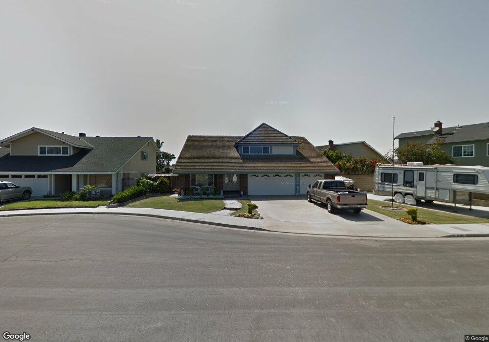
17481 Bellport Cir Huntington Beach, CA 92649
Estimated Value: $1,642,862 - $1,859,000
5
Beds
4
Baths
2,279
Sq Ft
$775/Sq Ft
Est. Value
About This Home
This home is located at 17481 Bellport Cir, Huntington Beach, CA 92649 and is currently estimated at $1,766,716, approximately $775 per square foot. 17481 Bellport Cir is a home located in Orange County with nearby schools including Hope View Elementary School, Marine View Middle, and Huntington Beach High School.
Ownership History
Date
Name
Owned For
Owner Type
Purchase Details
Closed on
Dec 20, 1994
Sold by
Cotton Donald F and Cotton Irene R
Bought by
Cotton Donald P and Cotton Irene R
Current Estimated Value
Purchase Details
Closed on
Oct 19, 1993
Sold by
Cotton Donald P and Cotton Irene R
Bought by
Cotton Donald P and Cotton Irene R
Home Financials for this Owner
Home Financials are based on the most recent Mortgage that was taken out on this home.
Original Mortgage
$70,000
Interest Rate
6.81%
Create a Home Valuation Report for This Property
The Home Valuation Report is an in-depth analysis detailing your home's value as well as a comparison with similar homes in the area
Home Values in the Area
Average Home Value in this Area
Purchase History
| Date | Buyer | Sale Price | Title Company |
|---|---|---|---|
| Cotton Donald P | -- | -- | |
| Cotton Donald P | -- | World Title Company |
Source: Public Records
Mortgage History
| Date | Status | Borrower | Loan Amount |
|---|---|---|---|
| Closed | Cotton Donald P | $70,000 |
Source: Public Records
Tax History Compared to Growth
Tax History
| Year | Tax Paid | Tax Assessment Tax Assessment Total Assessment is a certain percentage of the fair market value that is determined by local assessors to be the total taxable value of land and additions on the property. | Land | Improvement |
|---|---|---|---|---|
| 2025 | $2,182 | $173,888 | $39,126 | $134,762 |
| 2024 | $2,182 | $170,479 | $38,359 | $132,120 |
| 2023 | $2,128 | $167,137 | $37,607 | $129,530 |
| 2022 | $2,091 | $163,860 | $36,869 | $126,991 |
| 2021 | $2,053 | $160,648 | $36,147 | $124,501 |
| 2020 | $2,030 | $159,001 | $35,776 | $123,225 |
| 2019 | $1,998 | $155,884 | $35,075 | $120,809 |
| 2018 | $1,954 | $152,828 | $34,387 | $118,441 |
| 2017 | $1,922 | $149,832 | $33,713 | $116,119 |
| 2016 | $1,850 | $146,895 | $33,052 | $113,843 |
| 2015 | $1,820 | $144,689 | $32,556 | $112,133 |
| 2014 | $1,783 | $141,855 | $31,918 | $109,937 |
Source: Public Records
Map
Nearby Homes
- 5262 Glenroy Dr
- 5241 Glenroy Dr
- 17532 Montbury Cir
- 17202 Corbina Ln Unit 108
- 17191 Corbina Ln Unit 110
- 17372 Forbes Ln
- 17042 Twain Ln
- 5812 Raphael Dr
- 5862 Raphael Dr
- 17472 Oakbluffs Ln
- 17982 Whitford Ln
- 17322 Wareham Ln
- 17291 Wareham Ln
- 17272 Tidalridge Ln
- 4746 Oceanridge Dr
- 17212 Lynn Ln
- 16832 Roosevelt Ln
- 4711 Winthrop Dr
- 4822 Tiara Dr Unit 104
- 6051 Summerdale Dr
- 17491 Bellport Cir
- 5362 Glenstone Dr
- 5382 Glenstone Dr
- 5352 Glenstone Dr
- 17482 Bellport Cir
- 5342 Glenstone Dr
- 17472 Bellport Cir
- 5412 Glenstone Dr
- 17492 Bellport Cir
- 5332 Glenstone Dr
- 5422 Glenstone Dr
- 5361 Glenstone Dr
- 5381 Glenstone Dr
- 17511 Putney Cir
- 17471 Hillgate Ln
- 5351 Glenstone Dr
- 17512 Putney Cir
- 17481 Hillgate Ln
- 17451 Hillgate Ln
- 5341 Glenstone Dr