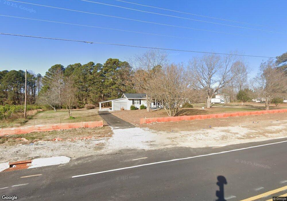
1756 Rolesville Rd Wake Forest, NC 27587
Estimated Value: $196,000 - $310,000
3
Beds
2
Baths
1,566
Sq Ft
$174/Sq Ft
Est. Value
About This Home
This home is located at 1756 Rolesville Rd, Wake Forest, NC 27587 and is currently estimated at $272,369, approximately $173 per square foot. 1756 Rolesville Rd is a home located in Wake County with nearby schools including Rolesville Elementary School, Rolesville Middle School, and Rolesville High School.
Ownership History
Date
Name
Owned For
Owner Type
Purchase Details
Closed on
May 4, 2023
Sold by
Rowell Pennina
Bought by
Department Of Transportation
Current Estimated Value
Purchase Details
Closed on
Nov 14, 2017
Sold by
Rowell Jason P and Rowell Pennina
Bought by
Rowell Pennina and Rowell Rachel
Purchase Details
Closed on
Dec 17, 2010
Sold by
Mcdonald Dawn
Bought by
Hayes Johnny W and Hayes Carol M
Purchase Details
Closed on
Apr 15, 2010
Sold by
Hayes Carol M and Hayes John W
Bought by
Hayes John W and Hayes Carol M
Create a Home Valuation Report for This Property
The Home Valuation Report is an in-depth analysis detailing your home's value as well as a comparison with similar homes in the area
Home Values in the Area
Average Home Value in this Area
Purchase History
| Date | Buyer | Sale Price | Title Company |
|---|---|---|---|
| Department Of Transportation | $44,000 | None Listed On Document | |
| Department Of Transportation | $44,000 | None Listed On Document | |
| Rowell Pennina | -- | None Available | |
| Hayes Johnny W | -- | None Available | |
| Hayes John W | $72,000 | None Available |
Source: Public Records
Tax History Compared to Growth
Tax History
| Year | Tax Paid | Tax Assessment Tax Assessment Total Assessment is a certain percentage of the fair market value that is determined by local assessors to be the total taxable value of land and additions on the property. | Land | Improvement |
|---|---|---|---|---|
| 2025 | -- | $226,961 | $58,000 | $168,961 |
| 2024 | $1,429 | $226,961 | $58,000 | $168,961 |
| 2023 | $1,239 | $156,296 | $48,000 | $108,296 |
| 2022 | $1,149 | $156,296 | $48,000 | $108,296 |
| 2021 | $1,118 | $156,296 | $48,000 | $108,296 |
| 2020 | $1,100 | $156,296 | $48,000 | $108,296 |
| 2019 | $1,007 | $120,835 | $40,000 | $80,835 |
| 2018 | $927 | $120,835 | $40,000 | $80,835 |
| 2017 | $879 | $120,835 | $40,000 | $80,835 |
| 2016 | $862 | $120,835 | $40,000 | $80,835 |
| 2015 | -- | $107,698 | $60,000 | $47,698 |
| 2014 | -- | $107,698 | $60,000 | $47,698 |
Source: Public Records
Map
Nearby Homes
- Norman Plan at Kalas Falls
- Jordan Plan at Kalas Falls
- Hampshire Plan at Kalas Falls
- Hartwell Plan at Kalas Falls
- Summit Plan at Kalas Falls
- Fleetwood Plan at Kalas Falls
- Wylie Plan at Kalas Falls
- 5833 Mitchell Mill Rd
- 3612 Bailey Meadows Dr
- 3604 Bailey Meadows Dr
- 5709 Flowery Meadow Ct
- 3608 Manly Farm Rd
- 3628 Manly Farm Rd
- 3904 Manly Farm Rd
- 6200 Emily Ln
- 2205 Seraphic Way Unit 403
- 2201 Seraphic Way Unit 404
- 2208 Seraphic Way Unit 381
- Leland Plan at The Point - Palisade
- Benson Plan at The Point - Palisade
- 1725 Rolesville Rd
- 1917 Rolesville Rd
- 1721 Rolesville Rd
- 1716 Rolesville Rd
- 5513 Amazon Trail
- 1809 Rolesville Rd
- 1700 Rolesville Rd
- 3813 Taviston Ct
- 3509 Taviswood Way
- 3820 Taviston Ct
- 1709 Rolesville Rd
- 1632 Rolesville Rd
- 3816 Taviston Ct
- 3500 Taviswood Way
- 1801 Rolesville Rd
- 3504 Taviswood Way
- 3813 Arbor Rose Ln
- 3512 Taviswood Way
- 3508 Taviswood Way
- 3812 Taviston Ct