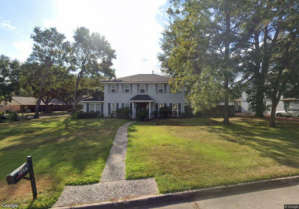
17603 Tall Cypress Dr Spring, TX 77388
Champions NeighborhoodEstimated Value: $313,635 - $340,000
5
Beds
3
Baths
2,678
Sq Ft
$122/Sq Ft
Est. Value
About This Home
This home is located at 17603 Tall Cypress Dr, Spring, TX 77388 and is currently estimated at $326,159, approximately $121 per square foot. 17603 Tall Cypress Dr is a home located in Harris County with nearby schools including Haude Elementary School, Strack Intermediate School, and Klein Collins High School.
Ownership History
Date
Name
Owned For
Owner Type
Purchase Details
Closed on
Dec 13, 2007
Sold by
Stoker Matthew W and Stoker Karen R
Bought by
Mccall Raymond E and Mccall Joellen
Current Estimated Value
Home Financials for this Owner
Home Financials are based on the most recent Mortgage that was taken out on this home.
Original Mortgage
$121,600
Outstanding Balance
$76,968
Interest Rate
6.3%
Mortgage Type
Purchase Money Mortgage
Estimated Equity
$249,191
Purchase Details
Closed on
Mar 24, 1998
Sold by
Berger Robert J and Berger Betty A
Bought by
Stoker Matthew S
Home Financials for this Owner
Home Financials are based on the most recent Mortgage that was taken out on this home.
Original Mortgage
$97,100
Interest Rate
7.12%
Create a Home Valuation Report for This Property
The Home Valuation Report is an in-depth analysis detailing your home's value as well as a comparison with similar homes in the area
Home Values in the Area
Average Home Value in this Area
Purchase History
| Date | Buyer | Sale Price | Title Company |
|---|---|---|---|
| Mccall Raymond E | -- | First American Title | |
| Stoker Matthew S | -- | Alamo Title Company #40 |
Source: Public Records
Mortgage History
| Date | Status | Borrower | Loan Amount |
|---|---|---|---|
| Open | Mccall Raymond E | $121,600 | |
| Previous Owner | Stoker Matthew S | $97,100 |
Source: Public Records
Tax History Compared to Growth
Tax History
| Year | Tax Paid | Tax Assessment Tax Assessment Total Assessment is a certain percentage of the fair market value that is determined by local assessors to be the total taxable value of land and additions on the property. | Land | Improvement |
|---|---|---|---|---|
| 2025 | $948 | $281,235 | $66,973 | $214,262 |
| 2024 | $948 | $281,383 | $66,973 | $214,410 |
| 2023 | $948 | $281,383 | $66,973 | $214,410 |
| 2022 | $5,649 | $274,005 | $66,973 | $207,032 |
| 2021 | $5,488 | $223,410 | $33,486 | $189,924 |
| 2020 | $5,335 | $205,260 | $33,486 | $171,774 |
| 2019 | $5,397 | $199,978 | $33,486 | $166,492 |
| 2018 | $1,197 | $189,041 | $33,486 | $155,555 |
| 2017 | $5,204 | $189,041 | $33,486 | $155,555 |
| 2016 | $4,995 | $181,449 | $33,486 | $147,963 |
| 2015 | $2,080 | $177,047 | $33,486 | $143,561 |
| 2014 | $2,080 | $167,172 | $33,486 | $133,686 |
Source: Public Records
Map
Nearby Homes
- 4126 Oxhill Rd
- 17618 Tall Cypress Dr
- 17623 Bent Cypress Dr
- 4034 Oxhill Rd
- 4223 Annawood Cir
- 17910 Loring Ln
- 3930 Cypress Hill Dr
- 3923 Cypress Lake Dr
- 3826 Cypress Hill Dr
- 4019 Fir Forest Dr
- 17722 Sorrel Ridge Dr
- 18011 Tall Cypress Dr
- 4034 Rolling Terrace Dr
- 18022 Blundell Dr
- 17926 Cypress Spring Dr
- 18023 Woodgum Dr
- 17833 S Cypress Villas Dr
- 18018 Cypress Spring Dr
- 4070 Coltwood Dr
- 4807 Coltwood Dr
- 17611 Tall Cypress Dr
- 4134 Laverock Rd
- 17615 Tall Cypress Dr
- 17606 Tall Cypress Dr
- 4119 Laverock Rd
- 17610 Tall Cypress Dr
- 4123 Laverock Rd
- 17602 Tall Cypress Dr
- 4138 Laverock Rd
- 4115 Laverock Rd
- 17614 Tall Cypress Dr
- 4127 Laverock Rd
- 17619 Tall Cypress Dr
- 4111 Laverock Rd
- 4142 Laverock Rd
- 4131 Laverock Rd
- 17615 Bent Cypress Dr
- 17611 Bent Cypress Dr
- 17619 Bent Cypress Dr
- 17603 Bent Cypress Dr