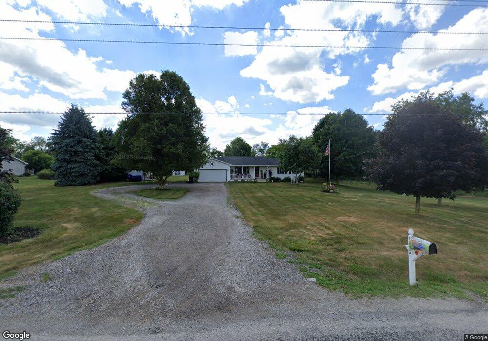
1772 County Road 555 Jeromesville, OH 44840
Estimated Value: $211,000 - $278,000
3
Beds
2
Baths
1,344
Sq Ft
$192/Sq Ft
Est. Value
About This Home
This home is located at 1772 County Road 555, Jeromesville, OH 44840 and is currently estimated at $258,537, approximately $192 per square foot. 1772 County Road 555 is a home located in Ashland County with nearby schools including Hillsdale Elementary School, Hillsdale Middle School, and Hillsdale High School.
Ownership History
Date
Name
Owned For
Owner Type
Purchase Details
Closed on
Mar 21, 2018
Sold by
Young Dennis I and Young Priscilla
Bought by
Maynard Jeremish D
Current Estimated Value
Home Financials for this Owner
Home Financials are based on the most recent Mortgage that was taken out on this home.
Original Mortgage
$126,000
Outstanding Balance
$94,869
Interest Rate
4.32%
Mortgage Type
New Conventional
Estimated Equity
$163,668
Purchase Details
Closed on
Apr 24, 1995
Bought by
Young Dennis I
Create a Home Valuation Report for This Property
The Home Valuation Report is an in-depth analysis detailing your home's value as well as a comparison with similar homes in the area
Home Values in the Area
Average Home Value in this Area
Purchase History
| Date | Buyer | Sale Price | Title Company |
|---|---|---|---|
| Maynard Jeremish D | $140,000 | Attorney Only | |
| Young Dennis I | $11,000 | -- |
Source: Public Records
Mortgage History
| Date | Status | Borrower | Loan Amount |
|---|---|---|---|
| Open | Maynard Jeremish D | $126,000 |
Source: Public Records
Tax History Compared to Growth
Tax History
| Year | Tax Paid | Tax Assessment Tax Assessment Total Assessment is a certain percentage of the fair market value that is determined by local assessors to be the total taxable value of land and additions on the property. | Land | Improvement |
|---|---|---|---|---|
| 2024 | $2,242 | $67,430 | $13,390 | $54,040 |
| 2023 | $2,242 | $67,430 | $13,390 | $54,040 |
| 2022 | $2,021 | $48,170 | $9,570 | $38,600 |
| 2021 | $2,024 | $46,800 | $9,570 | $37,230 |
| 2020 | $1,844 | $46,800 | $9,570 | $37,230 |
| 2019 | $1,708 | $42,500 | $9,330 | $33,170 |
| 2018 | $1,698 | $42,500 | $9,330 | $33,170 |
| 2017 | $1,700 | $42,500 | $9,330 | $33,170 |
| 2016 | $1,484 | $36,960 | $8,110 | $28,850 |
| 2015 | $1,466 | $36,960 | $8,110 | $28,850 |
| 2013 | $1,730 | $42,680 | $8,450 | $34,230 |
Source: Public Records
Map
Nearby Homes
- 1845 County Road 655
- 14 E South St
- 150 E Main St
- 1653 State Route 60
- 1653 Ohio 60
- 0 Twp Rd 1806 Unit 11591470
- 820 County Road 30a
- 0 Ashland County Road 2175
- 0 Ashland County Road 2175
- 2057 State Route 89
- 1446 Township Road 805
- 144 Township Road 1650
- 1346 State Route 89
- 1346 Ohio 89
- 1457 Township Road 853
- 1435 Township Road 853
- 1690 County Road 995
- 0 Eagle Way
- 1015 Township Road 1696
- 1581 County Road 995
- 1770 Cr 555
- 1774 County Road 555
- 561 Cr 1754
- 565 County Road 1754
- 0 Cr 555
- 548 County Road 1754
- 1788 Cr 555
- 519 County Road 1775
- 580 County Road 1754
- 533 County Road 1775
- 514 County Road 1775
- 580 County Road 1754
- 532 County Road 1775
- 1816 County Road 555
- 566 County Road 1754
- 574 County Road 1802
- 574 Cr 1802
- 571 County Road 1802
- 1735 Township Road 1575
- 592 County Road 1754