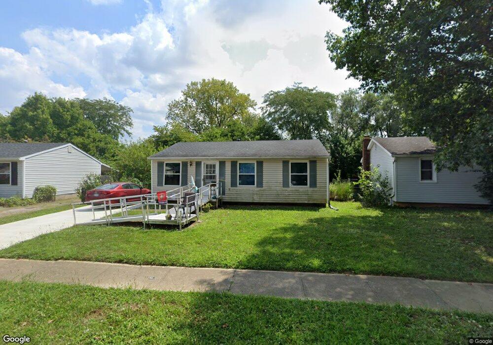
1776 Ripplebrook Rd Columbus, OH 43223
Riverbend NeighborhoodEstimated Value: $178,436 - $201,000
3
Beds
1
Bath
884
Sq Ft
$215/Sq Ft
Est. Value
About This Home
This home is located at 1776 Ripplebrook Rd, Columbus, OH 43223 and is currently estimated at $190,359, approximately $215 per square foot. 1776 Ripplebrook Rd is a home located in Franklin County with nearby schools including James A Harmon Elementary School, Franklin Woods Intermediate School, and Finland Middle School.
Ownership History
Date
Name
Owned For
Owner Type
Purchase Details
Closed on
Jan 9, 2001
Sold by
Smith Michael S
Bought by
Smith Michael S and Smith Karen V
Current Estimated Value
Home Financials for this Owner
Home Financials are based on the most recent Mortgage that was taken out on this home.
Original Mortgage
$57,000
Interest Rate
7.58%
Purchase Details
Closed on
Apr 8, 1971
Bought by
Smith Michael S
Create a Home Valuation Report for This Property
The Home Valuation Report is an in-depth analysis detailing your home's value as well as a comparison with similar homes in the area
Home Values in the Area
Average Home Value in this Area
Purchase History
| Date | Buyer | Sale Price | Title Company |
|---|---|---|---|
| Smith Michael S | -- | -- | |
| Smith Michael S | -- | -- |
Source: Public Records
Mortgage History
| Date | Status | Borrower | Loan Amount |
|---|---|---|---|
| Closed | Smith Michael S | $57,000 | |
| Closed | Smith Michael S | $23,000 |
Source: Public Records
Tax History Compared to Growth
Tax History
| Year | Tax Paid | Tax Assessment Tax Assessment Total Assessment is a certain percentage of the fair market value that is determined by local assessors to be the total taxable value of land and additions on the property. | Land | Improvement |
|---|---|---|---|---|
| 2024 | $1,941 | $53,240 | $16,590 | $36,650 |
| 2023 | $1,907 | $53,240 | $16,590 | $36,650 |
| 2022 | $1,459 | $29,900 | $8,650 | $21,250 |
| 2021 | $1,489 | $29,900 | $8,650 | $21,250 |
| 2020 | $1,480 | $29,900 | $8,650 | $21,250 |
| 2019 | $1,377 | $24,540 | $7,210 | $17,330 |
| 2018 | $1,312 | $24,540 | $7,210 | $17,330 |
| 2017 | $1,364 | $24,540 | $7,210 | $17,330 |
| 2016 | $1,254 | $20,730 | $4,800 | $15,930 |
| 2015 | $1,254 | $20,730 | $4,800 | $15,930 |
| 2014 | $1,255 | $20,730 | $4,800 | $15,930 |
| 2013 | $691 | $22,995 | $5,320 | $17,675 |
Source: Public Records
Map
Nearby Homes
- 3206 Andy Terrace
- 1657 Ripplebrook Rd
- 3326 Bluhm Ct
- 2930 Alkire Rd
- 1830 Winding Hollow Dr
- 3488 Rocky Rd
- 2062 Summer Banks Dr
- 1485 Demorest Rd
- 3623 High Creek Dr
- 1465 Tall Meadows Dr
- 2800 Alkire Rd
- 2188 Dry Ridge Ct
- 3728 Greenock Ct
- 1612 Green Friar Dr
- 2155 Pentress Dr
- 3728 Miltonsburg Dr
- 3766 Dunlane Ct
- 1520 Fall Brook Rd
- 1226 Pinnacle Dr
- 1181 Onslow Dr
- 1784 Ripplebrook Rd
- 1768 Ripplebrook Rd
- 1792 Ripplebrook Rd
- 1793 Aggie Ct
- 1762 Ripplebrook Rd
- 1800 Ripplebrook Rd
- 1769 Ripplebrook Rd
- 1761 Ripplebrook Rd
- 1777 Ripplebrook Rd
- 1798 Aggie Ct
- 1754 Ripplebrook Rd
- 3497 Royal Hill Dr
- 1753 Ripplebrook Rd
- 1805 Aggie Ct
- 1786 Rivermont Rd
- 3491 Royal Hill Dr
- 3471 Royal Hill Dr
- 3485 Royal Hill Dr
- 1804 Aggie Ct
- 1747 Ripplebrook Rd