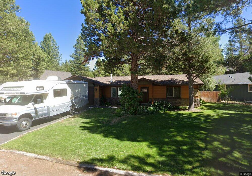
1777 Bakersfield St South Lake Tahoe, CA 96150
Estimated Value: $567,000 - $802,000
3
Beds
2
Baths
1,466
Sq Ft
$452/Sq Ft
Est. Value
About This Home
This home is located at 1777 Bakersfield St, South Lake Tahoe, CA 96150 and is currently estimated at $662,301, approximately $451 per square foot. 1777 Bakersfield St is a home located in El Dorado County with nearby schools including Tahoe Valley Elementary School, South Tahoe Middle School, and South Tahoe High School.
Ownership History
Date
Name
Owned For
Owner Type
Purchase Details
Closed on
Sep 10, 2025
Sold by
Livi Jeff and Livi Vali
Bought by
Jeff David Davies Living Trust and Davies
Current Estimated Value
Purchase Details
Closed on
Jul 20, 2017
Sold by
Davies Jeff David and Dees Vali
Bought by
Davies Jeff and Dees Vali
Purchase Details
Closed on
May 1, 2008
Sold by
Davies Jeff David
Bought by
Davies Jeff David and Dees Vali
Home Financials for this Owner
Home Financials are based on the most recent Mortgage that was taken out on this home.
Original Mortgage
$230,260
Interest Rate
5.88%
Mortgage Type
New Conventional
Purchase Details
Closed on
Oct 13, 1993
Sold by
Fielding Richard A and Fitzpatrick Jeanne Y
Bought by
Davies Jeff David
Home Financials for this Owner
Home Financials are based on the most recent Mortgage that was taken out on this home.
Original Mortgage
$112,200
Interest Rate
6.81%
Mortgage Type
Assumption
Create a Home Valuation Report for This Property
The Home Valuation Report is an in-depth analysis detailing your home's value as well as a comparison with similar homes in the area
Home Values in the Area
Average Home Value in this Area
Purchase History
| Date | Buyer | Sale Price | Title Company |
|---|---|---|---|
| Jeff David Davies Living Trust | -- | None Listed On Document | |
| Davies Jeff | -- | None Available | |
| Davies Jeff David | -- | First American Title Insuran | |
| Davies Jeff David | $110,000 | Placer Title Company |
Source: Public Records
Mortgage History
| Date | Status | Borrower | Loan Amount |
|---|---|---|---|
| Previous Owner | Davies Jeff David | $230,260 | |
| Previous Owner | Davies Jeff David | $112,200 |
Source: Public Records
Tax History Compared to Growth
Tax History
| Year | Tax Paid | Tax Assessment Tax Assessment Total Assessment is a certain percentage of the fair market value that is determined by local assessors to be the total taxable value of land and additions on the property. | Land | Improvement |
|---|---|---|---|---|
| 2025 | $3,010 | $285,437 | $50,968 | $234,469 |
| 2024 | $3,010 | $279,841 | $49,969 | $229,872 |
| 2023 | $2,957 | $274,355 | $48,990 | $225,365 |
| 2022 | $2,926 | $268,977 | $48,030 | $220,947 |
| 2021 | $2,878 | $263,704 | $47,089 | $216,615 |
| 2020 | $2,839 | $261,001 | $46,607 | $214,394 |
| 2019 | $2,824 | $255,885 | $45,694 | $210,191 |
| 2018 | $2,761 | $250,869 | $44,799 | $206,070 |
| 2017 | $2,716 | $245,951 | $43,921 | $202,030 |
| 2016 | $2,661 | $241,129 | $43,060 | $198,069 |
| 2015 | $2,525 | $237,509 | $42,414 | $195,095 |
| 2014 | $2,525 | $232,858 | $41,584 | $191,274 |
Source: Public Records
Map
Nearby Homes
- 1140 Sioux St
- 0 Tomahawk Ln
- 1982 Cherokee St
- 2001 Washoe St
- 1666 Arapahoe St
- 1871 Normuk St
- 1741 Delaware St
- 1889 Normuk St
- 1675 Arapahoe St
- 2877 Us Highway 50
- 1801 Meadow Vale Dr
- 2113 Oaxaco St
- 1820 Nez Perce Dr
- 1940 Apache Ave
- 1935 Apache Ave
- 712 Seneca Dr
- 1541 Arapahoe St
- 654 Tehama Dr
- 1431 Vanderhoof Rd
- 2004 Kickapoo St
- 1805 Bakersfield St
- 1787 Bakersfield St
- 1779 Bakersfield St
- 1815 Bakersfield St
- 1773 Bakersfield St
- 1765 Bakersfield St
- 1741 Blue Jay Cir
- 1835 Bakersfield St
- 1738 Blue Jay Cir
- 1747 Bakersfield Ct
- 1847 Bakersfield St
- 1739 Bakersfield St
- 1739 Bakersfield Ct
- 1719 Bakersfield Ct
- 1715 Bakersfield Ct
- 1856 Bakersfield St
- 1863 Bakersfield St
- 1862 Bakersfield St
- 1724 Bakersfield Ct
- 1724 Bakersfield St