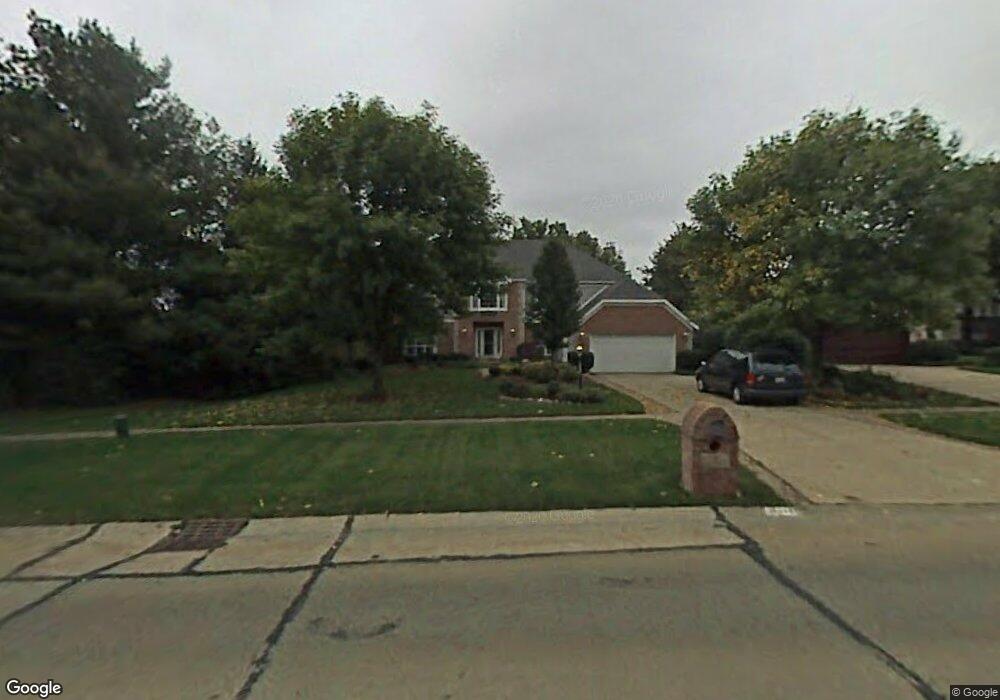
17775 Saratoga Trail Strongsville, OH 44136
Estimated Value: $466,000 - $564,000
4
Beds
4
Baths
3,287
Sq Ft
$158/Sq Ft
Est. Value
About This Home
This home is located at 17775 Saratoga Trail, Strongsville, OH 44136 and is currently estimated at $520,974, approximately $158 per square foot. 17775 Saratoga Trail is a home located in Cuyahoga County with nearby schools including Strongsville High School and Sts Joseph & John Interparochial School.
Ownership History
Date
Name
Owned For
Owner Type
Purchase Details
Closed on
May 4, 2020
Sold by
Storm Roger C and Storm Diana D
Bought by
Storm Roger C and Storm Diana D
Current Estimated Value
Purchase Details
Closed on
Mar 31, 2009
Sold by
Turk Michael G and Turk Deborah
Bought by
Storm Roger C and Storm Diana D
Home Financials for this Owner
Home Financials are based on the most recent Mortgage that was taken out on this home.
Original Mortgage
$284,000
Interest Rate
4.7%
Mortgage Type
Purchase Money Mortgage
Purchase Details
Closed on
Apr 16, 1993
Bought by
Turk Michael G
Purchase Details
Closed on
Feb 17, 1993
Bought by
Parkview Corp
Purchase Details
Closed on
Sep 7, 1989
Bought by
Carolwood Group Inc.
Purchase Details
Closed on
May 2, 1983
Bought by
Cfs Service Corp
Purchase Details
Closed on
Jan 1, 1977
Bought by
Casa Dev Co
Create a Home Valuation Report for This Property
The Home Valuation Report is an in-depth analysis detailing your home's value as well as a comparison with similar homes in the area
Home Values in the Area
Average Home Value in this Area
Purchase History
| Date | Buyer | Sale Price | Title Company |
|---|---|---|---|
| Storm Roger C | -- | None Available | |
| Storm Roger C | $355,000 | Chicago Title Insurance Co | |
| Turk Michael G | $260,000 | -- | |
| Parkview Corp | -- | -- | |
| Carolwood Group Inc. | $18,600 | -- | |
| Cfs Service Corp | -- | -- | |
| Casa Dev Co | -- | -- |
Source: Public Records
Mortgage History
| Date | Status | Borrower | Loan Amount |
|---|---|---|---|
| Closed | Storm Roger C | $284,000 |
Source: Public Records
Tax History Compared to Growth
Tax History
| Year | Tax Paid | Tax Assessment Tax Assessment Total Assessment is a certain percentage of the fair market value that is determined by local assessors to be the total taxable value of land and additions on the property. | Land | Improvement |
|---|---|---|---|---|
| 2024 | $8,655 | $184,345 | $25,760 | $158,585 |
| 2023 | $9,157 | $146,240 | $22,160 | $124,080 |
| 2022 | $9,090 | $146,230 | $22,155 | $124,075 |
| 2021 | $9,019 | $146,230 | $22,160 | $124,080 |
| 2020 | $8,942 | $128,280 | $19,430 | $108,850 |
| 2019 | $8,680 | $366,500 | $55,500 | $311,000 |
| 2018 | $7,878 | $128,280 | $19,430 | $108,850 |
| 2017 | $7,914 | $119,290 | $15,930 | $103,360 |
| 2016 | $7,849 | $119,290 | $15,930 | $103,360 |
| 2015 | $7,960 | $119,290 | $15,930 | $103,360 |
| 2014 | $7,960 | $119,290 | $15,930 | $103,360 |
Source: Public Records
Map
Nearby Homes
- 17159 Turkey Meadow Ln
- 17682 Drake Rd
- 16486 S Red Rock Dr
- 17024 Bear Creek Ln
- 18294 Drake Rd
- 17934 Cambridge Oval
- 17130 Golden Star Dr
- 16650 Lanier Ave
- 18411 Yorktown Oval
- 16711 Beech Cir
- 18229 Howe Rd
- 16450 Howe Rd
- 17069 Partridge Dr
- 18848 Pearl Rd
- 18162 Fawn Cir
- 3550 Boston Rd
- 17259 Woodshire Dr
- 19297 Lauren Way
- 19311 Bradford Ct
- 15604-REAR Boston Rd
- 17827 Saratoga Trail
- 17734 Oxford Oval
- 17748 Oxford Oval
- 17748 Oxford Oval Unit 8
- 17762 Oxford Oval
- 17762 Oxford Oval Unit 9
- 17853 Saratoga Trail
- 17814 Saratoga Trail
- 17776 Oxford Oval
- 17790 Oxford Oval
- 17790 Oxford Oval Unit 11
- 17846 Saratoga Trail
- 17879 Saratoga Trail
- 17721 Oxford Oval
- 17707 Oxford Oval
- 17707 Oxford Oval Unit 5
- 17179 Drake Rd
- 17693 Oxford Oval
- 17868 Saratoga Trail
- 17361 Drake Rd