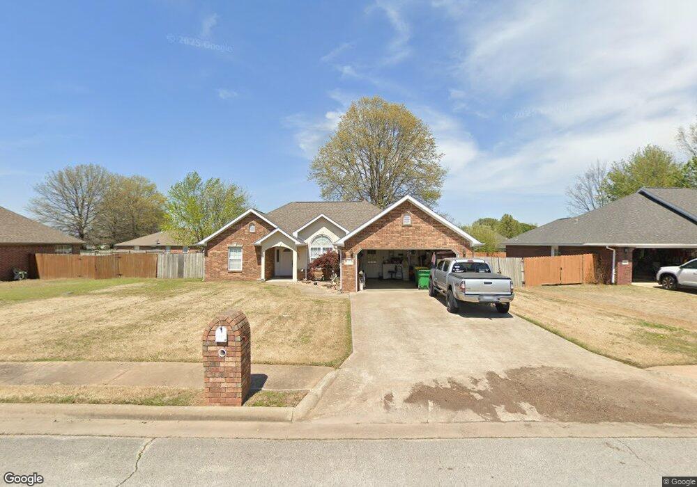
178 Whitney Ln Farmington, AR 72730
Estimated Value: $285,618 - $312,000
--
Bed
2
Baths
1,632
Sq Ft
$184/Sq Ft
Est. Value
About This Home
This home is located at 178 Whitney Ln, Farmington, AR 72730 and is currently estimated at $300,155, approximately $183 per square foot. 178 Whitney Ln is a home located in Washington County with nearby schools including Randall G. Lynch Middle School, Bob Folsom Elementary School, and Farmington Jr. High.
Ownership History
Date
Name
Owned For
Owner Type
Purchase Details
Closed on
Aug 25, 2017
Sold by
Ward Eugene and Ward Betty
Bought by
Ward Edward Neil
Current Estimated Value
Purchase Details
Closed on
Jan 8, 1998
Bought by
Devecsery Enterprises, Inc.
Purchase Details
Closed on
Oct 30, 1997
Bought by
Lossing John D
Purchase Details
Closed on
Jul 25, 1996
Bought by
Lossing John D
Create a Home Valuation Report for This Property
The Home Valuation Report is an in-depth analysis detailing your home's value as well as a comparison with similar homes in the area
Home Values in the Area
Average Home Value in this Area
Purchase History
| Date | Buyer | Sale Price | Title Company |
|---|---|---|---|
| Ward Edward Neil | -- | None Listed On Document | |
| Devecsery Enterprises, Inc. | $50,000 | -- | |
| Lossing John D | -- | -- | |
| Lossing John D | -- | -- |
Source: Public Records
Tax History Compared to Growth
Tax History
| Year | Tax Paid | Tax Assessment Tax Assessment Total Assessment is a certain percentage of the fair market value that is determined by local assessors to be the total taxable value of land and additions on the property. | Land | Improvement |
|---|---|---|---|---|
| 2025 | $1,176 | $51,730 | $9,000 | $42,730 |
| 2024 | $1,088 | $51,730 | $9,000 | $42,730 |
| 2023 | $607 | $51,730 | $9,000 | $42,730 |
| 2022 | $657 | $30,330 | $6,000 | $24,330 |
| 2021 | $663 | $30,330 | $6,000 | $24,330 |
| 2020 | $663 | $30,330 | $6,000 | $24,330 |
| 2019 | $666 | $27,830 | $6,000 | $21,830 |
| 2018 | $691 | $27,830 | $6,000 | $21,830 |
| 2017 | $68 | $27,830 | $6,000 | $21,830 |
| 2016 | $682 | $27,830 | $6,000 | $21,830 |
| 2015 | $682 | $27,830 | $6,000 | $21,830 |
| 2014 | $682 | $19,250 | $3,800 | $15,450 |
Source: Public Records
Map
Nearby Homes
- 271 Greenfield Ave
- 237 Briarhill Dr
- 201 Countryside Dr
- 285 Briarhill Dr
- 311 S Sundown Dr
- 275 S Nightfall Ave
- 93 Old Depot Rd
- Rye 1903 Plan at The Grove at Engles Mill
- Ouachita 1669 Plan at The Grove at Engles Mill
- Cache 1788 Plan at The Grove at Engles Mill
- Degray 1757 Plan at The Grove at Engles Mill
- Stella 1848 Plan at The Grove at Engles Mill
- Millwood 1862 Plan at The Grove at Engles Mill
- Magnolia 1556 Plan at The Grove at Engles Mill
- Eureka 1536 Plan at The Grove at Engles Mill
- Springs 1445 Plan at The Grove at Engles Mill
- Piper 2064 Plan at The Grove at Engles Mill
- Oak 1463 Plan at The Grove at Engles Mill
- Daisy 2147 Plan at The Grove at Engles Mill
- Ashton 1496 Plan at The Grove at Engles Mill
- 170 Whitney Ln
- 184 Whitney Ln
- 179 Rainsong Dr
- 171 Rainsong Dr
- 162 Whitney Ln
- 185 Rainsong Dr
- 177 Whitney Ln
- 163 Rainsong Dr
- 169 Whitney Ln
- 183 Whitney Ln
- 0 W Rainsong St Unit 598091
- 0 W Rainsong St Unit 644281
- 0 W Rainsong St Unit 667512
- 0 W Rainsong St Unit 695963
- 0 W Rainsong St Unit 724022
- 161 Whitney Ln
- 156 Whitney Ln
- 174 Rainsong Dr
- 157 Rainsong Dr
- 157 & 159 Rainsong St