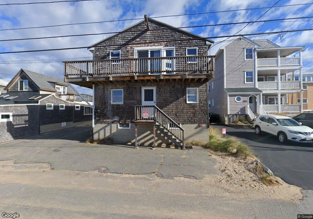
179 Atlantic Ave Salisbury, MA 01952
Estimated Value: $761,000 - $821,000
3
Beds
3
Baths
1,422
Sq Ft
$558/Sq Ft
Est. Value
About This Home
This home is located at 179 Atlantic Ave, Salisbury, MA 01952 and is currently estimated at $793,547, approximately $558 per square foot. 179 Atlantic Ave is a home with nearby schools including Triton Regional High School.
Ownership History
Date
Name
Owned For
Owner Type
Purchase Details
Closed on
Feb 13, 2012
Sold by
Bradley Claire F
Bought by
Bradley James C
Current Estimated Value
Purchase Details
Closed on
Aug 20, 2007
Sold by
Lagrasse Joseph D and Lagrasse Lila
Bought by
Lagrasse Lila
Purchase Details
Closed on
Dec 31, 1997
Sold by
Griffin Gillian H
Bought by
Mousseau Tracy A
Home Financials for this Owner
Home Financials are based on the most recent Mortgage that was taken out on this home.
Original Mortgage
$163,500
Interest Rate
7.11%
Mortgage Type
Purchase Money Mortgage
Create a Home Valuation Report for This Property
The Home Valuation Report is an in-depth analysis detailing your home's value as well as a comparison with similar homes in the area
Home Values in the Area
Average Home Value in this Area
Purchase History
| Date | Buyer | Sale Price | Title Company |
|---|---|---|---|
| Bradley James C | -- | -- | |
| Lagrasse Lila | -- | -- | |
| Mousseau Tracy A | $218,000 | -- |
Source: Public Records
Mortgage History
| Date | Status | Borrower | Loan Amount |
|---|---|---|---|
| Previous Owner | Mousseau Tracy A | $163,500 |
Source: Public Records
Tax History Compared to Growth
Tax History
| Year | Tax Paid | Tax Assessment Tax Assessment Total Assessment is a certain percentage of the fair market value that is determined by local assessors to be the total taxable value of land and additions on the property. | Land | Improvement |
|---|---|---|---|---|
| 2025 | $7,655 | $759,400 | $576,700 | $182,700 |
| 2024 | $7,317 | $700,200 | $538,400 | $161,800 |
| 2023 | $7,390 | $684,300 | $538,400 | $145,900 |
| 2022 | $6,947 | $623,600 | $493,500 | $130,100 |
| 2021 | $6,927 | $615,200 | $493,500 | $121,700 |
| 2020 | $6,938 | $605,400 | $493,500 | $111,900 |
| 2019 | $6,490 | $547,200 | $458,400 | $88,800 |
| 2018 | $6,348 | $538,900 | $458,400 | $80,500 |
| 2017 | $6,399 | $536,800 | $458,400 | $78,400 |
| 2016 | $6,264 | $536,800 | $458,400 | $78,400 |
| 2015 | $6,256 | $532,400 | $458,400 | $74,000 |
Source: Public Records
Map
Nearby Homes
- 141 Atlantic Ave
- 116 Railroad Ave
- 114 Railroad Ave
- 52 Brissette Ave
- 103 Railroad Ave
- 10 Meadowview Ln Unit B
- 16 N End Blvd Unit 10
- 16 N End Blvd Unit 8
- 16 N End Blvd Unit 3
- 16 N End Blvd Unit 12
- 16 N End Blvd Unit 5
- 38-40 Central Ave
- 45 Old County Rd Unit 1
- 170 Beach Rd Unit 52
- 98 Central Ave
- 2 Old County Rd Unit 13
- 2 Old County Rd Unit 11
- 2 Old County Rd Unit 10
- 2 Old County Rd Unit 7
- 2 Old County Rd Unit 15
- 183 Atlantic Ave Unit 2
- 183 Atlantic Ave Unit 1
- 175 Atlantic Ave
- 181 Atlantic Ave
- 177 Atlantic Ave
- 173 Atlantic Ave
- 187 Atlantic Ave
- 187 Atlantic Ave Unit 1
- 187 Atlantic Ave Unit 2
- 171 Atlantic Ave
- 185 Atlantic Ave Unit 2
- 185 Atlantic Ave Unit 1
- 185 Atlantic Ave Unit 1 & 2
- 185 Atlantic Ave
- 167 Atlantic Ave
- 189 Atlantic Ave
- 165 Atlantic Ave
- 163 Atlantic Ave
- 161 Atlantic Ave
- 159 Atlantic Ave