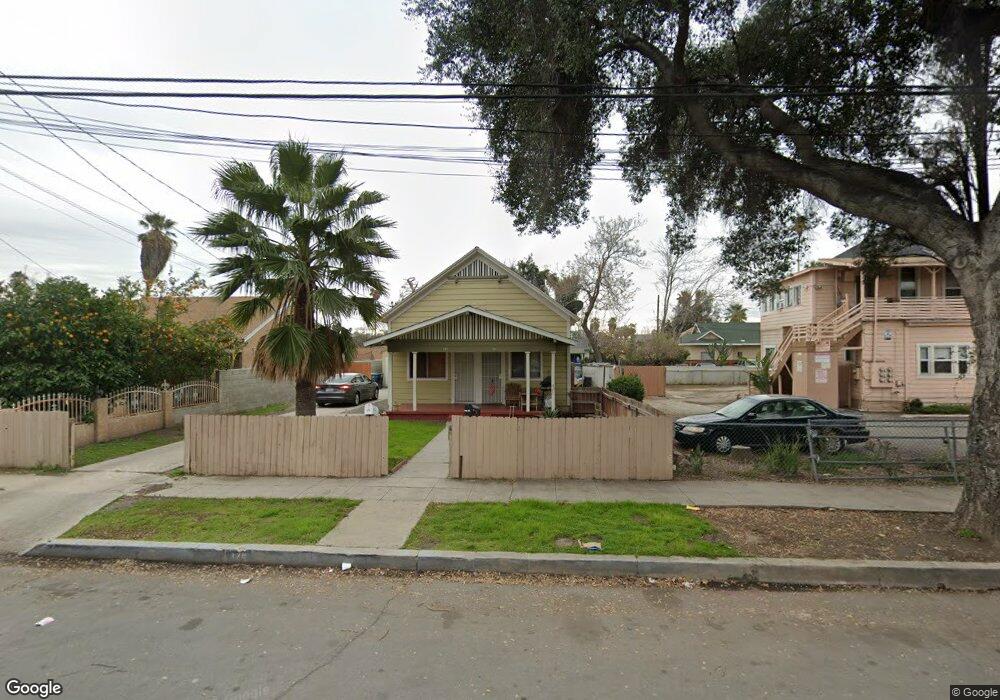
179 W 10th St San Bernardino, CA 92410
Hanes Park NeighborhoodEstimated Value: $379,721 - $579,000
2
Beds
4
Baths
1,276
Sq Ft
$361/Sq Ft
Est. Value
About This Home
This home is located at 179 W 10th St, San Bernardino, CA 92410 and is currently estimated at $461,180, approximately $361 per square foot. 179 W 10th St is a home located in San Bernardino County with nearby schools including Captain Leland Norton Elementary School, Arrowview Middle School, and Indian Springs High.
Ownership History
Date
Name
Owned For
Owner Type
Purchase Details
Closed on
Apr 4, 2011
Sold by
Tafeaga Taligafialogo and Tafeaga Sonia
Bought by
Voce Richard and Voce Sharon
Current Estimated Value
Purchase Details
Closed on
Jun 29, 1995
Sold by
Inland Empire Development Inc
Bought by
Deandrea Antonio and Deandrea Emma
Purchase Details
Closed on
Mar 29, 1994
Sold by
Great Western Bank
Bought by
Inland Empire Development Inc
Purchase Details
Closed on
Dec 13, 1993
Sold by
California Reconveyance Company
Bought by
Great Western Bank
Create a Home Valuation Report for This Property
The Home Valuation Report is an in-depth analysis detailing your home's value as well as a comparison with similar homes in the area
Home Values in the Area
Average Home Value in this Area
Purchase History
| Date | Buyer | Sale Price | Title Company |
|---|---|---|---|
| Voce Richard | $20,000 | Chicago Title Insurance Co | |
| Deandrea Antonio | $46,720 | Northern Counties Title | |
| Inland Empire Development Inc | $20,000 | Chicago Title Company | |
| Great Western Bank | $70,897 | Chicago Title Insurance Comp |
Source: Public Records
Tax History Compared to Growth
Tax History
| Year | Tax Paid | Tax Assessment Tax Assessment Total Assessment is a certain percentage of the fair market value that is determined by local assessors to be the total taxable value of land and additions on the property. | Land | Improvement |
|---|---|---|---|---|
| 2025 | $1,227 | $85,841 | $24,344 | $61,497 |
| 2024 | $1,227 | $84,158 | $23,867 | $60,291 |
| 2023 | $1,196 | $82,508 | $23,399 | $59,109 |
| 2022 | $1,194 | $80,890 | $22,940 | $57,950 |
| 2021 | $1,192 | $79,304 | $22,490 | $56,814 |
| 2020 | $1,192 | $78,490 | $22,259 | $56,231 |
| 2019 | $1,160 | $76,951 | $21,823 | $55,128 |
| 2018 | $1,148 | $75,442 | $21,395 | $54,047 |
| 2017 | $1,113 | $73,962 | $20,975 | $52,987 |
| 2016 | $1,080 | $72,512 | $20,564 | $51,948 |
| 2015 | $949 | $71,423 | $20,255 | $51,168 |
| 2014 | $923 | $70,024 | $19,858 | $50,166 |
Source: Public Records
Map
Nearby Homes
- 1001 N Mountain View Ave
- 958 N Sierra Way
- 891 N Mountain View Ave
- 170 W 11th St
- 928 N Arrowhead Ave
- 119 E 9th St
- 290 W 11th St
- 188 E Temple St
- 1137 N Mayfield Ave
- 1170 N Lugo Ave
- 983 Wall Ave
- 244 E 10th St
- 214 E Base Line St
- 338 W 7th St
- 1305 N Sierra Way
- 1319 N Sierra Way
- 1305 N D St
- 156 W Wabash St
- 1064 Acacia Ave
- 1354 N Arrowhead Ave
- 171 W 10th St
- 999 N Mountain View Ave
- 159 W 10th St
- 981 N Mountain View Ave
- 975 N Mountain View Ave
- 157 W 10th St
- 965 N Mountain View Ave
- 965 N Mountain View Ave
- 180 W 10th St
- 168 W 10th St
- 147 W 10th St
- 1015 N Mountain View Ave
- 158 W 10th St
- 955 N Mountain View Ave
- 144 W 10th St
- 137 W 10th St
- 1023 N Mountain View Ave
- 951 N Mountain View Ave
- 134 W 10th St
- 1000 N Mountain View Ave