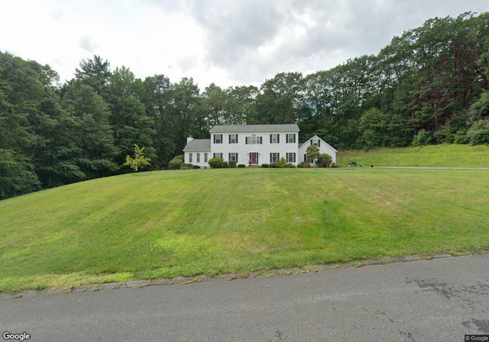
18 Iroquois Ln Wilbraham, MA 01095
Estimated Value: $658,889 - $721,000
4
Beds
3
Baths
2,880
Sq Ft
$241/Sq Ft
Est. Value
About This Home
This home is located at 18 Iroquois Ln, Wilbraham, MA 01095 and is currently estimated at $695,222, approximately $241 per square foot. 18 Iroquois Ln is a home located in Hampden County with nearby schools including Minnechaug Regional High School and Wilbraham & Monson Academy.
Ownership History
Date
Name
Owned For
Owner Type
Purchase Details
Closed on
Dec 2, 2024
Sold by
Patrakis Strati G and Patrakis Shari R
Bought by
Patrakis Ft and Patrakis
Current Estimated Value
Purchase Details
Closed on
Feb 18, 1999
Sold by
Cbs Dev Corp
Bought by
Patrakis Strati G and Patrakis Shari R
Create a Home Valuation Report for This Property
The Home Valuation Report is an in-depth analysis detailing your home's value as well as a comparison with similar homes in the area
Home Values in the Area
Average Home Value in this Area
Purchase History
| Date | Buyer | Sale Price | Title Company |
|---|---|---|---|
| Patrakis Ft | -- | None Available | |
| Patrakis Ft | -- | None Available | |
| Patrakis Strati G | $50,000 | -- | |
| Patrakis Strati G | $50,000 | -- |
Source: Public Records
Mortgage History
| Date | Status | Borrower | Loan Amount |
|---|---|---|---|
| Previous Owner | Patrakis Strati G | $50,000 | |
| Previous Owner | Patrakis Strati G | $50,000 | |
| Previous Owner | Patrakis Strati G | $180,000 |
Source: Public Records
Tax History Compared to Growth
Tax History
| Year | Tax Paid | Tax Assessment Tax Assessment Total Assessment is a certain percentage of the fair market value that is determined by local assessors to be the total taxable value of land and additions on the property. | Land | Improvement |
|---|---|---|---|---|
| 2025 | $10,751 | $601,300 | $108,100 | $493,200 |
| 2024 | $10,571 | $571,400 | $108,100 | $463,300 |
| 2023 | $9,489 | $509,100 | $108,100 | $401,000 |
| 2022 | $9,489 | $463,100 | $108,100 | $355,000 |
| 2021 | $9,877 | $430,200 | $112,000 | $318,200 |
| 2020 | $9,628 | $430,200 | $112,000 | $318,200 |
| 2019 | $9,381 | $430,300 | $112,000 | $318,300 |
| 2018 | $9,312 | $411,300 | $112,000 | $299,300 |
| 2017 | $9,049 | $411,300 | $112,000 | $299,300 |
| 2016 | $8,737 | $404,500 | $118,500 | $286,000 |
| 2015 | $8,446 | $404,500 | $118,500 | $286,000 |
Source: Public Records
Map
Nearby Homes
- 603 Glendale Rd
- 474 Mountain Rd
- 474-480 Mountain Rd
- 6 Hilltop Park
- 20 Old Orchard Rd
- 733 Monson Rd
- 17 Peak Rd
- 2 Bayberry Dr Unit 51
- 68 Monson Rd
- 60 Lakeshore Dr
- 182 Mountain Rd
- 2 Vista Rd
- 8 Patriot Ridge Ln
- 28 Decorie Dr
- 72 Beebe Rd
- 79 High Pine Cir
- 69 High Pine Cir
- 54 High Pine Cir
- 35 Lake Dr
- 254 Ames Rd