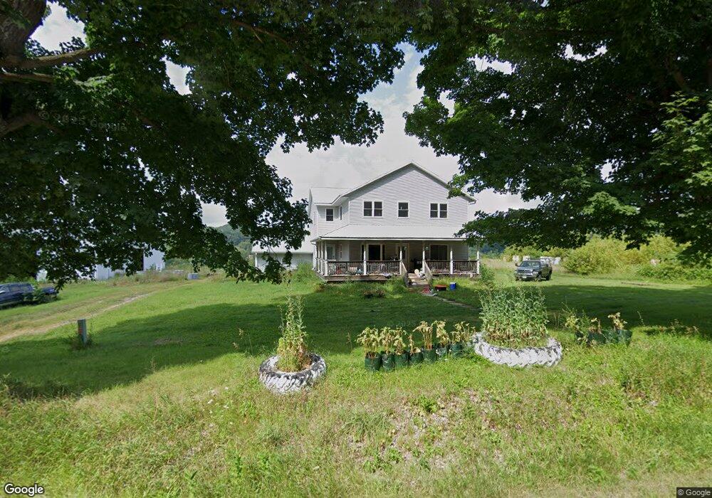
18014 County Highway A Norwalk, WI 54648
Estimated Value: $429,000 - $454,000
--
Bed
--
Bath
--
Sq Ft
4.61
Acres
About This Home
This home is located at 18014 County Highway A, Norwalk, WI 54648 and is currently estimated at $444,604. 18014 County Highway A is a home located in Monroe County.
Ownership History
Date
Name
Owned For
Owner Type
Purchase Details
Closed on
Apr 27, 2017
Sold by
Midland States Bank As Trustee Of The Donna M
Bought by
Lloyd Eric A
Current Estimated Value
Home Financials for this Owner
Home Financials are based on the most recent Mortgage that was taken out on this home.
Original Mortgage
$200,000
Outstanding Balance
$166,325
Interest Rate
4.1%
Mortgage Type
New Conventional
Estimated Equity
$278,279
Purchase Details
Closed on
Nov 1, 2012
Sold by
Anderson Bradley J and Anderson Tammy L
Bought by
Midland States Bank
Create a Home Valuation Report for This Property
The Home Valuation Report is an in-depth analysis detailing your home's value as well as a comparison with similar homes in the area
Home Values in the Area
Average Home Value in this Area
Purchase History
| Date | Buyer | Sale Price | Title Company |
|---|---|---|---|
| Lloyd Eric A | $200,000 | -- | |
| Midland States Bank | -- | -- |
Source: Public Records
Mortgage History
| Date | Status | Borrower | Loan Amount |
|---|---|---|---|
| Open | Lloyd Eric A | $200,000 |
Source: Public Records
Tax History Compared to Growth
Tax History
| Year | Tax Paid | Tax Assessment Tax Assessment Total Assessment is a certain percentage of the fair market value that is determined by local assessors to be the total taxable value of land and additions on the property. | Land | Improvement |
|---|---|---|---|---|
| 2024 | $5,145 | $251,300 | $14,900 | $236,400 |
| 2023 | $4,455 | $251,200 | $14,800 | $236,400 |
| 2022 | $4,433 | $251,100 | $14,700 | $236,400 |
| 2021 | $3,879 | $251,100 | $14,700 | $236,400 |
| 2020 | $4,032 | $251,100 | $14,700 | $236,400 |
| 2019 | $3,980 | $251,000 | $14,600 | $236,400 |
| 2018 | $4,820 | $246,300 | $12,600 | $233,700 |
| 2017 | $5,812 | $291,000 | $12,600 | $278,400 |
| 2016 | $5,747 | $291,000 | $12,600 | $278,400 |
| 2015 | $6,401 | $291,000 | $12,600 | $278,400 |
| 2014 | $5,602 | $291,000 | $12,600 | $278,400 |
| 2011 | $2,324 | $120,700 | $12,600 | $108,100 |
Source: Public Records
Map
Nearby Homes
- Lot 2 Spring Brook
- 15428 Hazel Green
- Lot 10 Hemmingford Ave
- 20623 Helmsman Ave
- 16715 Helmet Rd
- 17511 Havenwood Rd
- 22112 Kayak Rd
- 17595 Interior Rd
- 107 N West St
- 17326 Wisconsin 71
- 400 W Center St
- 120 Railroad St
- 205 S Water St
- 112 S Water St
- 206 S Water St
- 15165 Hennepin Rd
- 22007 Glasgow Ave
- 23484 Wisconsin 16
- 21812 Fleming Ave
- 1.5 acres Fleetwood Rd
- 17885 County Highway A
- 18043 County Highway A
- 17811 County Highway A
- 17807 Independence Rd
- 17753 County Highway A
- 18081 County Highway A
- 17997 Innswood Rd
- 17977 Innswood Rd
- 18077 Innswood Rd
- 17554 Independence Rd
- 17559 Independence Rd
- 18227 Innswood Rd
- 18003 Innswood Rd
- 17555 Independence Rd
- 18286 County Highway A
- 17551 Independence Rd
- 18468 Innswood Rd
- 18434 Index Ave
- 18134 Index Ave
- 18732 Index Ave