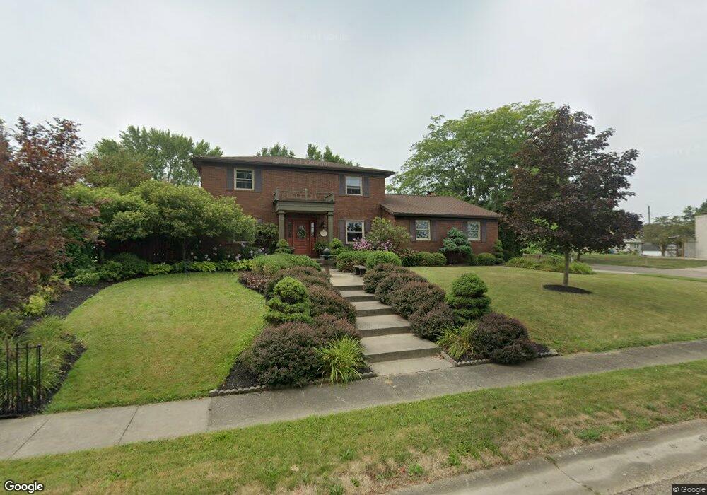
1804 Opal St Louisville, OH 44641
Estimated Value: $309,000 - $400,000
3
Beds
4
Baths
2,648
Sq Ft
$132/Sq Ft
Est. Value
About This Home
This home is located at 1804 Opal St, Louisville, OH 44641 and is currently estimated at $350,102, approximately $132 per square foot. 1804 Opal St is a home located in Stark County with nearby schools including Louisville High School and St. Thomas Aquinas High School & Middle School.
Ownership History
Date
Name
Owned For
Owner Type
Purchase Details
Closed on
Aug 17, 1995
Sold by
Brabec Michael L
Bought by
Dodson Glenn E and Dodson Cheryl
Current Estimated Value
Home Financials for this Owner
Home Financials are based on the most recent Mortgage that was taken out on this home.
Original Mortgage
$161,500
Interest Rate
7.64%
Mortgage Type
New Conventional
Purchase Details
Closed on
Dec 4, 1990
Create a Home Valuation Report for This Property
The Home Valuation Report is an in-depth analysis detailing your home's value as well as a comparison with similar homes in the area
Home Values in the Area
Average Home Value in this Area
Purchase History
| Date | Buyer | Sale Price | Title Company |
|---|---|---|---|
| Dodson Glenn E | $170,000 | -- | |
| -- | $160,000 | -- |
Source: Public Records
Mortgage History
| Date | Status | Borrower | Loan Amount |
|---|---|---|---|
| Closed | Dodson Glenn E | $161,500 |
Source: Public Records
Tax History Compared to Growth
Tax History
| Year | Tax Paid | Tax Assessment Tax Assessment Total Assessment is a certain percentage of the fair market value that is determined by local assessors to be the total taxable value of land and additions on the property. | Land | Improvement |
|---|---|---|---|---|
| 2025 | -- | $107,390 | $18,660 | $88,730 |
| 2024 | -- | $107,390 | $18,660 | $88,730 |
| 2023 | $3,152 | $82,470 | $17,610 | $64,860 |
| 2022 | $3,177 | $82,470 | $17,610 | $64,860 |
| 2021 | $3,186 | $82,470 | $17,610 | $64,860 |
| 2020 | $2,530 | $72,320 | $15,860 | $56,460 |
| 2019 | $2,504 | $71,450 | $15,860 | $55,590 |
| 2018 | $2,495 | $71,450 | $15,860 | $55,590 |
| 2017 | $2,271 | $63,810 | $13,930 | $49,880 |
| 2016 | $2,318 | $63,810 | $13,930 | $49,880 |
| 2015 | $2,325 | $63,810 | $13,930 | $49,880 |
| 2014 | $107 | $55,140 | $12,040 | $43,100 |
| 2013 | $1,057 | $55,140 | $12,040 | $43,100 |
Source: Public Records
Map
Nearby Homes
- 2110 Edmar St
- 1715 High St
- 1812 E Broad St
- 641 S Nickelplate St
- 520 S Silver St
- 308 Superior St
- 908 Sand Lot Cir
- 3390 Meese Rd NE
- 728 E Broad St
- 2015 E Main St
- 0 Michigan Blvd
- 510 S Bauman Ct
- 204 E Broad St
- 107 E Broad St
- 325 Lincoln Ave
- 8225 Georgetown St
- 1702 View Pointe Ave
- 1639 Horizon Dr
- 1170 Winding Ridge Ave
- 910 Crosswyck Cir