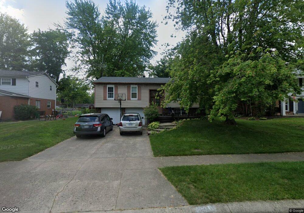
1813 Vanderbilt Dr Loveland, OH 45140
Estimated Value: $376,835 - $400,000
3
Beds
2
Baths
1,968
Sq Ft
$196/Sq Ft
Est. Value
About This Home
This home is located at 1813 Vanderbilt Dr, Loveland, OH 45140 and is currently estimated at $385,209, approximately $195 per square foot. 1813 Vanderbilt Dr is a home located in Hamilton County with nearby schools including Loveland Intermediate School, Loveland Primary School, and Loveland Elementary School.
Ownership History
Date
Name
Owned For
Owner Type
Purchase Details
Closed on
Sep 11, 1998
Sold by
Hoerth Christopher E and Hoerth Carol A
Bought by
Feder Lance B and Feder Heather K
Current Estimated Value
Home Financials for this Owner
Home Financials are based on the most recent Mortgage that was taken out on this home.
Original Mortgage
$104,950
Outstanding Balance
$22,652
Interest Rate
7.02%
Estimated Equity
$362,557
Purchase Details
Closed on
May 3, 1994
Sold by
Cooper Douglas A
Bought by
Hoerth Christopher E and Hoerth Carol A
Home Financials for this Owner
Home Financials are based on the most recent Mortgage that was taken out on this home.
Original Mortgage
$89,826
Interest Rate
8.5%
Mortgage Type
FHA
Create a Home Valuation Report for This Property
The Home Valuation Report is an in-depth analysis detailing your home's value as well as a comparison with similar homes in the area
Home Values in the Area
Average Home Value in this Area
Purchase History
| Date | Buyer | Sale Price | Title Company |
|---|---|---|---|
| Feder Lance B | $110,500 | Vintage Title Agency Inc | |
| Hoerth Christopher E | -- | -- |
Source: Public Records
Mortgage History
| Date | Status | Borrower | Loan Amount |
|---|---|---|---|
| Open | Feder Lance B | $104,950 | |
| Previous Owner | Hoerth Christopher E | $89,826 |
Source: Public Records
Tax History Compared to Growth
Tax History
| Year | Tax Paid | Tax Assessment Tax Assessment Total Assessment is a certain percentage of the fair market value that is determined by local assessors to be the total taxable value of land and additions on the property. | Land | Improvement |
|---|---|---|---|---|
| 2024 | $5,333 | $101,161 | $19,481 | $81,680 |
| 2023 | $5,485 | $101,161 | $19,481 | $81,680 |
| 2022 | $4,574 | $70,746 | $15,953 | $54,793 |
| 2021 | $4,339 | $70,746 | $15,953 | $54,793 |
| 2020 | $4,408 | $70,746 | $15,953 | $54,793 |
| 2019 | $4,030 | $60,466 | $13,636 | $46,830 |
| 2018 | $4,055 | $60,466 | $13,636 | $46,830 |
| 2017 | $3,845 | $60,466 | $13,636 | $46,830 |
| 2016 | $3,446 | $51,909 | $12,663 | $39,246 |
| 2015 | $3,484 | $51,909 | $12,663 | $39,246 |
| 2014 | $3,567 | $51,909 | $12,663 | $39,246 |
| 2013 | $3,147 | $49,914 | $12,177 | $37,737 |
Source: Public Records
Map
Nearby Homes
- 1873 Heidelberg Dr
- 1886 Lindenhall Dr
- 247 Sinclair Ct
- 1864 W Loveland Ave
- 160 Lexington Dr
- 142 Lakeview Ct
- 124 Pheasantlake Dr
- 131 Lakeview Ct
- 3026 Stratford Ct
- 3015 Stratford Ct Unit 126
- 196 Shoemaker Dr
- 3016 Stratford Ct
- 3021 Stratford Ct
- 4031 White Chapel Ln
- 5022 Bristol Ct Unit 207
- 5037 Bristol Ct Unit 213
- 228 Tuscarora Dr
- 9550 Union Cemetery Rd
- 9330 Greenhedge Ln
- 6172 Whileaway Dr
- 1819 Vanderbilt Dr
- 1807 Vanderbilt Dr
- 1825 Vanderbilt Dr
- 1806 Stockton Dr
- 1812 Stockton Dr
- 1800 Stockton Dr
- 243 Heidelberg Dr
- 1806 Vanderbilt Dr
- 1818 Stockton Dr
- 237 Heidelberg Dr
- 1712 Stockton Dr
- 1812 Vanderbilt Dr
- 1831 Vanderbilt Dr
- 1800 Vanderbilt Dr
- 1824 Stockton Dr
- 1818 Vanderbilt Dr
- 1706 Stockton Dr
- 231 Heidelberg Dr
- 1837 Vanderbilt Dr
- 255 Heidelberg Dr