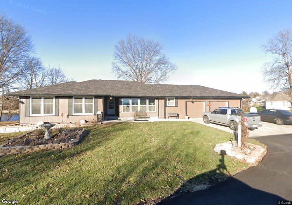
1817 Rose St Kearney, MO 64060
Estimated Value: $361,000 - $437,000
3
Beds
2
Baths
1,854
Sq Ft
$217/Sq Ft
Est. Value
About This Home
This home is located at 1817 Rose St, Kearney, MO 64060 and is currently estimated at $403,095, approximately $217 per square foot. 1817 Rose St is a home located in Clay County with nearby schools including Kearney Junior High School and Kearney High School.
Ownership History
Date
Name
Owned For
Owner Type
Purchase Details
Closed on
May 9, 2002
Sold by
Williams Steven W and Williams Kimberly R
Bought by
Biggs Mark A and Biggs Brenda S
Current Estimated Value
Home Financials for this Owner
Home Financials are based on the most recent Mortgage that was taken out on this home.
Original Mortgage
$130,000
Outstanding Balance
$55,897
Interest Rate
7.19%
Estimated Equity
$347,198
Purchase Details
Closed on
Dec 8, 1998
Sold by
Williams Steven W and Williams Kimberly R
Bought by
Williams Steven W and Williams Kimberly R
Home Financials for this Owner
Home Financials are based on the most recent Mortgage that was taken out on this home.
Original Mortgage
$108,250
Interest Rate
6.81%
Purchase Details
Closed on
Mar 10, 1997
Sold by
Barr Samuel J
Bought by
Williams Steven Wayne and Williams Steven W
Home Financials for this Owner
Home Financials are based on the most recent Mortgage that was taken out on this home.
Original Mortgage
$110,000
Interest Rate
7.88%
Create a Home Valuation Report for This Property
The Home Valuation Report is an in-depth analysis detailing your home's value as well as a comparison with similar homes in the area
Home Values in the Area
Average Home Value in this Area
Purchase History
| Date | Buyer | Sale Price | Title Company |
|---|---|---|---|
| Biggs Mark A | -- | -- | |
| Williams Steven W | -- | Old Republic Title Company | |
| Williams Steven Wayne | -- | -- |
Source: Public Records
Mortgage History
| Date | Status | Borrower | Loan Amount |
|---|---|---|---|
| Open | Biggs Mark A | $130,000 | |
| Previous Owner | Williams Steven W | $108,250 | |
| Previous Owner | Williams Steven Wayne | $110,000 |
Source: Public Records
Tax History Compared to Growth
Tax History
| Year | Tax Paid | Tax Assessment Tax Assessment Total Assessment is a certain percentage of the fair market value that is determined by local assessors to be the total taxable value of land and additions on the property. | Land | Improvement |
|---|---|---|---|---|
| 2025 | $4,015 | $66,160 | -- | -- |
| 2024 | $4,015 | $58,580 | -- | -- |
| 2023 | $4,001 | $58,580 | $0 | $0 |
| 2022 | $3,721 | $52,690 | $0 | $0 |
| 2021 | $3,648 | $52,687 | $6,422 | $46,265 |
| 2020 | $3,458 | $45,430 | $0 | $0 |
| 2019 | $3,440 | $45,429 | $6,422 | $39,007 |
| 2018 | $3,474 | $44,310 | $0 | $0 |
| 2017 | $2,918 | $44,310 | $4,710 | $39,600 |
| 2016 | $2,918 | $37,620 | $4,710 | $32,910 |
| 2015 | $2,918 | $37,620 | $4,710 | $32,910 |
| 2014 | $2,833 | $36,350 | $4,710 | $31,640 |
Source: Public Records
Map
Nearby Homes
- 806 E 18th St
- 808 E 16th St
- 804 Southbrook Pkwy
- 1710 Clear Creek Dr
- 1307 Stonecrest Dr
- 625 E 13th St
- 1209 Noah's Ln
- 210 E 22nd St
- 1207 Noah's Ln
- 1043 E 14th St
- 1205 Noah's Ln
- 1204 Susan St
- 1302 Melissa Ct
- 1202 Noah's Ln
- 1300 Melissa Ct
- 1200 Noah's Ln
- 1102 Noah's Ln
- 14117 Homestead Rd
- 1610 Renea Ct
- 1404 Colony Dr
- 700 Feldspar St
- 702 E 19th St
- 1816 Rose St
- 700 E 19th St
- 703 E 18th St
- 1711 Rockwater Ln
- 701 Feldspar St
- 702 Feldspar St
- 705 E 18th St
- 703 Feldspar St
- 1600 Rockwater Ln
- 704 Feldspar St
- 1710 Rockwater Ln
- 1708 Rockwater Ln
- 1818 Rose St
- 707 E 18th St
- 1610 Rockwater Ln
- 705 Feldspar N A
- 706 E 18th St
- 1820 Rose St