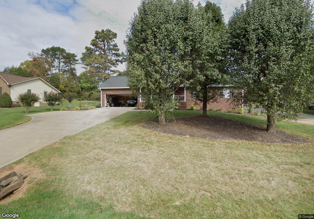
182 Ashbrook Rd Statesville, NC 28677
Estimated Value: $297,934 - $362,000
3
Beds
2
Baths
1,638
Sq Ft
$202/Sq Ft
Est. Value
About This Home
This home is located at 182 Ashbrook Rd, Statesville, NC 28677 and is currently estimated at $330,234, approximately $201 per square foot. 182 Ashbrook Rd is a home located in Iredell County with nearby schools including Celeste Henkel Elementary School, West Iredell Middle School, and West Iredell High School.
Ownership History
Date
Name
Owned For
Owner Type
Purchase Details
Closed on
Oct 1, 2015
Sold by
Cloaninger Troy Frank and Cloaninger Jan
Bought by
Ostwalt Mindy S and Ostwalt Mark
Current Estimated Value
Purchase Details
Closed on
Dec 6, 2001
Sold by
Boyd H Richard and Boyd Joanne V
Bought by
Cloaninger Troy Frank
Purchase Details
Closed on
Oct 1, 1994
Purchase Details
Closed on
Sep 1, 1992
Purchase Details
Closed on
Apr 1, 1992
Create a Home Valuation Report for This Property
The Home Valuation Report is an in-depth analysis detailing your home's value as well as a comparison with similar homes in the area
Home Values in the Area
Average Home Value in this Area
Purchase History
| Date | Buyer | Sale Price | Title Company |
|---|---|---|---|
| Ostwalt Mindy S | -- | None Available | |
| Cloaninger Troy Frank | $152,500 | -- | |
| -- | $6,000 | -- | |
| -- | $28,000 | -- | |
| -- | -- | -- |
Source: Public Records
Tax History Compared to Growth
Tax History
| Year | Tax Paid | Tax Assessment Tax Assessment Total Assessment is a certain percentage of the fair market value that is determined by local assessors to be the total taxable value of land and additions on the property. | Land | Improvement |
|---|---|---|---|---|
| 2024 | $1,676 | $273,940 | $25,000 | $248,940 |
| 2023 | $1,676 | $273,940 | $25,000 | $248,940 |
| 2022 | $1,248 | $189,280 | $20,000 | $169,280 |
| 2021 | $1,244 | $189,280 | $20,000 | $169,280 |
| 2020 | $1,244 | $189,280 | $20,000 | $169,280 |
| 2019 | $1,225 | $189,280 | $20,000 | $169,280 |
| 2018 | $951 | $150,480 | $17,000 | $133,480 |
| 2017 | $951 | $150,480 | $17,000 | $133,480 |
| 2016 | $951 | $150,480 | $17,000 | $133,480 |
| 2015 | $951 | $150,480 | $17,000 | $133,480 |
| 2014 | $990 | $168,970 | $17,000 | $151,970 |
Source: Public Records
Map
Nearby Homes
- 00 Jamie Dr Unit 6
- 130 Aviation Dr
- 827 Flint Dr
- 116 Bent Twig Dr
- 2844 Hickory Hwy
- 140 Swan Park Ln Unit 16
- 128 Swan Park Ln Unit 18
- 104 Swan Park Ln Unit 22
- 908 Westminster Dr
- 130 Greenwich Dr
- 3606 Rose St Unit 55
- 109 Gatwick Ct
- 3004 Newton Dr
- 103 Dublin Ct
- 516 Island Ford Rd
- 178 Old Airport Rd
- 289 Mary Locke Way
- Robie Plan at Bristol Terrace
- Penwell Plan at Bristol Terrace
- Hayden Plan at Bristol Terrace
- 188 Ashbrook Rd
- 0 Karen Dr Unit 2104883
- 174 Ashbrook Rd
- 113 Karmen Rd
- 121 Karmen Ln
- 116 Karmen Ln
- 181 Ashbrook Rd
- 164 Ashbrook Rd
- 169 Ashbrook Rd
- 198 Jamie Dr
- 193 Ashbrook Rd
- 122 Karmen Rd
- 127 Karmen Ln
- 203 Ashbrook Rd
- 204 Ashbrook Rd
- 165 Ashbrook Rd
- 154 Ashbrook Rd
- 139 Appalachian Trail Ln
- 220 Jamie Dr
- 190 Jamie Dr