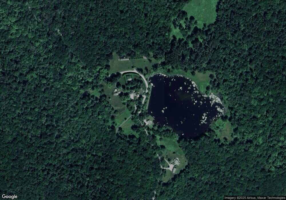
182 Whitcomb Hill Rd Cornwall Bridge, CT 06754
Estimated Value: $2,871,000 - $4,182,000
7
Beds
7
Baths
--
Sq Ft
57.2
Acres
About This Home
This home is located at 182 Whitcomb Hill Rd, Cornwall Bridge, CT 06754 and is currently estimated at $3,436,220. 182 Whitcomb Hill Rd is a home located in Litchfield County with nearby schools including Cornwall Consolidated School and Housatonic Valley Regional High School.
Ownership History
Date
Name
Owned For
Owner Type
Purchase Details
Closed on
May 9, 2011
Sold by
Horn John
Bought by
South 4Th Hamilton and Bellod Manuel
Current Estimated Value
Home Financials for this Owner
Home Financials are based on the most recent Mortgage that was taken out on this home.
Original Mortgage
$1,600,000
Interest Rate
4.82%
Create a Home Valuation Report for This Property
The Home Valuation Report is an in-depth analysis detailing your home's value as well as a comparison with similar homes in the area
Home Values in the Area
Average Home Value in this Area
Purchase History
| Date | Buyer | Sale Price | Title Company |
|---|---|---|---|
| South 4Th Hamilton | $2,325,000 | -- |
Source: Public Records
Mortgage History
| Date | Status | Borrower | Loan Amount |
|---|---|---|---|
| Open | South 4Th Hamilton | $1,995,000 | |
| Closed | South 4Th Hamilton | $1,600,000 | |
| Previous Owner | South 4Th Hamilton | $1,000,000 |
Source: Public Records
Tax History Compared to Growth
Tax History
| Year | Tax Paid | Tax Assessment Tax Assessment Total Assessment is a certain percentage of the fair market value that is determined by local assessors to be the total taxable value of land and additions on the property. | Land | Improvement |
|---|---|---|---|---|
| 2025 | $29,788 | $1,866,400 | $343,400 | $1,523,000 |
| 2024 | $28,556 | $1,866,400 | $343,400 | $1,523,000 |
| 2023 | $27,436 | $1,866,400 | $343,400 | $1,523,000 |
| 2022 | $27,044 | $1,866,400 | $343,400 | $1,523,000 |
| 2021 | $26,516 | $1,587,800 | $337,900 | $1,249,900 |
| 2020 | $26,516 | $1,587,800 | $337,900 | $1,249,900 |
| 2019 | $26,516 | $1,587,800 | $337,900 | $1,249,900 |
| 2018 | $26,389 | $1,587,800 | $337,900 | $1,249,900 |
| 2017 | $25,595 | $1,587,800 | $337,900 | $1,249,900 |
| 2016 | $22,590 | $1,475,500 | $210,500 | $1,265,000 |
| 2015 | $21,510 | $1,421,700 | $169,300 | $1,252,400 |
| 2014 | $21,183 | $1,421,700 | $169,300 | $1,252,400 |
Source: Public Records
Map
Nearby Homes
- 143 Whitcomb Hill Rd
- 11 Day Rd
- 70 Kent Rd S
- 11 Laurel Mountain Road Extension
- 8 Bobcat Ln
- 143 Melius Rd
- 50 Brick School Rd
- 10 Guinea Rd
- 102 Melius Rd
- 0 Stonewall Unit 39
- 11 Old Paddock Ln
- 0 Lake Rd
- 5 Weantinogue Ln
- 0 Mount Mauwee Rd
- 00 Sackett Hill Rd
- 00 Above All Rd
- 0 Gorham Rd Unit 24138133
- 23 Mauwee Brook Rd
- 441 Segar Mountain Rd
- 50 Popple Swamp Rd
- 209 Whitcomb Hill Rd Unit 211
- 147 Whitcomb Hill Rd
- 0 Wolfe Rd
- 145 Whitcomb Hill Rd
- 10 Wolfe Rd
- 138 Whitcomb Hill Rd
- 54 Chester Rd
- 150 Whitcomb Hill Rd
- 100 Wolfe Rd
- 44 Kent Rd
- 1 Withheld
- 120 Whitcomb Hill Rd
- 000 Whitcomb Hill Rd
- 140 Whitcomb Hill Rd
- 292 Brick School Rd
- 233 Warren Hill Rd
- 103 Whitcomb Hill Rd
- 26 Kent Rd
- 8 Chester Rd
- 25 Kent Rd