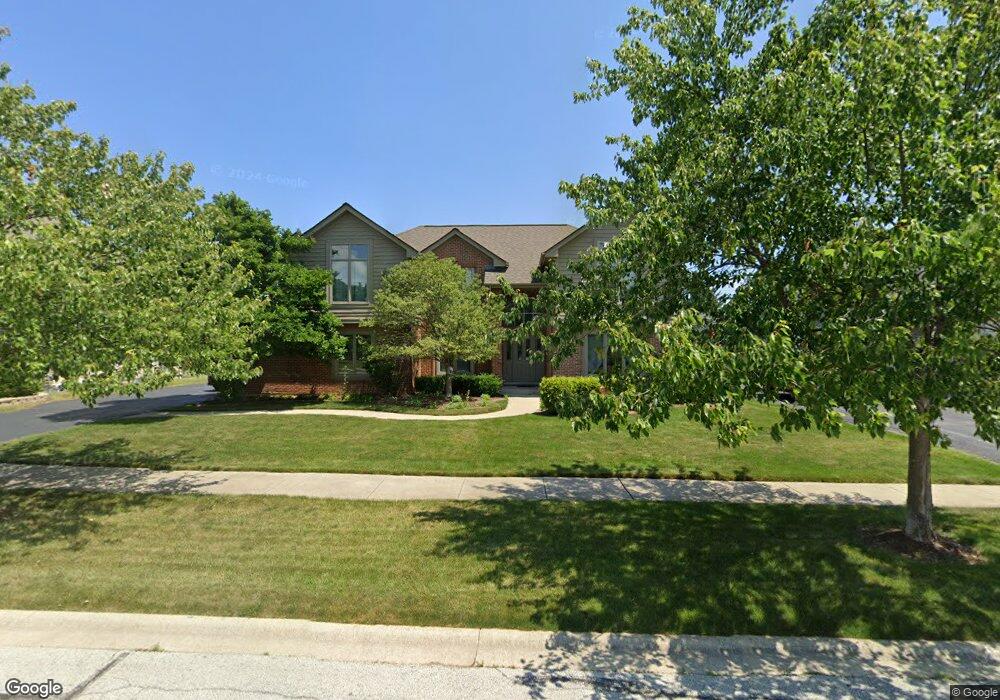
18207 Mockingbird Ln Tinley Park, IL 60487
Central Tinley Park NeighborhoodEstimated Value: $540,000 - $578,000
4
Beds
4
Baths
3,067
Sq Ft
$182/Sq Ft
Est. Value
About This Home
This home is located at 18207 Mockingbird Ln, Tinley Park, IL 60487 and is currently estimated at $559,349, approximately $182 per square foot. 18207 Mockingbird Ln is a home located in Cook County with nearby schools including Millennium Elementary School, Prairie View Middle School, and Victor J Andrew High School.
Ownership History
Date
Name
Owned For
Owner Type
Purchase Details
Closed on
Sep 28, 2001
Sold by
Copp Toni L
Bought by
Prokaski Gerald J and Prokaski Susan M
Current Estimated Value
Home Financials for this Owner
Home Financials are based on the most recent Mortgage that was taken out on this home.
Original Mortgage
$175,000
Interest Rate
6.88%
Purchase Details
Closed on
Aug 15, 1994
Sold by
Copp Toni L
Bought by
Copp Toni L and Toni L Copp Trust
Create a Home Valuation Report for This Property
The Home Valuation Report is an in-depth analysis detailing your home's value as well as a comparison with similar homes in the area
Home Values in the Area
Average Home Value in this Area
Purchase History
| Date | Buyer | Sale Price | Title Company |
|---|---|---|---|
| Prokaski Gerald J | $335,000 | Professional National Title | |
| Copp Toni L | -- | -- |
Source: Public Records
Mortgage History
| Date | Status | Borrower | Loan Amount |
|---|---|---|---|
| Closed | Prokaski Gerald J | $175,000 |
Source: Public Records
Tax History Compared to Growth
Tax History
| Year | Tax Paid | Tax Assessment Tax Assessment Total Assessment is a certain percentage of the fair market value that is determined by local assessors to be the total taxable value of land and additions on the property. | Land | Improvement |
|---|---|---|---|---|
| 2024 | $11,048 | $43,106 | $17,098 | $26,008 |
| 2023 | $11,351 | $43,106 | $17,098 | $26,008 |
| 2022 | $11,351 | $35,261 | $7,376 | $27,885 |
| 2021 | $11,017 | $35,260 | $7,375 | $27,885 |
| 2020 | $10,807 | $35,260 | $7,375 | $27,885 |
| 2019 | $10,522 | $35,872 | $6,705 | $29,167 |
| 2018 | $10,295 | $35,872 | $6,705 | $29,167 |
| 2017 | $10,039 | $35,872 | $6,705 | $29,167 |
| 2016 | $10,330 | $33,600 | $6,034 | $27,566 |
| 2015 | $10,178 | $33,600 | $6,034 | $27,566 |
| 2014 | $10,952 | $36,188 | $6,034 | $30,154 |
| 2013 | $8,902 | $32,104 | $6,034 | $26,070 |
Source: Public Records
Map
Nearby Homes
- 9038 Mansfield Dr Unit 8
- 9051 Mansfield Dr Unit 1
- 18261 Kirby Dr Unit 2918261
- 8423 Stratford Dr Unit 8423
- 8416 Stratford Dr Unit 8416
- 18055 Upland Dr
- 18248 Murphy Cir Unit 182
- 8836 Clifton Ln
- 17964 Upland Dr
- 8530 Radcliffe Rd
- 17631 Dover Ct
- Fremont Plan at Radcliffe Place
- Calysta Plan at Radcliffe Place
- Danbury Plan at Radcliffe Place
- Briarcliffe Plan at Radcliffe Place
- Eden Plan at Radcliffe Place
- Amberwood Plan at Radcliffe Place
- 17533 Pecan Ln
- 9280 Windsor Pkwy Unit 92
- 9260 Windsor Pkwy Unit 80
- 18201 Mockingbird Ln
- 18213 Mockingbird Ln
- 18206 Hummingbird Dr
- 18200 Hummingbird Dr
- 18212 Hummingbird Dr
- 18143 Mockingbird Ln
- 8830 Bluebird Dr
- 8828 Bluebird Dr
- 18204 Mockingbird Ln
- 18202 Mockingbird Ln
- 8826 Bluebird Dr
- 18206 Mockingbird Ln
- 8832 Bluebird Dr
- 18208 Mockingbird Ln
- 18144 Mockingbird Ln
- 8822 Bluebird Dr
- 18142 Hummingbird Dr
- 18212 Mockingbird Ln
- 18142 Mockingbird Ln
- 8820 Bluebird Dr