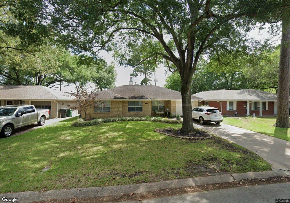
1823 De Milo Dr Houston, TX 77018
Oak Forest-Garden Oaks NeighborhoodEstimated Value: $421,736 - $560,000
2
Beds
1
Bath
1,374
Sq Ft
$356/Sq Ft
Est. Value
About This Home
This home is located at 1823 De Milo Dr, Houston, TX 77018 and is currently estimated at $489,434, approximately $356 per square foot. 1823 De Milo Dr is a home located in Harris County with nearby schools including Stevens Elementary School, Frank Black Middle School, and Waltrip High School.
Ownership History
Date
Name
Owned For
Owner Type
Purchase Details
Closed on
Apr 27, 1998
Sold by
Hinds Russell
Bought by
Alleman Faye
Current Estimated Value
Home Financials for this Owner
Home Financials are based on the most recent Mortgage that was taken out on this home.
Original Mortgage
$73,000
Outstanding Balance
$14,251
Interest Rate
7.09%
Estimated Equity
$475,183
Purchase Details
Closed on
Jan 19, 1998
Sold by
Quinn Paul and Cabiness Susan Quinn
Bought by
Hinds Russell
Home Financials for this Owner
Home Financials are based on the most recent Mortgage that was taken out on this home.
Original Mortgage
$43,200
Interest Rate
7.16%
Create a Home Valuation Report for This Property
The Home Valuation Report is an in-depth analysis detailing your home's value as well as a comparison with similar homes in the area
Home Values in the Area
Average Home Value in this Area
Purchase History
| Date | Buyer | Sale Price | Title Company |
|---|---|---|---|
| Alleman Faye | -- | Commonwealth Land Title Co | |
| Hinds Russell | -- | First American Title |
Source: Public Records
Mortgage History
| Date | Status | Borrower | Loan Amount |
|---|---|---|---|
| Open | Alleman Faye | $73,000 | |
| Previous Owner | Hinds Russell | $43,200 |
Source: Public Records
Tax History Compared to Growth
Tax History
| Year | Tax Paid | Tax Assessment Tax Assessment Total Assessment is a certain percentage of the fair market value that is determined by local assessors to be the total taxable value of land and additions on the property. | Land | Improvement |
|---|---|---|---|---|
| 2025 | $5,233 | $388,056 | $351,938 | $36,118 |
| 2024 | $5,233 | $363,842 | $331,634 | $32,208 |
| 2023 | $5,233 | $365,052 | $331,634 | $33,418 |
| 2022 | $7,070 | $321,088 | $291,026 | $30,062 |
| 2021 | $6,929 | $297,311 | $263,597 | $33,714 |
| 2020 | $7,244 | $299,160 | $263,597 | $35,563 |
| 2019 | $7,473 | $295,337 | $263,597 | $31,740 |
| 2018 | $5,294 | $286,783 | $249,349 | $37,434 |
| 2017 | $6,323 | $286,783 | $249,349 | $37,434 |
| 2016 | $5,748 | $286,783 | $249,349 | $37,434 |
| 2015 | $3,704 | $284,812 | $213,728 | $71,084 |
| 2014 | $3,704 | $237,193 | $178,106 | $59,087 |
Source: Public Records
Map
Nearby Homes
- 1850 Viking Dr
- 1818 Nina Lee Ln
- 1839 Bethlehem St
- 2023 Viking Dr
- 4403 Sumner Dr
- 4414 Lavell Dr
- 1720 Libbey Dr
- 2103 Brimberry St
- 4411 Deer Lodge Dr
- 4415 Donna Bell Ln
- 1634 Latexo Dr
- 4402 Fallbrook Dr
- 4410 Deer Lodge Dr
- 1623 Latexo Dr
- 1843 Candlelight Place Dr
- 1706 Hewitt Dr
- 2106 Nina Lee Ln
- 2202 De Milo Dr
- 1522 Hewitt Dr
- 2007 Hewitt Dr
- 1827 De Milo Dr
- 1815 De Milo Dr
- 1831 De Milo Dr
- 1843 De Milo Dr
- 1811 De Milo Dr
- 1835 De Milo Dr
- 1826 De Milo Dr
- 1818 De Milo Dr
- 1830 De Milo Dr
- 1807 De Milo Dr
- 1814 De Milo Dr
- 1903 De Milo Dr
- 1834 De Milo Dr
- 1810 De Milo Dr
- 1803 De Milo Dr
- 1907 De Milo Dr
- 1902 De Milo Dr
- 1839 Viking Dr
- 1806 De Milo Dr
- 1843 Viking Dr