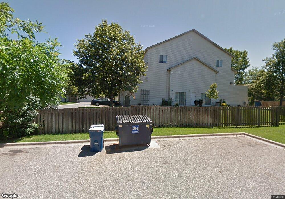
1823 E 122nd St Burnsville, MN 55337
Estimated Value: $243,000 - $251,628
2
Beds
2
Baths
1,356
Sq Ft
$181/Sq Ft
Est. Value
About This Home
This home is located at 1823 E 122nd St, Burnsville, MN 55337 and is currently estimated at $245,657, approximately $181 per square foot. 1823 E 122nd St is a home located in Dakota County with nearby schools including William Byrne Elementary School, Burnsville High School, and Gateway STEM Academy.
Ownership History
Date
Name
Owned For
Owner Type
Purchase Details
Closed on
Feb 6, 2020
Sold by
Opendoor Property C Llc
Bought by
Hockenberger Emest
Current Estimated Value
Purchase Details
Closed on
Jun 24, 2019
Sold by
Knutson Timothy Michael
Bought by
Opendoor Property C Llc
Purchase Details
Closed on
Aug 29, 2005
Sold by
Knutson Thomas W and Knutson Leigha M
Bought by
Knutson Timothy
Purchase Details
Closed on
Aug 21, 2003
Sold by
Karrigan Kellery J
Bought by
Knutson Thomas W and Knutson Leigha M
Purchase Details
Closed on
Aug 20, 1996
Sold by
Dean R Johnson Const Inc
Bought by
Karrigan Kellerey J
Create a Home Valuation Report for This Property
The Home Valuation Report is an in-depth analysis detailing your home's value as well as a comparison with similar homes in the area
Home Values in the Area
Average Home Value in this Area
Purchase History
| Date | Buyer | Sale Price | Title Company |
|---|---|---|---|
| Hockenberger Emest | $166,000 | North American Title Company | |
| Opendoor Property C Llc | $169,700 | Opendoor Title Llc | |
| Knutson Timothy | -- | -- | |
| Knutson Thomas W | $155,000 | -- | |
| Karrigan Kellerey J | $87,555 | -- |
Source: Public Records
Tax History Compared to Growth
Tax History
| Year | Tax Paid | Tax Assessment Tax Assessment Total Assessment is a certain percentage of the fair market value that is determined by local assessors to be the total taxable value of land and additions on the property. | Land | Improvement |
|---|---|---|---|---|
| 2024 | $2,600 | $213,800 | $42,300 | $171,500 |
| 2023 | $2,600 | $204,200 | $42,400 | $161,800 |
| 2022 | $2,104 | $199,000 | $42,300 | $156,700 |
| 2021 | $2,094 | $169,400 | $36,800 | $132,600 |
| 2020 | $1,870 | $174,700 | $35,000 | $139,700 |
| 2019 | $1,791 | $158,400 | $33,400 | $125,000 |
| 2018 | $1,644 | $144,000 | $30,900 | $113,100 |
| 2017 | $1,537 | $128,300 | $28,600 | $99,700 |
| 2016 | $1,642 | $117,500 | $27,200 | $90,300 |
| 2015 | $1,568 | $120,400 | $26,400 | $94,000 |
| 2014 | -- | $120,200 | $24,800 | $95,400 |
| 2013 | -- | $106,900 | $22,100 | $84,800 |
Source: Public Records
Map
Nearby Homes
- 2007 E 122nd St Unit B15
- 2011 E 122nd St Unit D24
- 2005 E 122nd St Unit A7
- 2005 E 122nd St Unit A14
- 2005 E 122nd St Unit A23
- 12316 Michelle Cir
- 12232 Oak Leaf Cir
- 1609 Riverwood Dr
- 12284 River Valley Dr
- 12251 River Valley Dr
- 12420 Chippewa Ln
- 1853 Riverwood Dr Unit 4
- 122 Birnamwood Dr
- 1800 Riverwood Dr Unit 110
- 1800 Riverwood Dr Unit 323
- 2300 Villaburne Ct W
- 1115 E Travelers Trail
- 37 Birnamwood Dr
- 2400 E 125th St
- 2200 Horizon Rd
- 1821 E 122nd St
- 1825 E 122nd St
- 1829 E 122nd St
- 1829 122nd St E
- 1829 1829 122nd-Street-e
- 1831 E 122nd St
- 1827 E 122nd St
- 1839 E 122nd St
- 1841 E 122nd St
- 1837 E 122nd St
- 1835 E 122nd St
- 1833 E 122nd St
- 1845 E 122nd St
- 1843 E 122nd St
- 1847 E 122nd St
- 1849 E 122nd St
- 1851 E 122nd St
- 12213 17th Ave S
- 12213 17th Ave S
- 1855 E 122nd St