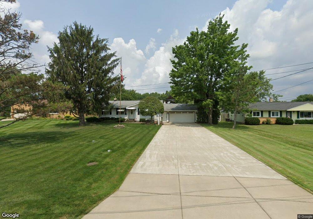
18302 Carol Dr Strongsville, OH 44136
Estimated Value: $275,000 - $327,000
4
Beds
2
Baths
1,710
Sq Ft
$176/Sq Ft
Est. Value
About This Home
This home is located at 18302 Carol Dr, Strongsville, OH 44136 and is currently estimated at $300,307, approximately $175 per square foot. 18302 Carol Dr is a home located in Cuyahoga County with nearby schools including Strongsville High School, Sts Joseph & John Interparochial School, and Strongsville Montessori School.
Ownership History
Date
Name
Owned For
Owner Type
Purchase Details
Closed on
Jun 5, 2025
Sold by
Dombrowski Family Trust and Dombrowski Neal F
Bought by
Nddj Trust and Dombrowski
Current Estimated Value
Purchase Details
Closed on
Sep 20, 2018
Sold by
Dombrowski Neal F and Dombrowski Dorothy A
Bought by
Dombrowski Neal F and Dombrowski Dorothy A
Purchase Details
Closed on
Mar 8, 1993
Sold by
Neal F Dombrowski
Bought by
Dombrowski Neal F
Purchase Details
Closed on
Feb 26, 1979
Sold by
Dombrowski Neal F and Dombrowski Dorothy
Bought by
Neal F Dombrowski
Purchase Details
Closed on
Jan 1, 1975
Bought by
Dombrowski Neal F and Dombrowski Dorothy
Create a Home Valuation Report for This Property
The Home Valuation Report is an in-depth analysis detailing your home's value as well as a comparison with similar homes in the area
Home Values in the Area
Average Home Value in this Area
Purchase History
| Date | Buyer | Sale Price | Title Company |
|---|---|---|---|
| Nddj Trust | -- | Ohio Real Title | |
| Dombrowski Neal F | -- | None Available | |
| Dombrowski Neal F | -- | -- | |
| Neal F Dombrowski | -- | -- | |
| Dombrowski Neal F | -- | -- |
Source: Public Records
Tax History Compared to Growth
Tax History
| Year | Tax Paid | Tax Assessment Tax Assessment Total Assessment is a certain percentage of the fair market value that is determined by local assessors to be the total taxable value of land and additions on the property. | Land | Improvement |
|---|---|---|---|---|
| 2024 | $3,446 | $83,195 | $12,915 | $70,280 |
| 2023 | $3,143 | $59,370 | $14,880 | $44,490 |
| 2022 | $3,147 | $59,360 | $14,880 | $44,490 |
| 2021 | $3,122 | $59,360 | $14,880 | $44,490 |
| 2020 | $2,781 | $48,650 | $12,180 | $36,470 |
| 2019 | $2,700 | $139,000 | $34,800 | $104,200 |
| 2018 | $2,450 | $48,650 | $12,180 | $36,470 |
| 2017 | $2,354 | $44,240 | $10,990 | $33,250 |
| 2016 | $2,335 | $44,240 | $10,990 | $33,250 |
| 2015 | $2,368 | $44,240 | $10,990 | $33,250 |
| 2014 | $2,368 | $44,240 | $10,990 | $33,250 |
Source: Public Records
Map
Nearby Homes
- 18630 Shurmer Rd
- 18162 Fawn Cir
- 17069 Partridge Dr
- 19160 Wheelers Ln
- 19513 Lunn Rd
- 19311 Bradford Ct
- 19620 Porters Ln Unit 15F
- 14112 Settlers Way
- 19297 Lauren Way
- 17289 Akita Ct Unit 4508
- 14703 Lenox Dr Unit 103
- 14826 Lenox Dr
- 13513 Suncrest Ct
- 17024 Bear Creek Ln
- 15639 Indianhead Ln
- 20078 Trapper Trail
- 17259 Woodshire Dr
- 16650 Lanier Ave
- 19908 Stoughton Dr
- 18294 Drake Rd
- 18294 Carol Dr
- 18300 Carol Dr
- 18361 Potomac Dr
- 18409 Potomac Dr
- 18250 Carol Dr
- 18313 Potomac Dr
- 18498 Carol Dr
- 18265 Potomac Dr
- 18295 Carol Dr
- 18204 Carol Dr
- 18505 Potomac Dr
- 18495 Carol Dr
- 18251 Carol Dr
- 18217 Potomac Dr
- 0 Carol Dr Unit 3951490
- 18553 Potomac Dr
- 18160 Carol Dr
- 18360 Potomac Dr
- 18408 Potomac Dr
- 18159 Potomac Dr