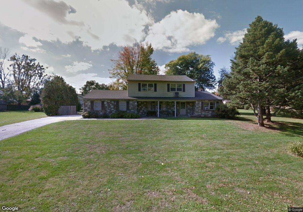
1832 Spera Ln Norristown, PA 19403
West Norriton Township NeighborhoodEstimated Value: $370,000 - $528,000
4
Beds
3
Baths
2,636
Sq Ft
$174/Sq Ft
Est. Value
About This Home
This home is located at 1832 Spera Ln, Norristown, PA 19403 and is currently estimated at $459,058, approximately $174 per square foot. 1832 Spera Ln is a home located in Montgomery County with nearby schools including Whitehall Elementary School, Charles Blockson Middle School, and East Norriton Middle School.
Ownership History
Date
Name
Owned For
Owner Type
Purchase Details
Closed on
Aug 26, 2024
Sold by
1832 Spera Lane Trust and Cavanaugh Robert W
Bought by
J & J Property Group Llc
Current Estimated Value
Home Financials for this Owner
Home Financials are based on the most recent Mortgage that was taken out on this home.
Original Mortgage
$246,627
Outstanding Balance
$243,865
Interest Rate
6.49%
Mortgage Type
Seller Take Back
Estimated Equity
$215,193
Purchase Details
Closed on
Apr 6, 2022
Sold by
Cavanaugh Robert W and Cavanaugh Christa M
Bought by
1832 Spera Lane Trust and Cavanaugh
Purchase Details
Closed on
Jan 3, 2019
Sold by
Hundley Sanford T
Bought by
Cavanaugh Robert W and Cavanaugh Christa M
Purchase Details
Closed on
Jul 1, 2013
Sold by
Hundley Donald T and Hundley Nancy W
Bought by
Hundley Sanford T
Create a Home Valuation Report for This Property
The Home Valuation Report is an in-depth analysis detailing your home's value as well as a comparison with similar homes in the area
Home Values in the Area
Average Home Value in this Area
Purchase History
| Date | Buyer | Sale Price | Title Company |
|---|---|---|---|
| J & J Property Group Llc | $340,000 | None Listed On Document | |
| 1832 Spera Lane Trust | -- | None Listed On Document | |
| Cavanaugh Robert W | $287,000 | None Available | |
| Hundley Sanford T | -- | None Available |
Source: Public Records
Mortgage History
| Date | Status | Borrower | Loan Amount |
|---|---|---|---|
| Open | J & J Property Group Llc | $246,627 |
Source: Public Records
Tax History Compared to Growth
Tax History
| Year | Tax Paid | Tax Assessment Tax Assessment Total Assessment is a certain percentage of the fair market value that is determined by local assessors to be the total taxable value of land and additions on the property. | Land | Improvement |
|---|---|---|---|---|
| 2025 | $7,455 | $152,570 | $43,840 | $108,730 |
| 2024 | $7,455 | $152,570 | $43,840 | $108,730 |
| 2023 | $7,370 | $152,570 | $43,840 | $108,730 |
| 2022 | $7,322 | $152,570 | $43,840 | $108,730 |
| 2021 | $7,278 | $152,570 | $43,840 | $108,730 |
| 2020 | $7,060 | $152,570 | $43,840 | $108,730 |
| 2019 | $6,903 | $152,570 | $43,840 | $108,730 |
| 2018 | $5,633 | $152,570 | $43,840 | $108,730 |
| 2017 | $6,517 | $152,570 | $43,840 | $108,730 |
| 2016 | $6,458 | $152,570 | $43,840 | $108,730 |
| 2015 | $5,983 | $152,570 | $43,840 | $108,730 |
| 2014 | $5,983 | $152,570 | $43,840 | $108,730 |
Source: Public Records
Map
Nearby Homes
- 709 Middleton Place
- 1104 Arden Dr Unit METHACTON SCHOOL
- 2025 Sterigere St
- 166 Hoover Ave
- 1749 W Marshall St
- 214 Oxford Cir
- 145 Colonial Ave
- 37 Burnside Ave
- 1635 W Marshall W Marshall St
- 612 Glen Ln Unit 56A
- 1924 Juniata Rd
- 1448 W James St
- 1506 W Marshall St
- 89 Centre Ave
- 0 Centre Unit 430 PAMC2099854
- 1633 Williams Way
- 1613 Countryside Ln
- 621 N Forrest
- 1219 Stonybrook Dr Unit 1219
- 805 Stonybrook Dr
- 1941 Clearview Ave
- 1945 Clearview Ave
- 1900 Davis Dr
- 1937 Clearview Ave
- 1949 Clearview Ave
- 1933 Clearview Ave
- 1953 Clearview Ave
- 1830 Spera Ln
- 1929 Clearview Ave
- 1825 Spera Ln
- 1904 Davis Dr
- 1901 Davis Dr
- 1925 Clearview Ave
- 1961 Clearview Ave
- 1946 Clearview Ave
- 1950 Clearview Ave
- 1942 Clearview Ave
- 1938 Clearview Ave
- 1965 Clearview Ave
- 1930 Clearview Ave