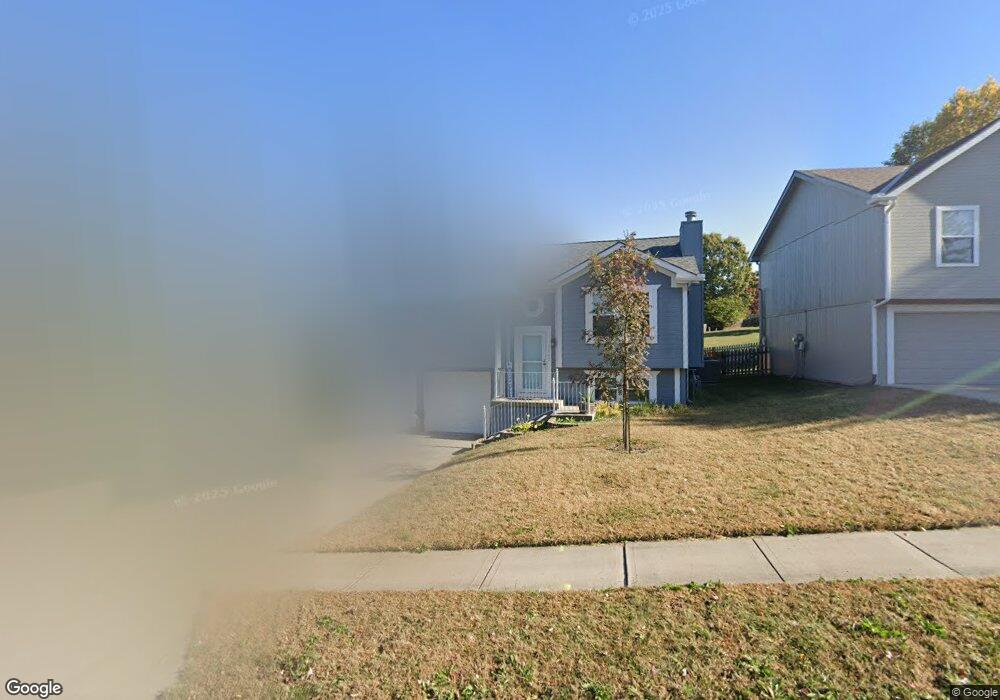
1842 Mallard Dr Liberty, MO 64068
Estimated Value: $271,537 - $305,000
3
Beds
2
Baths
1,076
Sq Ft
$265/Sq Ft
Est. Value
About This Home
This home is located at 1842 Mallard Dr, Liberty, MO 64068 and is currently estimated at $285,634, approximately $265 per square foot. 1842 Mallard Dr is a home located in Clay County with nearby schools including Lillian Schumacher Elementary School, Liberty Middle School, and Liberty High School.
Ownership History
Date
Name
Owned For
Owner Type
Purchase Details
Closed on
May 14, 2007
Sold by
Harr Scott D and Harr Renee L
Bought by
Ly Jason Tuan and Ly Brandy Marie
Current Estimated Value
Home Financials for this Owner
Home Financials are based on the most recent Mortgage that was taken out on this home.
Original Mortgage
$140,000
Outstanding Balance
$84,972
Interest Rate
6.13%
Mortgage Type
Purchase Money Mortgage
Estimated Equity
$200,662
Purchase Details
Closed on
Mar 20, 1998
Sold by
Odell & Heckman Development Co Llc
Bought by
Harr Scott D and Harr Renee L
Home Financials for this Owner
Home Financials are based on the most recent Mortgage that was taken out on this home.
Original Mortgage
$102,472
Interest Rate
7.17%
Mortgage Type
FHA
Create a Home Valuation Report for This Property
The Home Valuation Report is an in-depth analysis detailing your home's value as well as a comparison with similar homes in the area
Home Values in the Area
Average Home Value in this Area
Purchase History
| Date | Buyer | Sale Price | Title Company |
|---|---|---|---|
| Ly Jason Tuan | -- | Community Land Title | |
| Harr Scott D | -- | Thomson Title Corp |
Source: Public Records
Mortgage History
| Date | Status | Borrower | Loan Amount |
|---|---|---|---|
| Open | Ly Jason Tuan | $140,000 | |
| Previous Owner | Harr Scott D | $102,472 | |
| Closed | Harr Scott D | $5,195 |
Source: Public Records
Tax History Compared to Growth
Tax History
| Year | Tax Paid | Tax Assessment Tax Assessment Total Assessment is a certain percentage of the fair market value that is determined by local assessors to be the total taxable value of land and additions on the property. | Land | Improvement |
|---|---|---|---|---|
| 2025 | $2,573 | $38,440 | -- | -- |
| 2024 | $2,573 | $33,460 | -- | -- |
| 2023 | $2,617 | $33,460 | $0 | $0 |
| 2022 | $0 | $29,550 | $0 | $0 |
| 2021 | $2,323 | $29,545 | $6,650 | $22,895 |
| 2020 | $2,110 | $25,210 | $0 | $0 |
| 2019 | $2,110 | $25,213 | $4,940 | $20,273 |
| 2018 | $1,913 | $22,440 | $0 | $0 |
| 2017 | $1,895 | $22,440 | $3,990 | $18,450 |
| 2016 | $1,895 | $22,440 | $3,990 | $18,450 |
| 2015 | $1,895 | $22,440 | $3,990 | $18,450 |
| 2014 | $1,852 | $21,750 | $3,990 | $17,760 |
Source: Public Records
Map
Nearby Homes
- 1847 Mallard Dr
- 1905 Claywoods Pkwy
- 1876 Kingbird Ln
- 1872 Kingbird Ln
- 1004 Hackberry Ct
- 1103 Pier
- 3.86 acres Southview Dr
- 1435 Sumac Cir
- 345 Cates Ct
- 2504 Magnolia Ave
- 450 E Ruth Ewing Rd
- 1116 Silverleaf Ln
- 1059 Fir Ln
- 1051 Fir Ln
- 1112 White Birch St
- 1044 Silverleaf Ln
- 1024 Redwood Ln
- 1015 Poplar Ln
- 1011 Poplar Ln
- 1007 Poplar Ln
- 1846 Mallard Dr
- 1838 Mallard Dr
- 1850 Mallard Dr
- 1834 Mallard Dr
- 1851 Mallard Dr
- 1139 Meadowlark Ln
- 1143 Meadowlark Ln
- 1851 Current St
- 1855 Mallard Dr
- 1135 Meadowlark Ln
- 1847 Current St
- 1120 Mallard Ct
- 1147 Meadowlark Ln
- 1121 Mallard Ct
- 1859 Mallard Dr
- 1843 Current St
- 1835 Mallard Dr
- 1151 Meadowlark Ln
- 1116 Mallard Ct
- 1117 Mallard Ct