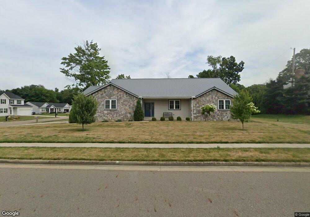
1847 Briarwood St Louisville, OH 44641
Estimated Value: $349,321 - $403,000
3
Beds
3
Baths
2,365
Sq Ft
$158/Sq Ft
Est. Value
About This Home
This home is located at 1847 Briarwood St, Louisville, OH 44641 and is currently estimated at $374,830, approximately $158 per square foot. 1847 Briarwood St is a home with nearby schools including Louisville High School and St. Thomas Aquinas High School & Middle School.
Ownership History
Date
Name
Owned For
Owner Type
Purchase Details
Closed on
Aug 24, 2015
Sold by
Clapper Robert A and Clapper Vicky L
Bought by
Greco Carmen and Greco Anna
Current Estimated Value
Purchase Details
Closed on
Jun 25, 2013
Sold by
Djs Family Properties Ltd
Bought by
Clapper Robert A and Clapper Vicky L
Purchase Details
Closed on
May 15, 2013
Sold by
Djs Family Properties Ltd
Bought by
Schalmo Janet T
Create a Home Valuation Report for This Property
The Home Valuation Report is an in-depth analysis detailing your home's value as well as a comparison with similar homes in the area
Home Values in the Area
Average Home Value in this Area
Purchase History
| Date | Buyer | Sale Price | Title Company |
|---|---|---|---|
| Greco Carmen | $28,000 | Attorney | |
| Clapper Robert A | $75,000 | None Available | |
| Schalmo Janet T | $2,000 | None Available |
Source: Public Records
Tax History Compared to Growth
Tax History
| Year | Tax Paid | Tax Assessment Tax Assessment Total Assessment is a certain percentage of the fair market value that is determined by local assessors to be the total taxable value of land and additions on the property. | Land | Improvement |
|---|---|---|---|---|
| 2025 | -- | $122,570 | $17,920 | $104,650 |
| 2024 | -- | $122,570 | $17,920 | $104,650 |
| 2023 | $3,882 | $99,540 | $16,940 | $82,600 |
| 2022 | $1,954 | $99,540 | $16,940 | $82,600 |
| 2021 | $3,918 | $99,540 | $16,940 | $82,600 |
| 2020 | $3,215 | $89,670 | $15,260 | $74,410 |
| 2019 | $3,228 | $89,670 | $15,260 | $74,410 |
| 2018 | $3,216 | $89,670 | $15,260 | $74,410 |
| 2017 | $3,333 | $89,680 | $13,410 | $76,270 |
| 2016 | $440 | $10,050 | $10,050 | $0 |
| 2015 | $441 | $10,050 | $10,050 | $0 |
| 2014 | $404 | $8,680 | $8,680 | $0 |
| 2013 | $202 | $8,680 | $8,680 | $0 |
Source: Public Records
Map
Nearby Homes
- 1812 E Broad St
- 1715 High St
- 2110 Edmar St
- 641 S Nickelplate St
- 2015 E Main St
- 308 Superior St
- 520 S Silver St
- 0 Michigan Blvd
- 728 E Broad St
- 3390 Meese Rd NE
- 908 Sand Lot Cir
- 510 S Bauman Ct
- 204 E Broad St
- 107 E Broad St
- 325 Lincoln Ave
- 1170 Winding Ridge Ave
- 910 Crosswyck Cir
- 1702 View Pointe Ave
- 8225 Georgetown St
- 1639 Horizon Dr
- 1857 Briarwood St
- 750 Cypress Ave
- 825 Cypress Ave
- 775 Cypress Ave
- 825 Hillcliff St
- 1867 Briarwood St
- 950 Cypress Ave
- 540 Cypress Ave
- 725 Cypress Ave
- 0 Briarwood St Unit 3768345
- 935 Cypress Ave
- 905 Hillcliff St
- 970 Cypress Ave
- 970 Cypress Ave
- 1905 Briarwood St
- 1814 High St
- 32 Thewes Cir
- 36 Thewes Cir
- 30 Thewes Cir
- 34 Thewes Cir