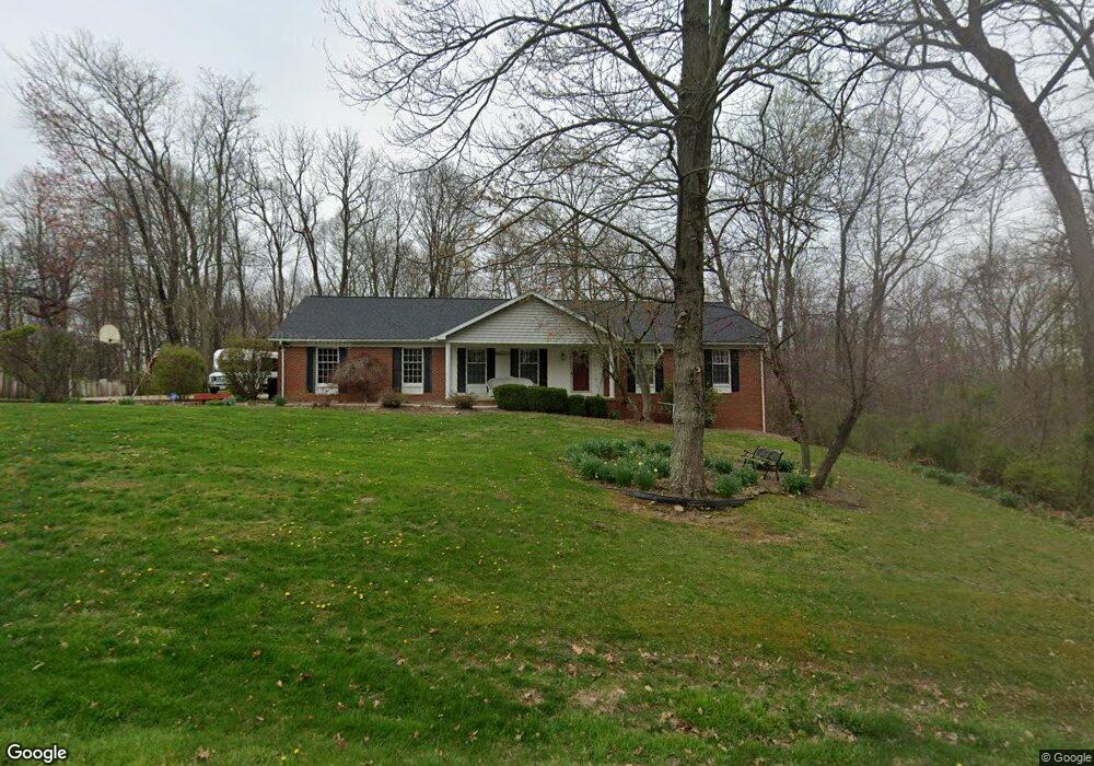
185 Eagles Nest Rd Zanesville, OH 43701
Estimated Value: $305,000 - $403,353
4
Beds
3
Baths
1,600
Sq Ft
$229/Sq Ft
Est. Value
About This Home
This home is located at 185 Eagles Nest Rd, Zanesville, OH 43701 and is currently estimated at $366,338, approximately $228 per square foot. 185 Eagles Nest Rd is a home located in Muskingum County with nearby schools including Perry Elementary School, East Muskingum Middle School, and Larry Miller Intermediate Elementary School.
Ownership History
Date
Name
Owned For
Owner Type
Purchase Details
Closed on
Apr 5, 1999
Sold by
Gemma Thomas M
Bought by
Smith Douglas E and Smith Jill M
Current Estimated Value
Home Financials for this Owner
Home Financials are based on the most recent Mortgage that was taken out on this home.
Original Mortgage
$86,000
Interest Rate
6.89%
Mortgage Type
New Conventional
Purchase Details
Closed on
May 17, 1994
Bought by
Gemma Thomas M and Gemma Cynthia
Create a Home Valuation Report for This Property
The Home Valuation Report is an in-depth analysis detailing your home's value as well as a comparison with similar homes in the area
Home Values in the Area
Average Home Value in this Area
Purchase History
| Date | Buyer | Sale Price | Title Company |
|---|---|---|---|
| Smith Douglas E | $157,500 | -- | |
| Gemma Thomas M | $137,900 | -- |
Source: Public Records
Mortgage History
| Date | Status | Borrower | Loan Amount |
|---|---|---|---|
| Previous Owner | Smith Douglas E | $86,000 |
Source: Public Records
Tax History Compared to Growth
Tax History
| Year | Tax Paid | Tax Assessment Tax Assessment Total Assessment is a certain percentage of the fair market value that is determined by local assessors to be the total taxable value of land and additions on the property. | Land | Improvement |
|---|---|---|---|---|
| 2024 | $3,514 | $97,650 | $14,315 | $83,335 |
| 2023 | $3,290 | $83,685 | $9,555 | $74,130 |
| 2022 | $3,120 | $83,685 | $9,555 | $74,130 |
| 2021 | $3,085 | $83,685 | $9,555 | $74,130 |
| 2020 | $2,903 | $76,090 | $8,680 | $67,410 |
| 2019 | $2,889 | $76,090 | $8,680 | $67,410 |
| 2018 | $2,945 | $76,090 | $8,680 | $67,410 |
| 2017 | $2,203 | $59,535 | $8,680 | $50,855 |
| 2016 | $2,207 | $59,540 | $8,680 | $50,860 |
| 2015 | $2,261 | $59,540 | $8,680 | $50,860 |
| 2013 | $2,420 | $59,540 | $8,680 | $50,860 |
Source: Public Records
Map
Nearby Homes
- 310 Trappers Hollow Rd
- 400 Spring Valley Dr
- 130 Airport Rd
- 1305 Bald Hill Rd
- 5180 Pine Valley Dr
- 6265 Canterbury Way Unit LOT 30
- 6600 Bridgeville Dr
- 4460 East Pike
- 365 Walters Way
- 360 Walters Way
- 7115 East Pike
- 0 Sonora Rd Unit 225018643
- 0 Sonora Rd Unit 5125925
- 350 Urban Hill Rd
- 380 Urban Hill Rd
- 0 E Wheeling Rd Unit 5162172
- 1605 Jackson Rd
- 7915 East Pike
- 3620 Old Wheeling Rd
- 2125 Long Rd
- 195 Eagles Nest Rd
- 205 Eagles Nest Rd
- 155 Eagles Nest Rd
- 155 Eagles Nest Rd
- 155 Eagles Nest Rd
- 155 Eagles Nest Rd
- 155 Eagles Nest Rd
- 155 Eagles Nest Rd
- 200 Eagles Nest Rd
- 210 Eagles Nest Rd
- 215 Eagles Nest Rd
- 5525 Airwood Dr
- 5535 Airwood Dr
- 5505 Airwood Dr
- 235 Eagles Nest Rd
- 5545 Airwood Dr
- 5501 Airwood Dr
- 5477 Airwood Dr
- 5555 Airwood Dr
- 5520 Airwood Dr