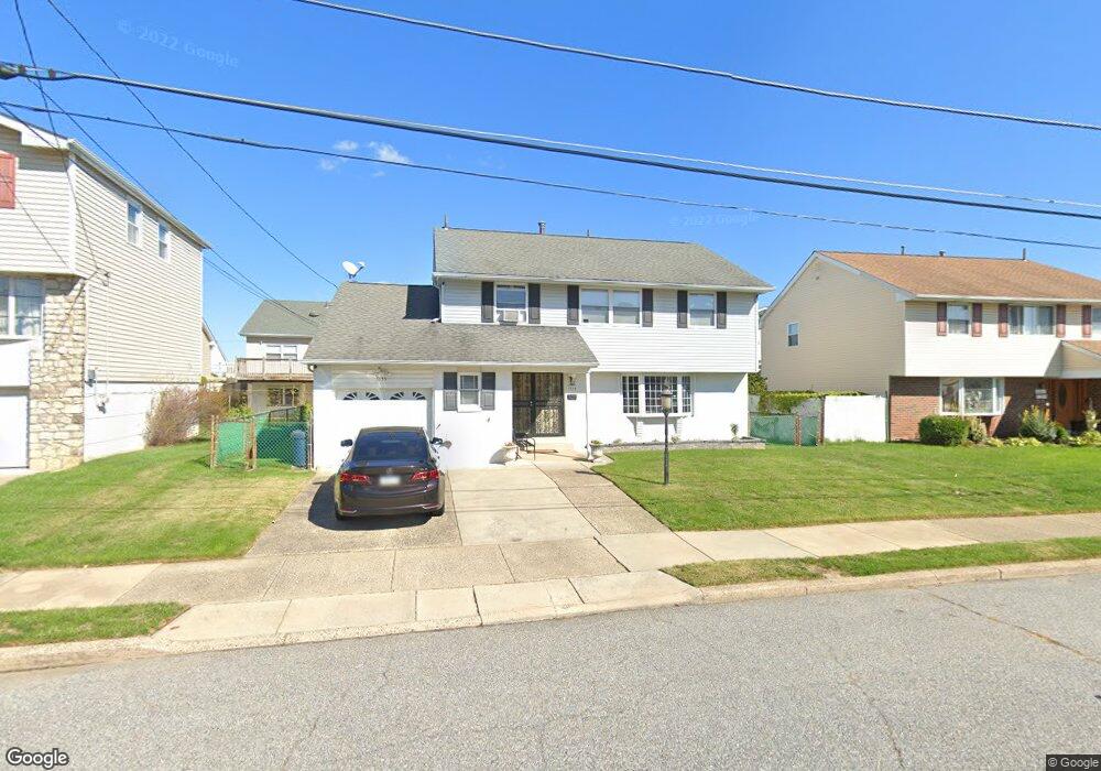
1855 Garth Rd Philadelphia, PA 19116
Somerton NeighborhoodEstimated Value: $445,107 - $512,000
--
Bed
--
Bath
2,066
Sq Ft
$238/Sq Ft
Est. Value
About This Home
This home is located at 1855 Garth Rd, Philadelphia, PA 19116 and is currently estimated at $491,277, approximately $237 per square foot. 1855 Garth Rd is a home located in Philadelphia County with nearby schools including Frank Anne School, CCA Baldi Middle School, and George Washington High School.
Ownership History
Date
Name
Owned For
Owner Type
Purchase Details
Closed on
Nov 21, 2002
Sold by
Brenneisen Shannon and Brenneisen Barbara
Bought by
Shah Atul and Shah Gita
Current Estimated Value
Home Financials for this Owner
Home Financials are based on the most recent Mortgage that was taken out on this home.
Original Mortgage
$148,000
Interest Rate
6.19%
Purchase Details
Closed on
Sep 14, 2001
Sold by
Brenneisen Blossom
Bought by
Brenneisen Blossom and Brenneisen Shannon M
Create a Home Valuation Report for This Property
The Home Valuation Report is an in-depth analysis detailing your home's value as well as a comparison with similar homes in the area
Home Values in the Area
Average Home Value in this Area
Purchase History
| Date | Buyer | Sale Price | Title Company |
|---|---|---|---|
| Shah Atul | $185,000 | -- | |
| Brenneisen Blossom | -- | -- |
Source: Public Records
Mortgage History
| Date | Status | Borrower | Loan Amount |
|---|---|---|---|
| Previous Owner | Shah Atul | $148,000 |
Source: Public Records
Tax History Compared to Growth
Tax History
| Year | Tax Paid | Tax Assessment Tax Assessment Total Assessment is a certain percentage of the fair market value that is determined by local assessors to be the total taxable value of land and additions on the property. | Land | Improvement |
|---|---|---|---|---|
| 2025 | $4,950 | $419,000 | $83,800 | $335,200 |
| 2024 | $4,950 | $419,000 | $83,800 | $335,200 |
| 2023 | $4,950 | $353,600 | $70,720 | $282,880 |
| 2022 | $4,320 | $308,600 | $70,720 | $237,880 |
| 2021 | $4,128 | $0 | $0 | $0 |
| 2020 | $4,128 | $0 | $0 | $0 |
| 2019 | $3,953 | $0 | $0 | $0 |
| 2018 | $0 | $0 | $0 | $0 |
| 2017 | $3,687 | $0 | $0 | $0 |
| 2016 | $3,267 | $0 | $0 | $0 |
| 2015 | $25,737 | $0 | $0 | $0 |
| 2014 | -- | $263,400 | $114,240 | $149,160 |
| 2012 | -- | $35,392 | $7,628 | $27,764 |
Source: Public Records
Map
Nearby Homes
- 1724 Nathaniel Dr
- 1829 Tomlinson Rd
- 1912 Tomlinson Rd
- 10123 Alexandra Ln
- 859 Selmer Rd
- 11003 Stevens Rd
- 2044 Gorman St
- 831 Lawler St
- 9990 Sandy Rd
- 9987 Hardy Rd
- 9921 Bustleton Ave Unit K11
- 9921 Bustleton Ave Unit P3
- 9926 00 Haldeman Ave
- 9926 Haldeman Unit#133 Ave
- 9926 Haldeman Ave
- 9839 Haldeman Ave
- 770 Selmer Rd
- 9837 Haldeman Ave
- 825 Delray St
- 813 Piermont St