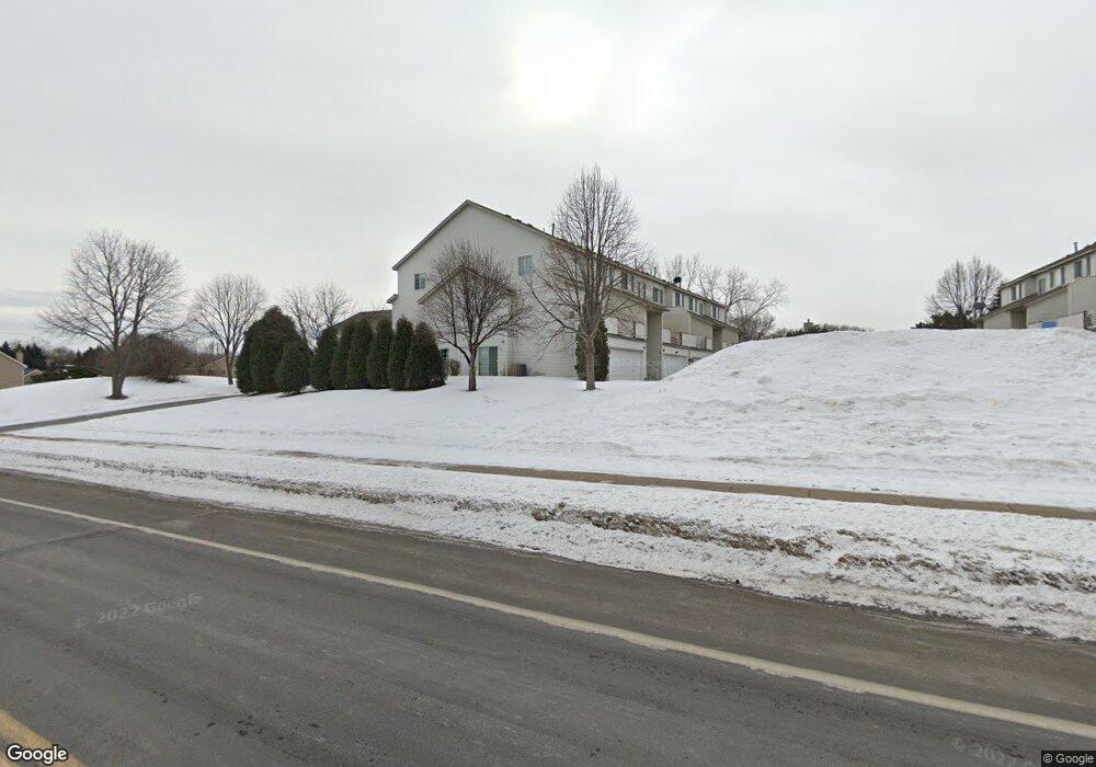
1861 E 122nd St Burnsville, MN 55337
Estimated Value: $249,000 - $270,000
2
Beds
2
Baths
1,241
Sq Ft
$211/Sq Ft
Est. Value
About This Home
This home is located at 1861 E 122nd St, Burnsville, MN 55337 and is currently estimated at $262,367, approximately $211 per square foot. 1861 E 122nd St is a home located in Dakota County with nearby schools including William Byrne Elementary School, Burnsville High School, and Gateway STEM Academy.
Ownership History
Date
Name
Owned For
Owner Type
Purchase Details
Closed on
Aug 11, 2022
Sold by
Smith Scott
Bought by
Lynch Austin
Current Estimated Value
Home Financials for this Owner
Home Financials are based on the most recent Mortgage that was taken out on this home.
Original Mortgage
$231,500
Outstanding Balance
$221,655
Interest Rate
5.7%
Mortgage Type
New Conventional
Estimated Equity
$40,712
Purchase Details
Closed on
Feb 19, 2020
Sold by
Lambert Jeffrey L and Lambert Sheila Kathryn
Bought by
Brandy Braziel and Sargent Jennin Cristian
Purchase Details
Closed on
Aug 11, 2000
Sold by
Turpen David W and Turpen Beth Ann
Bought by
Smith Scott D
Purchase Details
Closed on
Oct 30, 1998
Sold by
Demke Paul A and Shaffner Demke Lisa A
Bought by
Turpen Beth Ann
Purchase Details
Closed on
Dec 31, 1996
Sold by
Dean R Johnson Construction Inc
Bought by
Demke Paul A and Demke Lisa A
Create a Home Valuation Report for This Property
The Home Valuation Report is an in-depth analysis detailing your home's value as well as a comparison with similar homes in the area
Home Values in the Area
Average Home Value in this Area
Purchase History
| Date | Buyer | Sale Price | Title Company |
|---|---|---|---|
| Lynch Austin | $233,500 | -- | |
| Brandy Braziel | $185,000 | Watermark Title Agency | |
| Smith Scott D | $129,900 | -- | |
| Turpen Beth Ann | $103,000 | -- | |
| Demke Paul A | $93,105 | -- |
Source: Public Records
Mortgage History
| Date | Status | Borrower | Loan Amount |
|---|---|---|---|
| Open | Lynch Austin | $231,500 |
Source: Public Records
Tax History Compared to Growth
Tax History
| Year | Tax Paid | Tax Assessment Tax Assessment Total Assessment is a certain percentage of the fair market value that is determined by local assessors to be the total taxable value of land and additions on the property. | Land | Improvement |
|---|---|---|---|---|
| 2024 | $2,526 | $248,400 | $46,600 | $201,800 |
| 2023 | $2,526 | $240,100 | $46,700 | $193,400 |
| 2022 | $1,968 | $233,900 | $46,600 | $187,300 |
| 2021 | $1,912 | $198,600 | $40,500 | $158,100 |
| 2020 | $1,768 | $184,900 | $38,500 | $146,400 |
| 2019 | $1,670 | $167,500 | $36,700 | $130,800 |
| 2018 | $1,498 | $153,200 | $34,000 | $119,200 |
| 2017 | $1,354 | $136,500 | $31,400 | $105,100 |
| 2016 | $1,465 | $124,900 | $29,900 | $95,000 |
| 2015 | $1,402 | $102,825 | $23,286 | $79,539 |
| 2014 | -- | $102,389 | $21,821 | $80,568 |
| 2013 | -- | $86,911 | $18,542 | $68,369 |
Source: Public Records
Map
Nearby Homes
- 2007 E 122nd St Unit B15
- 2011 E 122nd St Unit D24
- 2005 E 122nd St Unit A7
- 2005 E 122nd St Unit A14
- 2005 E 122nd St Unit A23
- 12232 Oak Leaf Cir
- 12316 Michelle Cir
- 1609 Riverwood Dr
- 12284 River Valley Dr
- 12420 Chippewa Ln
- 12251 River Valley Dr
- 1853 Riverwood Dr Unit 4
- 2300 Villaburne Ct W
- 1800 Riverwood Dr Unit 110
- 1800 Riverwood Dr Unit 323
- 122 Birnamwood Dr
- 2400 E 125th St
- 1115 E Travelers Trail
- 2200 Horizon Rd
- 37 Birnamwood Dr
- 1859 E 122nd St
- 1871 E 122nd St
- 1869 E 122nd St
- 1857 E 122nd St
- 1857 122nd St E
- 1867 E 122nd St
- 1855 E 122nd St
- 1865 E 122nd St
- 1863 E 122nd St
- 1851 E 122nd St
- 1849 E 122nd St
- 1847 E 122nd St
- 1845 E 122nd St
- 1843 E 122nd St
- 1873 E 122nd St
- 1833 E 122nd St
- 1835 E 122nd St
- 1837 E 122nd St
- 1839 E 122nd St
- 1875 E 122nd St