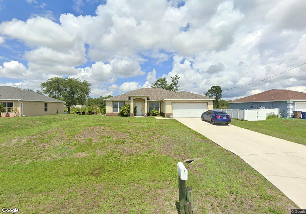
1863 Mayberry Dr Unit 29 Lehigh Acres, FL 33972
Richmond NeighborhoodEstimated Value: $271,000 - $309,000
4
Beds
2
Baths
1,803
Sq Ft
$157/Sq Ft
Est. Value
About This Home
This home is located at 1863 Mayberry Dr Unit 29, Lehigh Acres, FL 33972 and is currently estimated at $283,089, approximately $157 per square foot. 1863 Mayberry Dr Unit 29 is a home located in Lee County with nearby schools including Lehigh Elementary School, The Alva School, and Gateway Elementary School.
Ownership History
Date
Name
Owned For
Owner Type
Purchase Details
Closed on
Jul 27, 2011
Sold by
Jhoff Enterprises Llc
Bought by
Kurywchak Daniel A and Kurywchak Cheryl A
Current Estimated Value
Purchase Details
Closed on
Jun 7, 2011
Sold by
Wells Fargo Bank National Association
Bought by
Jhoff Enterprises Llc
Purchase Details
Closed on
Dec 15, 2010
Sold by
Martin Leo J and Marin Kathyl
Bought by
Wells Fargo Bank National Association
Purchase Details
Closed on
Mar 16, 2006
Sold by
Benincasa Enterprises Llc
Bought by
Marin Leo J and Marin Kathy L
Home Financials for this Owner
Home Financials are based on the most recent Mortgage that was taken out on this home.
Original Mortgage
$275,200
Interest Rate
6.19%
Mortgage Type
Construction
Create a Home Valuation Report for This Property
The Home Valuation Report is an in-depth analysis detailing your home's value as well as a comparison with similar homes in the area
Home Values in the Area
Average Home Value in this Area
Purchase History
| Date | Buyer | Sale Price | Title Company |
|---|---|---|---|
| Kurywchak Daniel A | $64,200 | Cape Coral Title Insurance A | |
| Jhoff Enterprises Llc | $57,800 | Attorney | |
| Wells Fargo Bank National Association | $277,100 | None Available | |
| Marin Leo J | $60,000 | Paradise Title Services Inc |
Source: Public Records
Mortgage History
| Date | Status | Borrower | Loan Amount |
|---|---|---|---|
| Previous Owner | Marin Leo J | $275,200 |
Source: Public Records
Tax History Compared to Growth
Tax History
| Year | Tax Paid | Tax Assessment Tax Assessment Total Assessment is a certain percentage of the fair market value that is determined by local assessors to be the total taxable value of land and additions on the property. | Land | Improvement |
|---|---|---|---|---|
| 2025 | $3,323 | $202,337 | -- | -- |
| 2024 | $3,154 | $183,943 | -- | -- |
| 2023 | $3,154 | $167,221 | $0 | $0 |
| 2022 | $2,906 | $152,019 | $0 | $0 |
| 2021 | $2,475 | $164,484 | $3,900 | $160,584 |
| 2020 | $2,372 | $154,233 | $3,900 | $150,333 |
| 2019 | $2,302 | $147,774 | $4,500 | $143,274 |
| 2018 | $2,151 | $133,225 | $4,250 | $128,975 |
| 2017 | $2,016 | $125,971 | $3,700 | $122,271 |
| 2016 | $1,872 | $111,814 | $3,700 | $108,114 |
| 2015 | $1,691 | $89,701 | $2,640 | $87,061 |
| 2014 | $1,582 | $91,109 | $2,540 | $88,569 |
| 2013 | -- | $71,507 | $2,100 | $69,407 |
Source: Public Records
Map
Nearby Homes
- 1857 Maiden St
- 1868 Newtonia St
- 545 Oakshire Ln
- 533 Willowbrook Dr
- 562 Woodview Dr
- 1860 Maurice Ave
- 1806 Mayberry Dr
- 1808 Mayberry Dr
- 1866 Mayberry Dr
- 563 Oakshire Ln
- 1869 Maurice Ave
- 1846 Mobile Ct
- 1842 Mobile Ct
- 1874 Outpost Cir
- 1868 Outpost Cir
- 507 Windermere Dr
- 506 Windermere Dr
- 601 Windermere Dr
- 557 Windermere Dr
- 1810 Desoto Ave
- 1865 Mayberry Dr
- 1861 Mayberry Dr
- 1862 Maiden St
- 1864 Mayberry Dr
- 1858 Maiden St
- 1858 Mayberry Dr
- 1868 Mayberry Dr
- 1865 Maiden St
- 1859 Maiden St
- 1867 Maiden St
- 1857 Maiden St Unit 10
- 1860 Maiden St
- 1871 Maiden St
- 1856 Maiden St
- 1869 Maiden St
- 1848 Mayberry Dr
- 1846 Mayberry Dr
- 1874 Mayberry Dr
- 1844 Mayberry Dr
- 1842 Mayberry Dr