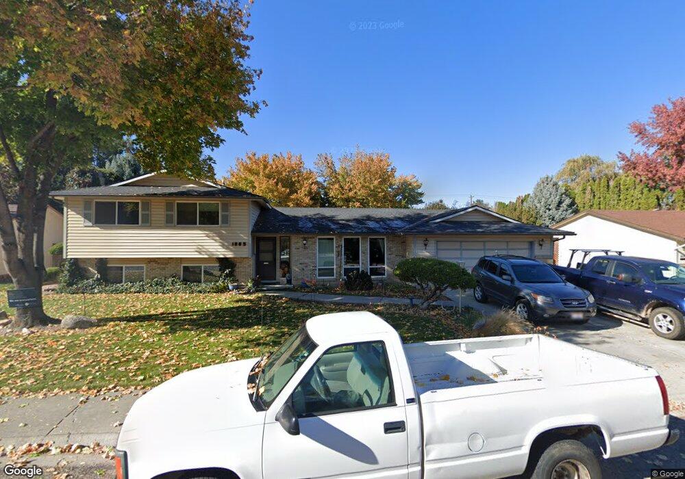
1865 Regent Ave Boise, ID 83709
Southwest Boise NeighborhoodEstimated Value: $538,000 - $582,000
4
Beds
4
Baths
2,052
Sq Ft
$273/Sq Ft
Est. Value
About This Home
This home is located at 1865 Regent Ave, Boise, ID 83709 and is currently estimated at $560,036, approximately $272 per square foot. 1865 Regent Ave is a home located in Ada County with nearby schools including Maple Grove Elementary School, West Junior High School, and Borah Senior High School.
Ownership History
Date
Name
Owned For
Owner Type
Purchase Details
Closed on
May 12, 2022
Sold by
Frances Peterson
Bought by
Peterson Family Trust
Current Estimated Value
Purchase Details
Closed on
Apr 17, 1997
Sold by
Marecki Edward A and Marecki Joann R
Bought by
Peterson Eugene R and Peterson Frances K
Home Financials for this Owner
Home Financials are based on the most recent Mortgage that was taken out on this home.
Original Mortgage
$100,000
Interest Rate
7.86%
Mortgage Type
Purchase Money Mortgage
Create a Home Valuation Report for This Property
The Home Valuation Report is an in-depth analysis detailing your home's value as well as a comparison with similar homes in the area
Home Values in the Area
Average Home Value in this Area
Purchase History
| Date | Buyer | Sale Price | Title Company |
|---|---|---|---|
| Peterson Family Trust | -- | None Listed On Document | |
| Peterson Eugene R | -- | Pioneer Title Company |
Source: Public Records
Mortgage History
| Date | Status | Borrower | Loan Amount |
|---|---|---|---|
| Previous Owner | Peterson Eugene R | $100,000 |
Source: Public Records
Tax History Compared to Growth
Tax History
| Year | Tax Paid | Tax Assessment Tax Assessment Total Assessment is a certain percentage of the fair market value that is determined by local assessors to be the total taxable value of land and additions on the property. | Land | Improvement |
|---|---|---|---|---|
| 2025 | $3,246 | $507,800 | -- | -- |
| 2024 | $3,083 | $482,700 | -- | -- |
| 2023 | $3,083 | $447,800 | $0 | $0 |
| 2022 | $3,419 | $519,300 | $0 | $0 |
| 2021 | $3,491 | $444,400 | $0 | $0 |
| 2020 | $2,962 | $349,500 | $0 | $0 |
| 2019 | $3,069 | $326,200 | $0 | $0 |
| 2018 | $2,747 | $280,900 | $0 | $0 |
| 2017 | $2,546 | $259,300 | $0 | $0 |
| 2016 | $2,292 | $234,700 | $0 | $0 |
| 2015 | $1,977 | $223,200 | $0 | $0 |
| 2012 | -- | $157,600 | $0 | $0 |
Source: Public Records
Map
Nearby Homes
- 2033 S Stonyfield Place
- 10685 W Hollandale Dr
- 10471 W Bantam St
- 2029 S Wilde Creek Way
- 10875 W Hollandale Dr
- 10334 W Bantam St
- 10776 W Smoke Ranch Dr
- 2484 S Culpeper Ave
- 9999 W Hollandale Dr
- 1877 S Rustic Mill Place
- 971 S Wavetrain Ave
- 10512 W Martingale Dr
- 9631 W Ottawa Ct
- 960 S Nautilus Ave
- 941 S Wavetrain Ave
- 11505 W Baserri Dr
- 937 S Nautilus Ave
- 10324 W Antietam St
- 11225 W Camas St
- 2476 S Amaya Ln
- 1843 Regent Ave
- 1887 Regent Ave
- 1905 Regent Ave
- 1821 S Regent Ave
- 1905 S Regent Ave
- 1821 Regent Ave
- 1866 S Regent Ave
- 1844 Regent Ave
- 1844 S Regent Ave
- 1866 Regent Ave
- 1888 Regent Ave
- 1927 Regent Ave
- 1822 Regent Ave
- 1822 S Regent Ave
- 10837 W Southerland St
- 1906 Regent Ave
- 10475 W Southerland Dr
- 1928 Regent Ave
- 1951 Regent Ave
- 10556 W Southerland Dr