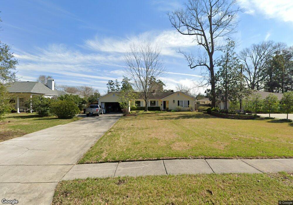
1867 Longwood Dr Baton Rouge, LA 70808
Mid City South NeighborhoodEstimated Value: $453,000 - $562,000
--
Bed
--
Bath
1,948
Sq Ft
$259/Sq Ft
Est. Value
About This Home
This home is located at 1867 Longwood Dr, Baton Rouge, LA 70808 and is currently estimated at $504,661, approximately $259 per square foot. 1867 Longwood Dr is a home located in East Baton Rouge Parish with nearby schools including Bernard Terrace Elementary School, Westdale Middle School, and Tara High School.
Ownership History
Date
Name
Owned For
Owner Type
Purchase Details
Closed on
Apr 3, 2001
Sold by
Meador Meador Thomas Randal
Bought by
Hodges Blake S and Hodges Stephanie S
Current Estimated Value
Home Financials for this Owner
Home Financials are based on the most recent Mortgage that was taken out on this home.
Original Mortgage
$190,800
Outstanding Balance
$70,912
Interest Rate
7.13%
Estimated Equity
$433,749
Create a Home Valuation Report for This Property
The Home Valuation Report is an in-depth analysis detailing your home's value as well as a comparison with similar homes in the area
Home Values in the Area
Average Home Value in this Area
Purchase History
| Date | Buyer | Sale Price | Title Company |
|---|---|---|---|
| Hodges Blake S | $212,000 | -- |
Source: Public Records
Mortgage History
| Date | Status | Borrower | Loan Amount |
|---|---|---|---|
| Open | Hodges Blake S | $190,800 |
Source: Public Records
Tax History Compared to Growth
Tax History
| Year | Tax Paid | Tax Assessment Tax Assessment Total Assessment is a certain percentage of the fair market value that is determined by local assessors to be the total taxable value of land and additions on the property. | Land | Improvement |
|---|---|---|---|---|
| 2024 | $3,546 | $37,012 | $8,000 | $29,012 |
| 2023 | $3,546 | $34,090 | $8,000 | $26,090 |
| 2022 | $4,070 | $34,090 | $8,000 | $26,090 |
| 2021 | $3,977 | $34,090 | $8,000 | $26,090 |
| 2020 | $3,951 | $34,090 | $8,000 | $26,090 |
| 2019 | $4,027 | $33,250 | $8,000 | $25,250 |
| 2018 | $3,977 | $33,250 | $8,000 | $25,250 |
| 2017 | $3,977 | $33,250 | $8,000 | $25,250 |
| 2016 | $3,101 | $33,250 | $8,000 | $25,250 |
| 2015 | $3,104 | $33,250 | $8,000 | $25,250 |
| 2014 | $3,093 | $33,250 | $8,000 | $25,250 |
| 2013 | -- | $33,250 | $8,000 | $25,250 |
Source: Public Records
Map
Nearby Homes
- 4352 Woodside Dr
- 1958 Ingleside Dr
- 1932 Glenmore Ave
- 4624 Wells St
- 1547 Avondale Dr
- 4936 Abelia Dr
- 2165 Glenmore Ave
- 2027 Richland Ave
- 3955 Chatfield Ave
- 1454 Ormandy Dr
- 1667 Ormandy Dr
- 1758 Marshall Dr
- 4044 S Ramsey Dr
- 5065 Bardwell Dr
- 4956 Bawell St
- 1321 Richland Ave
- 2376 Mississippi St
- 2572 Valley St
- 2100 College Dr Unit 63
- 2100 College Dr Unit 98
- 1837 Longwood Dr
- 1937 Longwood Dr
- 1864 Country Club Dr
- 1813 Longwood Dr
- 1957 Longwood Dr
- 1932 Country Club Dr
- 1834 Country Club Dr
- 1944 Country Club Dr
- 1820 Country Club Dr
- 1785 Longwood Dr
- 1979 Longwood Dr
- 1866 Longwood Dr
- 1952 Country Club Dr
- 1956 Longwood Dr
- 1913 Country Club Dr
- 1763 Longwood Dr
- 1964 Country Club Dr
- 1978 Longwood Dr
- 1776 Longwood Dr
- 1997 Longwood Dr