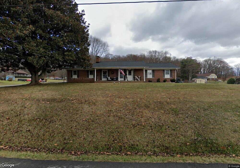
187 Holston Dr Blountville, TN 37617
Estimated Value: $232,000 - $503,000
3
Beds
2
Baths
1,450
Sq Ft
$234/Sq Ft
Est. Value
About This Home
This home is located at 187 Holston Dr, Blountville, TN 37617 and is currently estimated at $338,895, approximately $233 per square foot. 187 Holston Dr is a home located in Sullivan County with nearby schools including Holston Elementary School, Sullivan Central Middle School, and Tri-Cities Christian Academy.
Ownership History
Date
Name
Owned For
Owner Type
Purchase Details
Closed on
Dec 7, 2020
Sold by
Dickson Louise B
Bought by
Naegle Stephanie G and Naegle Bradley J
Current Estimated Value
Home Financials for this Owner
Home Financials are based on the most recent Mortgage that was taken out on this home.
Original Mortgage
$132,554
Outstanding Balance
$118,013
Interest Rate
2.7%
Mortgage Type
FHA
Estimated Equity
$220,882
Purchase Details
Closed on
Sep 21, 2011
Sold by
Dickson Todd J
Bought by
Dickson Todd J and Dickson Louise B
Purchase Details
Closed on
Apr 20, 2006
Sold by
Pendleton Carlson Shirley
Bought by
Dickson Todd J
Home Financials for this Owner
Home Financials are based on the most recent Mortgage that was taken out on this home.
Original Mortgage
$76,000
Interest Rate
6.28%
Create a Home Valuation Report for This Property
The Home Valuation Report is an in-depth analysis detailing your home's value as well as a comparison with similar homes in the area
Home Values in the Area
Average Home Value in this Area
Purchase History
| Date | Buyer | Sale Price | Title Company |
|---|---|---|---|
| Naegle Stephanie G | $153,265 | Heritage Ttl & Closing Svcs | |
| Dickson Todd J | -- | -- | |
| Dickson Todd J | $105,000 | -- |
Source: Public Records
Mortgage History
| Date | Status | Borrower | Loan Amount |
|---|---|---|---|
| Open | Naegle Stephanie G | $132,554 | |
| Previous Owner | Dickson Todd J | $76,000 |
Source: Public Records
Tax History Compared to Growth
Tax History
| Year | Tax Paid | Tax Assessment Tax Assessment Total Assessment is a certain percentage of the fair market value that is determined by local assessors to be the total taxable value of land and additions on the property. | Land | Improvement |
|---|---|---|---|---|
| 2024 | $970 | $38,875 | $4,125 | $34,750 |
| 2023 | $935 | $38,875 | $4,125 | $34,750 |
| 2022 | $935 | $38,875 | $4,125 | $34,750 |
| 2021 | $935 | $38,875 | $4,125 | $34,750 |
| 2020 | $928 | $38,875 | $4,125 | $34,750 |
| 2019 | $928 | $36,100 | $4,125 | $31,975 |
| 2018 | $921 | $36,100 | $4,125 | $31,975 |
| 2017 | $921 | $36,100 | $4,125 | $31,975 |
| 2016 | $767 | $29,775 | $4,125 | $25,650 |
| 2014 | -- | $29,782 | $0 | $0 |
Source: Public Records
Map
Nearby Homes
- 101 Bond Town Rd
- 355 Holston Dr
- 2188 Tennessee 75
- 550 Country View Private Dr
- 210 Centenary Rd
- The Quinn Plan at Ashland Oaks
- The Audrey Plan at Ashland Oaks
- Phoenix Single Plan at Ashland Oaks
- 132 Sanders St
- 1091 Shipley Ferry Rd
- 239 Brown Cir
- 129 Forest Ln N
- 205 Grande Harbor Way
- 191 Grande Harbor Way
- 304 Rutledge Ln
- 148 Forest Ln S
- 295 Brown Cir
- 205 Forest Ct
- 999 Muddy Creek Rd
- 1009 Muddy Creek Rd