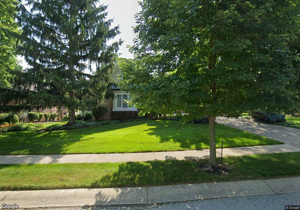
1875 Dockside Dr Greenwood, IN 46143
Frances-Stones Crossing NeighborhoodEstimated Value: $762,000 - $879,000
5
Beds
4
Baths
5,610
Sq Ft
$150/Sq Ft
Est. Value
About This Home
This home is located at 1875 Dockside Dr, Greenwood, IN 46143 and is currently estimated at $840,286, approximately $149 per square foot. 1875 Dockside Dr is a home located in Johnson County with nearby schools including Center Grove Elementary School, Center Grove Middle School Central, and Center Grove High School.
Ownership History
Date
Name
Owned For
Owner Type
Purchase Details
Closed on
Oct 7, 2011
Sold by
Robertson Charles F and Robertson Joyce Ann
Bought by
Langston Gary L and Langston Robin E
Current Estimated Value
Home Financials for this Owner
Home Financials are based on the most recent Mortgage that was taken out on this home.
Original Mortgage
$476,000
Outstanding Balance
$338,691
Interest Rate
5.02%
Mortgage Type
Adjustable Rate Mortgage/ARM
Estimated Equity
$501,595
Create a Home Valuation Report for This Property
The Home Valuation Report is an in-depth analysis detailing your home's value as well as a comparison with similar homes in the area
Home Values in the Area
Average Home Value in this Area
Purchase History
| Date | Buyer | Sale Price | Title Company |
|---|---|---|---|
| Langston Gary L | -- | None Available |
Source: Public Records
Mortgage History
| Date | Status | Borrower | Loan Amount |
|---|---|---|---|
| Open | Langston Gary L | $476,000 |
Source: Public Records
Tax History Compared to Growth
Tax History
| Year | Tax Paid | Tax Assessment Tax Assessment Total Assessment is a certain percentage of the fair market value that is determined by local assessors to be the total taxable value of land and additions on the property. | Land | Improvement |
|---|---|---|---|---|
| 2025 | $7,161 | $855,300 | $90,400 | $764,900 |
| 2024 | $7,161 | $716,100 | $90,400 | $625,700 |
| 2023 | $6,560 | $641,500 | $90,400 | $551,100 |
| 2022 | $6,111 | $597,400 | $90,400 | $507,000 |
| 2021 | $5,618 | $554,700 | $90,400 | $464,300 |
| 2020 | $5,613 | $554,700 | $90,400 | $464,300 |
| 2019 | $5,615 | $554,700 | $90,400 | $464,300 |
| 2018 | $5,613 | $565,700 | $90,400 | $475,300 |
| 2017 | $5,445 | $536,500 | $91,200 | $445,300 |
| 2016 | $5,729 | $542,600 | $91,200 | $451,400 |
| 2014 | $5,312 | $521,400 | $91,200 | $430,200 |
| 2013 | $5,312 | $512,500 | $91,600 | $420,900 |
Source: Public Records
Map
Nearby Homes
- 2041 Dockside Dr
- 3621 Olive Branch Rd
- 2163 Harbor Ct
- 2259 Willow Lake Dr
- 4030 Brockton Manor North Dr
- 148 Plaza Granda St
- 3696 Lakeshore Ct
- Aruba Bay Plan at Briar Creek - Ranches
- Grand Bahama Plan at Briar Creek - Ranches
- Dominica Spring Plan at Briar Creek - Ranches
- Grand Cayman Plan at Briar Creek - Ranches
- Eden Cay Plan at Briar Creek - Ranches
- 3608 Olive Branch Rd
- 1408 Eagle Trace Dr
- 3998 Eagle Trace
- 3081 Golfview Dr
- 2545 Willow St
- 1324 Eagle Valley Dr
- 3037 Golfview Dr
- 3362 Shore Dr
- 1913 Dockside Dr
- 1851 Dockside Dr
- 3752 Lomond Ct
- 1868 Dockside Dr
- 1945 Dockside Dr
- 1840 Dockside Dr
- 1833 Dockside Dr
- 3751 Lomond Ct
- 1900 Caledonian Ct
- 1962 Dockside Dr
- 3831 Atherton Ln
- 1979 Dockside Dr
- 1938 Caledonian Ct
- 3775 Lomond Ct
- 3809 Atherton Ln
- 1819 Dockside Dr
- 1915 Caledonian Ct
- 2000 Dockside Dr
- 3853 Atherton Ln
- 3820 Lomond Ct