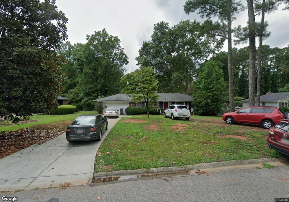
1879 Glynda Dr NE Marietta, GA 30062
East Cobb NeighborhoodEstimated Value: $422,299 - $463,000
3
Beds
2
Baths
1,493
Sq Ft
$294/Sq Ft
Est. Value
About This Home
This home is located at 1879 Glynda Dr NE, Marietta, GA 30062 and is currently estimated at $438,575, approximately $293 per square foot. 1879 Glynda Dr NE is a home located in Cobb County with nearby schools including Murdock Elementary School, Dodgen Middle School, and Pope High School.
Ownership History
Date
Name
Owned For
Owner Type
Purchase Details
Closed on
Aug 9, 2018
Sold by
Shattuck Omergene F
Bought by
Shattuck Omergene F and Shattuck Douglas Charles
Current Estimated Value
Purchase Details
Closed on
Nov 29, 1993
Sold by
Goldstein Jacob J
Bought by
Shattuck Omergene F
Home Financials for this Owner
Home Financials are based on the most recent Mortgage that was taken out on this home.
Original Mortgage
$52,900
Interest Rate
7.14%
Create a Home Valuation Report for This Property
The Home Valuation Report is an in-depth analysis detailing your home's value as well as a comparison with similar homes in the area
Home Values in the Area
Average Home Value in this Area
Purchase History
| Date | Buyer | Sale Price | Title Company |
|---|---|---|---|
| Shattuck Omergene F | -- | -- | |
| Shattuck Omergene F | $72,000 | -- |
Source: Public Records
Mortgage History
| Date | Status | Borrower | Loan Amount |
|---|---|---|---|
| Previous Owner | Shattuck Omergene F | $52,900 |
Source: Public Records
Tax History Compared to Growth
Tax History
| Year | Tax Paid | Tax Assessment Tax Assessment Total Assessment is a certain percentage of the fair market value that is determined by local assessors to be the total taxable value of land and additions on the property. | Land | Improvement |
|---|---|---|---|---|
| 2025 | $724 | $143,184 | $36,000 | $107,184 |
| 2024 | $727 | $143,184 | $36,000 | $107,184 |
| 2023 | $498 | $135,536 | $36,000 | $99,536 |
| 2022 | $637 | $113,132 | $25,600 | $87,532 |
| 2021 | $561 | $87,828 | $25,600 | $62,228 |
| 2020 | $561 | $87,828 | $25,600 | $62,228 |
| 2019 | $561 | $87,828 | $25,600 | $62,228 |
| 2018 | $590 | $97,584 | $25,600 | $71,984 |
| 2017 | $445 | $66,800 | $21,600 | $45,200 |
| 2016 | $448 | $66,800 | $21,600 | $45,200 |
| 2015 | $495 | $71,988 | $21,600 | $50,388 |
| 2014 | $451 | $56,752 | $0 | $0 |
Source: Public Records
Map
Nearby Homes
- 1900 Holly Springs Rd NE
- 2726 Whitehurst Dr NE
- 1677 Daffodil Dr
- 2792 Craig Ct
- 1670 Holly Springs Rd NE
- 2346 Jomarc Way
- 2764 Brookcliff Landing
- 1686 N Cobb Pkwy
- 2451 Cedar Fork Trail Unit 5
- 2197 Cedar Forks Dr Unit 1
- 1519 Brookcliff Cir
- 1502 Wood Thrush Way
- 2186 Cedar Forks Dr
- 2262 Pine Warbler Way
- 2138 Cedar Forks Dr Unit 2
- 3025 Bunker Hill Cir
- 2255 Abbey Cove Ct
- 1865 Glynda Dr NE
- 1891 Glynda Dr NE Unit 2
- 2623 Whitehurst Dr NE
- 1851 Glynda Dr NE
- 1911 Glynda Dr NE
- 1878 Glynda Dr NE
- 1864 Glynda Dr NE
- 1864 Glynda Dr NE Unit 1864
- 1892 Glynda Dr NE
- 2635 Whitehurst Dr NE
- 1882 Holly Springs Rd NE
- 1850 Glynda Dr NE
- 1837 Glynda Dr NE
- 1914 Holly Springs Rd NE
- 1906 Glynda Dr NE
- 1876 Holly Springs Rd NE
- 1918 Glynda Dr NE
- 1919 Brownridge Dr NE
- 1924 Holly Springs Rd NE
- 2689 Whitehurst Dr NE