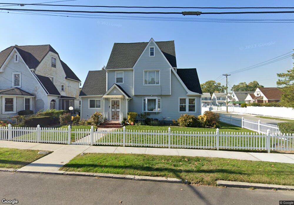
18831 Lewiston Ave Saint Albans, NY 11412
Hollis NeighborhoodEstimated Value: $804,000 - $861,000
--
Bed
--
Bath
2,239
Sq Ft
$370/Sq Ft
Est. Value
About This Home
This home is located at 18831 Lewiston Ave, Saint Albans, NY 11412 and is currently estimated at $827,886, approximately $369 per square foot. 18831 Lewiston Ave is a home located in Queens County with nearby schools including P.S. 118 Lorraine Hansberry, I.S. 192 The Linden, and Riverton Street Charter School.
Ownership History
Date
Name
Owned For
Owner Type
Purchase Details
Closed on
Aug 1, 2024
Sold by
Cromer-Tull Gail and Tull Godfrey
Bought by
Cromer-Tull Gail and Tull Alexandra D
Current Estimated Value
Purchase Details
Closed on
Sep 13, 1999
Sold by
Austin Gloria and Ashley Gayle Gloria T
Bought by
Tull Godfrey and Cromel Tull Gail
Home Financials for this Owner
Home Financials are based on the most recent Mortgage that was taken out on this home.
Original Mortgage
$194,275
Interest Rate
7.73%
Mortgage Type
FHA
Create a Home Valuation Report for This Property
The Home Valuation Report is an in-depth analysis detailing your home's value as well as a comparison with similar homes in the area
Home Values in the Area
Average Home Value in this Area
Purchase History
| Date | Buyer | Sale Price | Title Company |
|---|---|---|---|
| Cromer-Tull Gail | -- | -- | |
| Tull Godfrey | $185,000 | Stewart Title Insurance Co | |
| Tull Godfrey | $185,000 | Stewart Title Insurance Co |
Source: Public Records
Mortgage History
| Date | Status | Borrower | Loan Amount |
|---|---|---|---|
| Previous Owner | Tull Godfrey | $194,275 |
Source: Public Records
Tax History Compared to Growth
Tax History
| Year | Tax Paid | Tax Assessment Tax Assessment Total Assessment is a certain percentage of the fair market value that is determined by local assessors to be the total taxable value of land and additions on the property. | Land | Improvement |
|---|---|---|---|---|
| 2025 | $7,115 | $35,424 | $10,933 | $24,491 |
| 2024 | $7,115 | $35,424 | $11,840 | $23,584 |
| 2023 | $6,797 | $33,840 | $11,371 | $22,469 |
| 2022 | $6,621 | $38,160 | $15,000 | $23,160 |
| 2021 | $6,585 | $40,800 | $15,000 | $25,800 |
| 2020 | $6,249 | $35,100 | $15,000 | $20,100 |
| 2019 | $6,175 | $30,060 | $15,000 | $15,060 |
| 2018 | $5,749 | $28,200 | $12,072 | $16,128 |
| 2017 | $5,634 | $27,640 | $12,749 | $14,891 |
| 2016 | $5,213 | $27,640 | $12,749 | $14,891 |
| 2015 | $3,209 | $24,600 | $16,680 | $7,920 |
| 2014 | $3,209 | $24,600 | $16,680 | $7,920 |
Source: Public Records
Map
Nearby Homes
- 18833 Keeseville Ave
- 188-07 Mangin Ave
- 18823 Mangin Ave
- 188-25 Mangin Ave
- 18914 114th Rd
- 187-44 Jordan Ave
- 189-18 114th Dr
- 188-45 Quencer Rd
- 114-13 203rd st 203rd St
- 19022 111th Rd
- 191-16 114th Rd
- 186-16 Hilburn Ave
- 191-40 112th Rd
- 111-06 Farmers Blvd
- 191-34 114th Rd
- 187-15 Tioga Dr
- 190-59 112th Ave
- 18724 Tioga Dr
- 190-63 112th Ave
- 191-47 114th Dr
- 18823 Lewiston Ave
- 18819 Lewiston Ave
- 18748 Lewiston Ave
- 18903 Lewiston Ave
- 18748 Keeseville Ave
- 18742 Keeseville Ave
- 18740 Keeseville Ave
- 18815 Lewiston Ave
- 18736 Keeseville Ave
- 112-59 Mayville St
- 11332 Mayville St
- 18824 Lewiston Ave
- 18734 Keeseville Ave
- 18907 Lewiston Ave
- 188-22 Lewiston Ave Unit 1
- 188-22 Lewiston Ave
- 18734 Keeseville Ave
- 18822 Lewiston Ave
- 18811 Lewiston Ave
- 11255 Mayville St