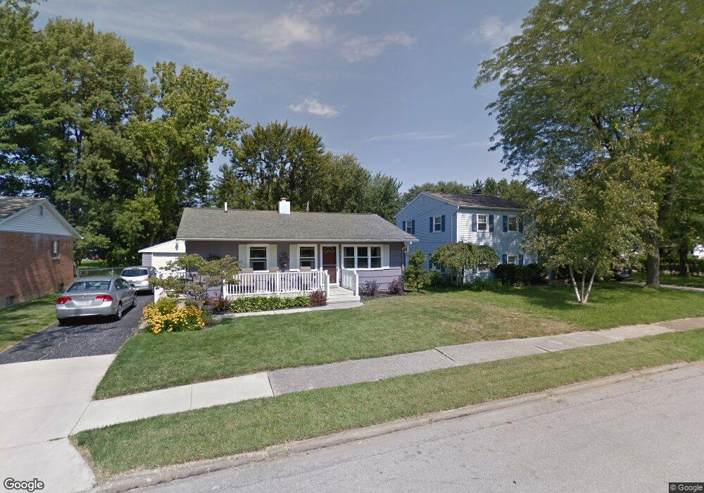
189 Scottwood Ave Norwalk, OH 44857
Estimated Value: $136,000 - $164,000
3
Beds
1
Bath
1,008
Sq Ft
$151/Sq Ft
Est. Value
About This Home
This home is located at 189 Scottwood Ave, Norwalk, OH 44857 and is currently estimated at $151,965, approximately $150 per square foot. 189 Scottwood Ave is a home located in Huron County with nearby schools including Maplehurst Elementary School, League Elementary School, and Pleasant Elementary School.
Ownership History
Date
Name
Owned For
Owner Type
Purchase Details
Closed on
Apr 11, 2008
Bought by
Lesch Mary Kay
Current Estimated Value
Purchase Details
Closed on
Feb 22, 2002
Sold by
Schuh Schephen A
Bought by
Kramb Dannielle M
Purchase Details
Closed on
Dec 27, 1996
Sold by
Everman Eric L
Bought by
Schuh Stephen A and Kaman Julie
Purchase Details
Closed on
Aug 10, 1990
Bought by
Everman Eric L
Create a Home Valuation Report for This Property
The Home Valuation Report is an in-depth analysis detailing your home's value as well as a comparison with similar homes in the area
Home Values in the Area
Average Home Value in this Area
Purchase History
| Date | Buyer | Sale Price | Title Company |
|---|---|---|---|
| Lesch Mary Kay | $96,000 | -- | |
| Kramb Dannielle M | $85,000 | -- | |
| Schuh Stephen A | $72,000 | -- | |
| Everman Eric L | $58,500 | -- |
Source: Public Records
Tax History Compared to Growth
Tax History
| Year | Tax Paid | Tax Assessment Tax Assessment Total Assessment is a certain percentage of the fair market value that is determined by local assessors to be the total taxable value of land and additions on the property. | Land | Improvement |
|---|---|---|---|---|
| 2024 | $1,352 | $42,910 | $6,410 | $36,500 |
| 2023 | $1,352 | $32,070 | $5,120 | $26,950 |
| 2022 | $940 | $32,070 | $5,120 | $26,950 |
| 2021 | $940 | $32,070 | $5,120 | $26,950 |
| 2020 | $804 | $27,710 | $5,120 | $22,590 |
| 2019 | $1,149 | $27,710 | $5,120 | $22,590 |
| 2018 | $1,129 | $27,710 | $5,120 | $22,590 |
| 2017 | $991 | $24,250 | $5,120 | $19,130 |
| 2016 | $973 | $24,250 | $5,120 | $19,130 |
| 2015 | $959 | $23,940 | $5,130 | $18,810 |
| 2014 | $959 | $23,730 | $5,110 | $18,620 |
| 2013 | $834 | $23,730 | $5,110 | $18,620 |
Source: Public Records
Map
Nearby Homes
- 203 Spino St
- 45 Grove Ave
- 173 Saint Marys St
- 14 Republic St
- 6 Blossom Dr Unit B
- 154 Gallup Ave
- 34 Old State Rd N
- 112 State Route 61 Unit 25
- 0 Milan Ave
- 121 Leisure Ln
- 17 Sara Dr
- 123 E Main St
- 0 Cleveland Rd
- 57 Milan Ave
- 29 Corwin St
- 14 Corwin St
- 6 White Tail Way Unit A
- 85 Woodlawn Ave
- 11 Granny Smith St
- 15 E Washington St
- 187 Scottwood Ave
- 191 Scottwood Ave
- 55 Central Blvd
- 185 Scottwood Ave
- 190 Scottwood Ave
- 190 Spino St
- 192 Spino St
- 183 Scottwood Ave
- 188 Spino St
- 186 Scottwood Ave
- 194 Spino St
- 45 Central Blvd
- 196 Scottwood Ave
- 184 Scottwood Ave
- 186 Spino St
- 186 Spino St
- 46 Central Blvd
- 181 Scottwood Ave
- 197 Scottwood Ave
- 56 Central Blvd